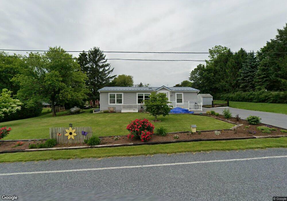
451 Beagle Rd Myerstown, PA 17067
Estimated Value: $272,763 - $310,000
3
Beds
1
Bath
1,296
Sq Ft
$222/Sq Ft
Est. Value
About This Home
This home is located at 451 Beagle Rd, Myerstown, PA 17067 and is currently estimated at $288,191, approximately $222 per square foot. 451 Beagle Rd is a home located in Lebanon County with nearby schools including Northern Lebanon Senior High School, Pleasant Hill Parochial School, and Nacetown Mennonite School.
Ownership History
Date
Name
Owned For
Owner Type
Purchase Details
Closed on
Oct 28, 2021
Sold by
Derr Patricia J
Bought by
Peachey Jonas L and Peachey Emma R
Current Estimated Value
Home Financials for this Owner
Home Financials are based on the most recent Mortgage that was taken out on this home.
Original Mortgage
$165,000
Interest Rate
3.01%
Mortgage Type
New Conventional
Create a Home Valuation Report for This Property
The Home Valuation Report is an in-depth analysis detailing your home's value as well as a comparison with similar homes in the area
Home Values in the Area
Average Home Value in this Area
Purchase History
| Date | Buyer | Sale Price | Title Company |
|---|---|---|---|
| Peachey Jonas L | $172,000 | Lancaster Cnty Stlmt Svcs Ll |
Source: Public Records
Mortgage History
| Date | Status | Borrower | Loan Amount |
|---|---|---|---|
| Closed | Peachey Jonas L | $165,000 |
Source: Public Records
Tax History Compared to Growth
Tax History
| Year | Tax Paid | Tax Assessment Tax Assessment Total Assessment is a certain percentage of the fair market value that is determined by local assessors to be the total taxable value of land and additions on the property. | Land | Improvement |
|---|---|---|---|---|
| 2025 | $3,530 | $157,400 | $55,500 | $101,900 |
| 2024 | $3,128 | $157,400 | $55,500 | $101,900 |
| 2023 | $3,128 | $157,400 | $55,500 | $101,900 |
| 2022 | $3,029 | $157,400 | $55,500 | $101,900 |
| 2021 | $2,836 | $157,400 | $55,500 | $101,900 |
| 2020 | $2,782 | $157,400 | $55,500 | $101,900 |
| 2019 | $2,739 | $157,400 | $55,500 | $101,900 |
| 2018 | $2,677 | $157,400 | $55,500 | $101,900 |
| 2017 | $518 | $157,400 | $55,500 | $101,900 |
| 2016 | $2,599 | $157,400 | $55,500 | $101,900 |
| 2015 | -- | $157,400 | $55,500 | $101,900 |
| 2014 | -- | $157,400 | $55,500 | $101,900 |
Source: Public Records
Map
Nearby Homes
- 175 Strack Dr
- 460 Shirksville Rd
- Lot #1 Johns Way Dr
- 2860 22 State Route 22
- 306 Yeagley Rd
- 147 Oaken Way
- 77 Bauer Dr
- 360 Woleber Rd
- 559 Bella May Cir
- 21 Mount Lebanon Dr
- 46 Mount Lebanon Dr
- 01 Bella May Cir
- 00 Bella May Cir
- 14 Firefly Dr
- 2860 22 Us Highway 22 and 3
- 604 Liliana Dr
- 604 Lilliana Dr
- 609 Lilliana Dr
- 926 Sweetbay Ln
- Huntington Plan at Briar Ridge