Estimated Value: $272,000 - $326,000
3
Beds
1
Bath
1,250
Sq Ft
$233/Sq Ft
Est. Value
About This Home
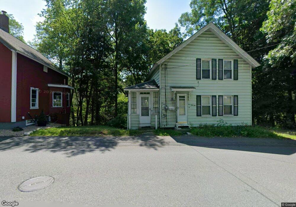
This home is located at 451 Hapgood St Unit 1/1, Athol, MA 01331 and is currently estimated at $290,747, approximately $232 per square foot. 451 Hapgood St Unit 1/1 is a home located in Worcester County with nearby schools including Athol High School.
Ownership History
Date
Name
Owned For
Owner Type
Purchase Details
Closed on
Sep 23, 2020
Sold by
Lebonte Deborah J
Bought by
Sullivan Christopher R and Mccarthy Matthew P
Current Estimated Value
Home Financials for this Owner
Home Financials are based on the most recent Mortgage that was taken out on this home.
Original Mortgage
$153,150
Outstanding Balance
$135,910
Interest Rate
2.9%
Mortgage Type
New Conventional
Estimated Equity
$154,837
Purchase Details
Closed on
Dec 19, 1997
Sold by
Barber Merle R and Barber Theresa J
Bought by
Labonte Deborah J
Home Financials for this Owner
Home Financials are based on the most recent Mortgage that was taken out on this home.
Original Mortgage
$43,000
Interest Rate
7.14%
Mortgage Type
Purchase Money Mortgage
Create a Home Valuation Report for This Property
The Home Valuation Report is an in-depth analysis detailing your home's value as well as a comparison with similar homes in the area
Home Values in the Area
Average Home Value in this Area
Purchase History
| Date | Buyer | Sale Price | Title Company |
|---|---|---|---|
| Sullivan Christopher R | $168,000 | None Available | |
| Labonte Deborah J | $43,000 | -- |
Source: Public Records
Mortgage History
| Date | Status | Borrower | Loan Amount |
|---|---|---|---|
| Open | Sullivan Christopher R | $153,150 | |
| Previous Owner | Labonte Deborah J | $43,000 | |
| Previous Owner | Labonte Deborah J | $110,000 | |
| Previous Owner | Labonte Deborah J | $32,000 |
Source: Public Records
Tax History Compared to Growth
Tax History
| Year | Tax Paid | Tax Assessment Tax Assessment Total Assessment is a certain percentage of the fair market value that is determined by local assessors to be the total taxable value of land and additions on the property. | Land | Improvement |
|---|---|---|---|---|
| 2025 | $2,963 | $233,100 | $39,900 | $193,200 |
| 2024 | $2,711 | $211,300 | $39,900 | $171,400 |
| 2023 | $2,627 | $187,100 | $28,900 | $158,200 |
| 2022 | $2,409 | $150,100 | $27,500 | $122,600 |
| 2021 | $2,045 | $115,800 | $25,000 | $90,800 |
| 2020 | $1,905 | $110,900 | $22,700 | $88,200 |
| 2019 | $1,780 | $102,000 | $21,400 | $80,600 |
| 2018 | $1,740 | $88,900 | $19,500 | $69,400 |
| 2017 | $1,744 | $85,500 | $19,500 | $66,000 |
| 2016 | $1,610 | $81,200 | $19,500 | $61,700 |
| 2015 | $1,545 | $81,200 | $19,500 | $61,700 |
| 2014 | $1,497 | $81,200 | $19,500 | $61,700 |
Source: Public Records
Map
Nearby Homes
- 631 Chestnut St
- 9 Kendall St
- 161 Prospect St
- 22 Charles Place
- 350 Riverbend St Unit 109
- 91 Cottage St Unit A
- 98 Drury Ave
- 979 Chestnut St
- 792 Cottage St
- 696 Cottage St Unit Lot 10
- 282 School St
- 128 Allen St
- 62 Lindsay Ln
- 71 Wendell St
- 182 Harrison St
- 133 Harvard Ave
- 193 Freedom St
- 73 Fern St
- 551 Sanders St
- 503 School St
- 451 Hapgood St
- 461 Hapgood St
- 341 Beacon St
- 429 Hapgood St
- L3 Harugari St
- 415 Hapgood St
- 329 Beacon St
- 344 Beacon St
- 621 Chestnut St
- 0 Beacon St
- 92 Hampstead Place
- 621 Chesnut St
- 615 Chestnut St
- 6 Harugari St
- 641 Chestnut St
- 651 Chestnut St
- 26 Harugari St
- 661 Chestnut St
- 312 Beacon St
- 86 Hampstead Place