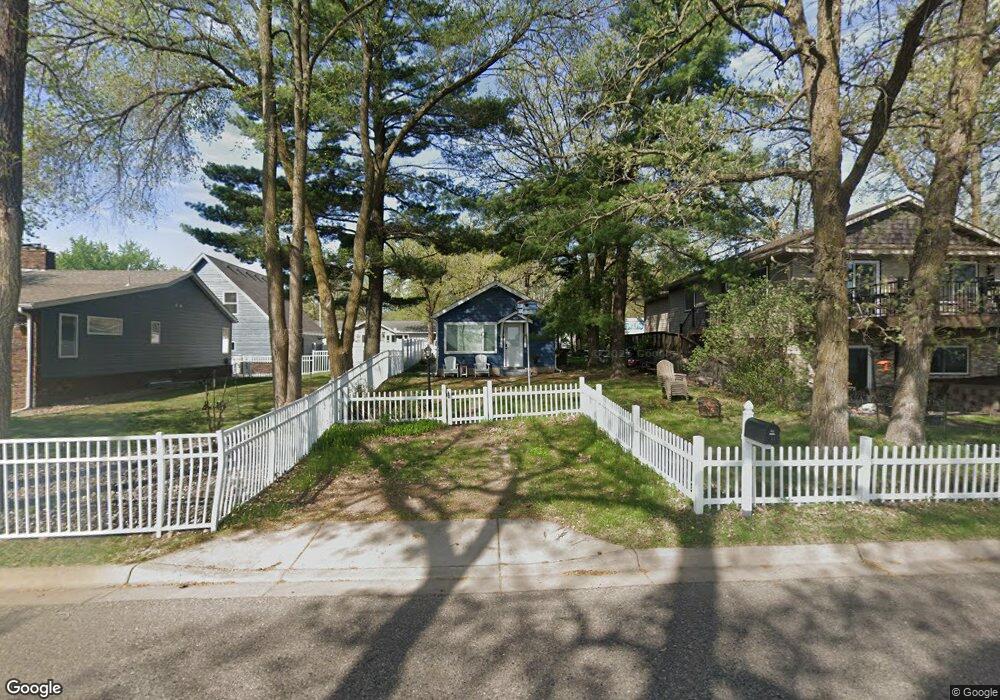
451 Lakeshore Dr Big Lake, MN 55309
Estimated Value: $251,000 - $287,000
1
Bed
1
Bath
648
Sq Ft
$408/Sq Ft
Est. Value
About This Home
This home is located at 451 Lakeshore Dr, Big Lake, MN 55309 and is currently estimated at $264,257, approximately $407 per square foot. 451 Lakeshore Dr is a home located in Sherburne County with nearby schools including Liberty Elementary School, Independence Elementary School, and Big Lake Middle School.
Ownership History
Date
Name
Owned For
Owner Type
Purchase Details
Closed on
Jun 21, 2021
Sold by
Anderson Daniel P and Anderson Jeanette Marie
Bought by
Hanson Mary J
Current Estimated Value
Home Financials for this Owner
Home Financials are based on the most recent Mortgage that was taken out on this home.
Original Mortgage
$195,750
Interest Rate
2.9%
Mortgage Type
New Conventional
Purchase Details
Closed on
Jun 17, 2021
Sold by
Anderson Daniel P and Anderson Jeanette Marie
Bought by
Hanson Mary J
Home Financials for this Owner
Home Financials are based on the most recent Mortgage that was taken out on this home.
Original Mortgage
$195,750
Interest Rate
2.9%
Mortgage Type
New Conventional
Purchase Details
Closed on
Aug 21, 1998
Sold by
Davis Gerald D and Davis Dorothy L
Bought by
Anderson Daniel P
Create a Home Valuation Report for This Property
The Home Valuation Report is an in-depth analysis detailing your home's value as well as a comparison with similar homes in the area
Home Values in the Area
Average Home Value in this Area
Purchase History
| Date | Buyer | Sale Price | Title Company |
|---|---|---|---|
| Hanson Mary J | $217,500 | Modern Title Llc | |
| Hanson Mary J | $217,500 | Modern Title Llc | |
| Anderson Daniel P | $31,000 | -- | |
| Hanson Mary Mary | $217,500 | -- |
Source: Public Records
Mortgage History
| Date | Status | Borrower | Loan Amount |
|---|---|---|---|
| Previous Owner | Hanson Mary J | $195,750 | |
| Previous Owner | Hanson Mary J | $195,750 | |
| Closed | Anderson Daniel P | -- | |
| Closed | Hanson Mary Mary | $207,500 |
Source: Public Records
Tax History Compared to Growth
Tax History
| Year | Tax Paid | Tax Assessment Tax Assessment Total Assessment is a certain percentage of the fair market value that is determined by local assessors to be the total taxable value of land and additions on the property. | Land | Improvement |
|---|---|---|---|---|
| 2025 | $2,784 | $243,700 | $153,600 | $90,100 |
| 2024 | $2,544 | $243,700 | $153,600 | $90,100 |
| 2023 | $2,164 | $223,200 | $148,000 | $75,200 |
| 2022 | $1,878 | $188,100 | $116,100 | $72,000 |
| 2020 | $1,784 | $142,100 | $84,300 | $57,800 |
| 2019 | $1,934 | $134,600 | $80,300 | $54,300 |
| 2018 | $1,910 | $124,200 | $70,300 | $53,900 |
| 2017 | $1,846 | $117,300 | $67,700 | $49,600 |
| 2016 | $1,744 | $110,500 | $64,700 | $45,800 |
| 2015 | $1,454 | $104,800 | $61,400 | $43,400 |
| 2014 | $1,598 | $88,400 | $46,400 | $42,000 |
| 2013 | -- | $90,800 | $46,000 | $44,800 |
Source: Public Records
Map
Nearby Homes
- 491 Highland Ave
- 679 Lakeshore Dr
- 241 Leighton Dr
- TBD Highway 10 NW
- TBD Manitou St
- 20050 County Road 81 NW
- 20311 Gordon Ln
- 3300 Lake View Ln
- 240 Wyoming Ave
- 5008 Bluff Rd
- 4637 Pond View Cir
- 3250 Lake Ridge Dr
- 4265 Lake Ridge Dr
- 637 Norwood Ln
- 110 Powell Cir E
- 20189 Esther Pkwy
- 20172 Truman Dr
- 1075 Kilbirnie Rd
- 5607 Egret Ave
- 18585 Arctic Ave
- 471 Lakeshore Dr
- 401 Lakeshore Dr
- 401 Highland Ave
- 381 Lakeshore Dr
- 310 Lake Ave
- 411 Highland Ave
- 501 Lakeshore Dr
- 361 Lakeshore Dr
- 531 Lakeshore Dr
- 341 Lakeshore Dr
- 320 Lake Ave
- 311 Lake Ave
- 421 Highland Ave
- 421 Highland Ave
- 430 Highland Ave
- 450 Highland Ave
- 321 Lakeshore Dr
- 591 Lakeshore Dr
- 441 Highland Ave
- 337 Lake Ave