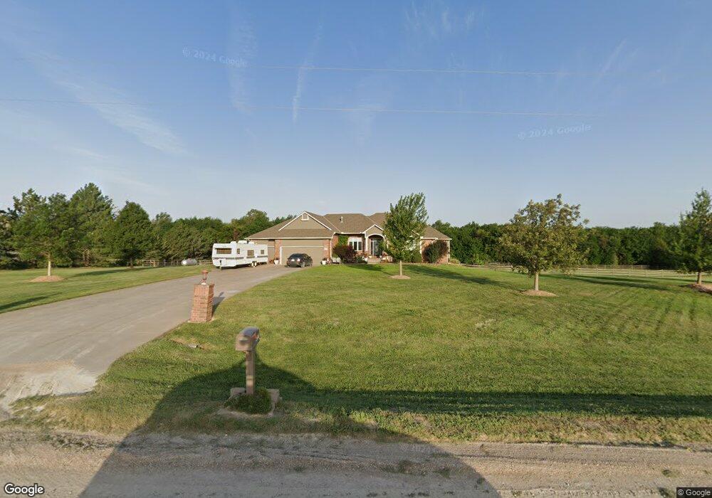
451 N 179th Cir W Goddard, KS 67052
Estimated Value: $700,005 - $787,000
4
Beds
4
Baths
3,603
Sq Ft
$206/Sq Ft
Est. Value
About This Home
This home is located at 451 N 179th Cir W, Goddard, KS 67052 and is currently estimated at $743,503, approximately $206 per square foot. 451 N 179th Cir W is a home located in Sedgwick County with nearby schools including Explorer Elementary School, Discovery Intermediate School, and Dwight D. Eisenhower Middle School.
Ownership History
Date
Name
Owned For
Owner Type
Purchase Details
Closed on
Apr 22, 2022
Sold by
Engle Daniel J and Engle Penni L
Bought by
Daniel J Engle Living Trust and Penni L Engle Living Trust
Current Estimated Value
Purchase Details
Closed on
Apr 30, 2010
Sold by
Simons Lawrence M
Bought by
Engle Daniel J and Engle Penni L
Home Financials for this Owner
Home Financials are based on the most recent Mortgage that was taken out on this home.
Original Mortgage
$268,000
Interest Rate
4.91%
Mortgage Type
New Conventional
Purchase Details
Closed on
Feb 26, 2010
Sold by
Simons Priscilla A
Bought by
Simons Lawrence M
Create a Home Valuation Report for This Property
The Home Valuation Report is an in-depth analysis detailing your home's value as well as a comparison with similar homes in the area
Home Values in the Area
Average Home Value in this Area
Purchase History
| Date | Buyer | Sale Price | Title Company |
|---|---|---|---|
| Daniel J Engle Living Trust | -- | None Listed On Document | |
| Engle Daniel J | -- | Security 1St Title | |
| Simons Lawrence M | -- | Security 1St Title |
Source: Public Records
Mortgage History
| Date | Status | Borrower | Loan Amount |
|---|---|---|---|
| Previous Owner | Engle Daniel J | $260,500 | |
| Previous Owner | Engle Daniel J | $268,000 | |
| Previous Owner | Simons Lawrence M | $80,000 |
Source: Public Records
Tax History Compared to Growth
Tax History
| Year | Tax Paid | Tax Assessment Tax Assessment Total Assessment is a certain percentage of the fair market value that is determined by local assessors to be the total taxable value of land and additions on the property. | Land | Improvement |
|---|---|---|---|---|
| 2025 | $7,161 | $67,287 | $10,350 | $56,937 |
| 2024 | $7,161 | $67,287 | $9,143 | $58,144 |
| 2023 | $7,161 | $58,652 | $9,143 | $49,509 |
| 2022 | $5,394 | $48,543 | $8,625 | $39,918 |
| 2021 | $5,615 | $51,034 | $6,900 | $44,134 |
| 2020 | $5,705 | $51,034 | $6,900 | $44,134 |
| 2019 | $5,410 | $48,013 | $5,865 | $42,148 |
| 2018 | $5,233 | $45,603 | $5,520 | $40,083 |
| 2017 | $4,893 | $0 | $0 | $0 |
| 2016 | $4,882 | $0 | $0 | $0 |
| 2015 | $4,911 | $0 | $0 | $0 |
| 2014 | $4,797 | $0 | $0 | $0 |
Source: Public Records
Map
Nearby Homes
- 19966 W Pine St
- 148 N Gowen St
- 2123 E Elk Ridge Ave
- 2412 E Elk Ridge Ave
- 2122 E Elk Ridge Ave
- 2418 E Elk Ridge Ave
- 2410 E Elk Ridge Ave
- 2120 E Elk Ridge Ave
- 2424 E Elk Ridge Ave
- 2121 E Elk Ridge Ave
- 2128 E Elk Ridge Ave
- 2126 E Elk Ridge Ave
- 150 N Gowen St
- 142 N Gowen St
- 2436 S Pronghorn St
- 2430 S Pronghorn St
- 2314 S Spring Hill Ct
- 17130-17132 W Lawson Cir
- 17132 W Lawson Cir
- 17130 W Lawson Cir
- 543 N 179th Cir W
- 459 N 179th Cir W
- 370 N 179th Ct W
- 300 N 179th Ct W
- 440 N 179th Ct W
- 435 N 179th Cir W
- 452 N 183rd St W
- 362 N 179th Ct W
- 446 N 183rd St W
- 438 N 183rd St W
- 318 N 179th Ct W
- 18215 W Central St
- 430 N 183rd St W
- 460 N 183rd St W
- 340 N 179th Ct W
- 250 N 179th Ct W
- 210 N 179th Ct W
- 330 N 183rd St W
- 18300 W Central St
- 332 N 179th Ct W