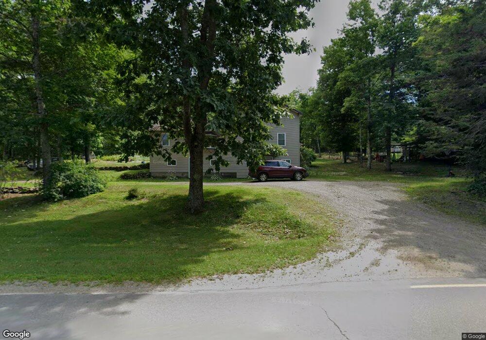
451 Simpson Corner Rd Dixmont, ME 04932
Estimated Value: $287,177 - $429,000
--
Bed
--
Bath
--
Sq Ft
4
Acres
About This Home
This home is located at 451 Simpson Corner Rd, Dixmont, ME 04932 and is currently estimated at $365,544. 451 Simpson Corner Rd is a home located in Penobscot County with nearby schools including Nokomis Regional Middle School/High School.
Ownership History
Date
Name
Owned For
Owner Type
Purchase Details
Closed on
Jul 11, 2019
Sold by
Witts Jason L
Bought by
Witts Jennifer R
Current Estimated Value
Home Financials for this Owner
Home Financials are based on the most recent Mortgage that was taken out on this home.
Original Mortgage
$135,000
Outstanding Balance
$118,272
Interest Rate
3.82%
Mortgage Type
Stand Alone Refi Refinance Of Original Loan
Estimated Equity
$247,272
Create a Home Valuation Report for This Property
The Home Valuation Report is an in-depth analysis detailing your home's value as well as a comparison with similar homes in the area
Home Values in the Area
Average Home Value in this Area
Purchase History
| Date | Buyer | Sale Price | Title Company |
|---|---|---|---|
| Witts Jennifer R | -- | -- | |
| Witts Jennifer R | -- | -- |
Source: Public Records
Mortgage History
| Date | Status | Borrower | Loan Amount |
|---|---|---|---|
| Open | Witts Jennifer R | $135,000 | |
| Closed | Witts Jennifer R | $135,000 |
Source: Public Records
Tax History Compared to Growth
Tax History
| Year | Tax Paid | Tax Assessment Tax Assessment Total Assessment is a certain percentage of the fair market value that is determined by local assessors to be the total taxable value of land and additions on the property. | Land | Improvement |
|---|---|---|---|---|
| 2024 | $2,686 | $248,700 | $44,420 | $204,280 |
| 2023 | $2,505 | $184,220 | $32,900 | $151,320 |
| 2022 | $2,395 | $184,220 | $32,900 | $151,320 |
| 2021 | $2,395 | $184,220 | $32,900 | $151,320 |
| 2020 | $2,395 | $184,220 | $32,900 | $151,320 |
| 2019 | $2,257 | $184,220 | $32,900 | $151,320 |
| 2018 | $2,072 | $184,219 | $32,900 | $151,319 |
| 2017 | $1,766 | $144,200 | $20,260 | $123,940 |
| 2016 | $1,622 | $144,200 | $20,260 | $123,940 |
| 2015 | $1,478 | $144,200 | $20,260 | $123,940 |
| 2014 | $1,586 | $144,200 | $20,260 | $123,940 |
Source: Public Records
Map
Nearby Homes
- 15 Cottrell Rd
- 296 Western Ave
- 664 North Rd
- 582 Western Ave
- 1957 Dixmont Rd
- 1719 Dixmont Rd
- 1766 Dixmont Rd
- 700 Old County Rd
- 1083 North Rd
- Lot 3 & 4 Nason Hill Rd
- 5-1 Garland & Nason Hill Roads
- 678 Moosehead Trail
- M3 L17 S Road & Church Hill Rd
- 165 Red School House Rd
- 1257 Moosehead Trail Hwy
- M 4 L 43 Off Route 9 and Route 7
- M10L30 Troy Center Rd
- 68 Old Farm Rd
- 130 Kennard Rd
- 2636 Kennebec Rd
- 457 Simpson Corner Rd
- 444 Simpson Corner Rd
- 243 Simpson Corner Rd
- 0 Simpson Corner Rd
- 410 Simpson Corner Rd
- 143 Simpson Corner Rd
- 577 Miles Rd
- 41 Old County Rd N
- 378 Simpson Corner Rd
- 20 Smith Rd
- 4 Smith Rd
- 34 Smith Rd
- 51 Smith Rd
- 580 Simpson Corner Rd
- Lot 34 Simpson Corner Rd
- 91 Old County Rd N
- 540 Miles Rd
- 330 Simpson Corner Rd
- 521 Miles Rd
- 0 Cottreal Unit 942785