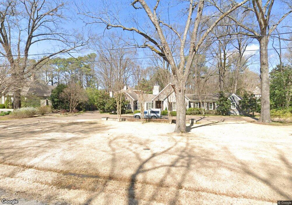
4510 Normandy Ave Memphis, TN 38117
East Memphis NeighborhoodEstimated Value: $722,000 - $862,077
4
Beds
6
Baths
4,370
Sq Ft
$184/Sq Ft
Est. Value
About This Home
This home is located at 4510 Normandy Ave, Memphis, TN 38117 and is currently estimated at $802,019, approximately $183 per square foot. 4510 Normandy Ave is a home located in Shelby County with nearby schools including White Station Elementary School, White Station High, and White Station Middle.
Ownership History
Date
Name
Owned For
Owner Type
Purchase Details
Closed on
Aug 8, 2003
Sold by
Peckham Louise J
Bought by
Coleman John R and Coleman Deborah B
Current Estimated Value
Home Financials for this Owner
Home Financials are based on the most recent Mortgage that was taken out on this home.
Original Mortgage
$318,000
Outstanding Balance
$139,014
Interest Rate
5.52%
Mortgage Type
Purchase Money Mortgage
Estimated Equity
$663,005
Purchase Details
Closed on
Nov 18, 1997
Sold by
Peckham Steve D
Bought by
Peckham Louise J
Purchase Details
Closed on
Jul 1, 1996
Sold by
Johnson Claudia A
Bought by
Peckham Steven D and Peckham Louise J
Create a Home Valuation Report for This Property
The Home Valuation Report is an in-depth analysis detailing your home's value as well as a comparison with similar homes in the area
Home Values in the Area
Average Home Value in this Area
Purchase History
| Date | Buyer | Sale Price | Title Company |
|---|---|---|---|
| Coleman John R | $435,000 | Chicago Title Company | |
| Peckham Louise J | -- | -- | |
| Peckham Steven D | -- | Mid South Title |
Source: Public Records
Mortgage History
| Date | Status | Borrower | Loan Amount |
|---|---|---|---|
| Open | Coleman John R | $318,000 |
Source: Public Records
Tax History
| Year | Tax Paid | Tax Assessment Tax Assessment Total Assessment is a certain percentage of the fair market value that is determined by local assessors to be the total taxable value of land and additions on the property. | Land | Improvement |
|---|---|---|---|---|
| 2025 | $6,602 | $236,925 | $82,600 | $154,325 |
| 2024 | $6,602 | $194,750 | $82,600 | $112,150 |
| 2023 | $11,863 | $194,750 | $82,600 | $112,150 |
| 2022 | $11,863 | $194,750 | $82,600 | $112,150 |
| 2021 | $12,003 | $194,750 | $82,600 | $112,150 |
| 2020 | $12,695 | $175,200 | $82,600 | $92,600 |
| 2019 | $12,695 | $175,200 | $82,600 | $92,600 |
| 2018 | $12,695 | $175,200 | $82,600 | $92,600 |
| 2017 | $6,852 | $166,725 | $82,600 | $84,125 |
| 2016 | $6,326 | $144,750 | $0 | $0 |
Source: Public Records
Map
Nearby Homes
- 4525 Barfield Rd
- 91 N Grove Park Rd
- 4565 Normandy Rd
- 150 Waring Rd
- 180 Waring Rd
- 4303 Hathaway Ln
- 4640 Chickasaw Rd
- 207 Gardenia Cove
- 4525 Sequoia Rd
- 140 S Grove Park Rd
- 126 Wood Grove Rd
- 4578 Sequoia Rd
- 4798 Normandy Ln
- 130 Greenbriar Dr
- 4766 Chickasaw Rd
- 154 Perkins Extension
- 4809 Normandy Ln
- 159 Perkins Extension
- 4366 Tuckahoe Rd
- 176 Belhaven St
- 4490 Normandy Ave
- 4540 Normandy Ave
- 4501 Normandy Ave
- 101 N Grove Park Rd
- 4511 Barfield Rd
- 4491 Barfield Rd
- 4540 Normandy Rd
- 4470 Normandy Ave
- 4491 Normandy Ave
- 4545 Barfield Rd
- 4481 Barfield Rd
- 4481 Normandy Ave
- 100 N Grove Park Rd
- 4554 Normandy Ave
- 4460 Normandy Ave
- 4471 Normandy Ave
- 77 N Grove Park Rd
- 4555 Barfield Rd
- 4461 Barfield Rd
- 90 N Grove Park Rd
Your Personal Tour Guide
Ask me questions while you tour the home.