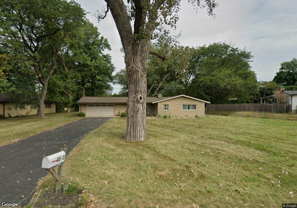
4512 Brookview Rd Rockford, IL 61107
Estimated Value: $182,000 - $226,000
3
Beds
2
Baths
1,614
Sq Ft
$129/Sq Ft
Est. Value
About This Home
This home is located at 4512 Brookview Rd, Rockford, IL 61107 and is currently estimated at $207,470, approximately $128 per square foot. 4512 Brookview Rd is a home located in Winnebago County with nearby schools including Brookview Elementary School, Eisenhower Middle School, and Guilford High School.
Ownership History
Date
Name
Owned For
Owner Type
Purchase Details
Closed on
Oct 21, 2022
Sold by
Cleary Carrie F
Bought by
Snydacker Samuel
Current Estimated Value
Purchase Details
Closed on
Oct 17, 2022
Sold by
Cleary Carrie F
Bought by
Snydacker Collette and Snydacker Samuel
Purchase Details
Closed on
Oct 27, 2014
Sold by
Federal Natl Mtg Assn Fnma
Bought by
Cleary Carrie F and Cleary Snydacker
Purchase Details
Closed on
Jan 17, 2013
Bought by
Snydacker Collette
Create a Home Valuation Report for This Property
The Home Valuation Report is an in-depth analysis detailing your home's value as well as a comparison with similar homes in the area
Home Values in the Area
Average Home Value in this Area
Purchase History
| Date | Buyer | Sale Price | Title Company |
|---|---|---|---|
| Snydacker Samuel | -- | -- | |
| Snydacker Collette | -- | None Listed On Document | |
| Cleary Carrie F | -- | Attorneys Title Guaranty Fund | |
| Snydacker Collette | $72,000 | -- |
Source: Public Records
Tax History Compared to Growth
Tax History
| Year | Tax Paid | Tax Assessment Tax Assessment Total Assessment is a certain percentage of the fair market value that is determined by local assessors to be the total taxable value of land and additions on the property. | Land | Improvement |
|---|---|---|---|---|
| 2024 | $1,627 | $53,175 | $14,943 | $38,232 |
| 2023 | $1,768 | $46,887 | $13,176 | $33,711 |
| 2022 | $1,934 | $41,908 | $11,777 | $30,131 |
| 2021 | $2,028 | $38,427 | $10,799 | $27,628 |
| 2020 | $2,119 | $36,327 | $10,209 | $26,118 |
| 2019 | $2,204 | $34,623 | $9,730 | $24,893 |
| 2018 | $2,385 | $33,497 | $9,170 | $24,327 |
| 2017 | $2,429 | $32,058 | $8,776 | $23,282 |
| 2016 | $2,398 | $31,458 | $8,612 | $22,846 |
| 2015 | $2,428 | $31,458 | $8,612 | $22,846 |
| 2014 | $2,821 | $32,759 | $10,751 | $22,008 |
Source: Public Records
Map
Nearby Homes
- 2180 Stornway Dr
- 4303 Singleton Close
- 1954 Wisteria Rd
- 4814 Spring Creek Rd
- 3505 Brookview Rd
- 5075 Welsh Rd
- 2020 Valley Rd
- 4015 Coventry Dr
- 2020 Glenview Rd
- 2014 Glenview Rd
- 4011 Dorset Dr
- 1718 Larkspur Dr
- 2699 Hickory Ave
- 4012 Highcrest Rd
- 4113 Eaton Dr
- 4000 Crestview Dr
- 4604 Mohawk Rd
- 4965 Crofton Dr
- 1461 Williamsburg Rd
- 3606 Pinecrest Rd
- 2404 Spring Brook Ave
- 4508 Brookview Rd
- 2408 Spring Brook Ave
- 4515 Brookview Rd
- 4504 Brookview Rd
- 4509 Brookview Rd
- 2412 Spring Brook Ave
- 2403 Spring Brook Ave
- 4503 Brookview Rd
- 2321 Spring Brook Ave
- 2407 Spring Brook Ave
- 2322 Spring Brook Ave
- 4608 Brookview Rd
- 2411 Spring Brook Ave
- 2327 N Alpine Rd
- 2420 Spring Brook Ave
- 2317 Spring Brook Ave
- 2316 Spring Brook Ave
- 4605 Brookview Rd
- 2415 Spring Brook Ave
