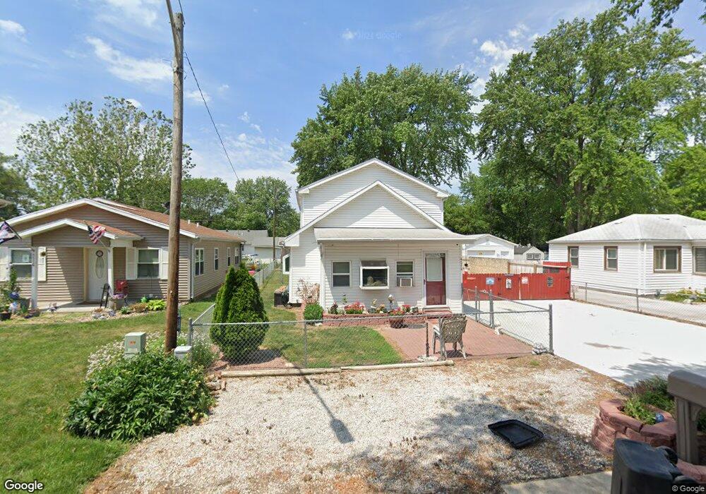
4514 Apache St Council Bluffs, IA 51501
Lake Manawa NeighborhoodEstimated Value: $180,000 - $228,000
3
Beds
2
Baths
1,536
Sq Ft
$126/Sq Ft
Est. Value
About This Home
This home is located at 4514 Apache St, Council Bluffs, IA 51501 and is currently estimated at $193,084, approximately $125 per square foot. 4514 Apache St is a home located in Pottawattamie County with nearby schools including E.A. Kreft Primary School, Titan Hill Intermediate School, and Lewis Central Middle School.
Ownership History
Date
Name
Owned For
Owner Type
Purchase Details
Closed on
May 2, 2007
Sold by
St Lucas Charles A and St Lucas Vickie
Bought by
Dorris Heather Michelle
Current Estimated Value
Home Financials for this Owner
Home Financials are based on the most recent Mortgage that was taken out on this home.
Original Mortgage
$76,794
Outstanding Balance
$46,788
Interest Rate
6.2%
Mortgage Type
FHA
Estimated Equity
$146,296
Create a Home Valuation Report for This Property
The Home Valuation Report is an in-depth analysis detailing your home's value as well as a comparison with similar homes in the area
Home Values in the Area
Average Home Value in this Area
Purchase History
| Date | Buyer | Sale Price | Title Company |
|---|---|---|---|
| Dorris Heather Michelle | $78,000 | None Available |
Source: Public Records
Mortgage History
| Date | Status | Borrower | Loan Amount |
|---|---|---|---|
| Open | Dorris Heather Michelle | $76,794 |
Source: Public Records
Tax History
| Year | Tax Paid | Tax Assessment Tax Assessment Total Assessment is a certain percentage of the fair market value that is determined by local assessors to be the total taxable value of land and additions on the property. | Land | Improvement |
|---|---|---|---|---|
| 2025 | $2,026 | $143,000 | $23,700 | $119,300 |
| 2024 | $2,026 | $122,800 | $20,600 | $102,200 |
| 2023 | $1,958 | $122,800 | $20,600 | $102,200 |
| 2022 | $1,630 | $88,900 | $19,900 | $69,000 |
| 2021 | $2,470 | $88,900 | $19,900 | $69,000 |
| 2020 | $1,480 | $88,900 | $19,900 | $69,000 |
| 2019 | $1,544 | $75,091 | $11,995 | $63,096 |
| 2018 | $1,506 | $75,091 | $11,995 | $63,096 |
| 2017 | $1,536 | $75,091 | $11,995 | $63,096 |
| 2015 | $1,506 | $75,091 | $11,995 | $63,096 |
| 2014 | $1,628 | $75,091 | $11,995 | $63,096 |
Source: Public Records
Map
Nearby Homes
- 4624 Navajo St Unit 14
- 20 Huron Cir
- 4821 Navajo St
- 40 Pickard Ln
- 0 Wallace Ave
- 1301 Veterans Memorial Hwy
- 5730 Merlin Ln
- 5743 Merlin Ln
- 11.63ACRES S 11th St
- LOT 7 Fannin Cir
- 69 ACRES M L Gifford Rd
- 7.19 ACRES Harry Langdon Blvd
- .54 ACRES Harry Langdon Blvd
- 4220 Gifford Rd
- 84.26 Gifford Rd
- 4823 Navajo St
- .90 ACRES Veterans Memorial Hwy
- 35.94 Ac M L 192nd St
- 4445 Gifford Rd
- 3105 S 21st St
Your Personal Tour Guide
Ask me questions while you tour the home.