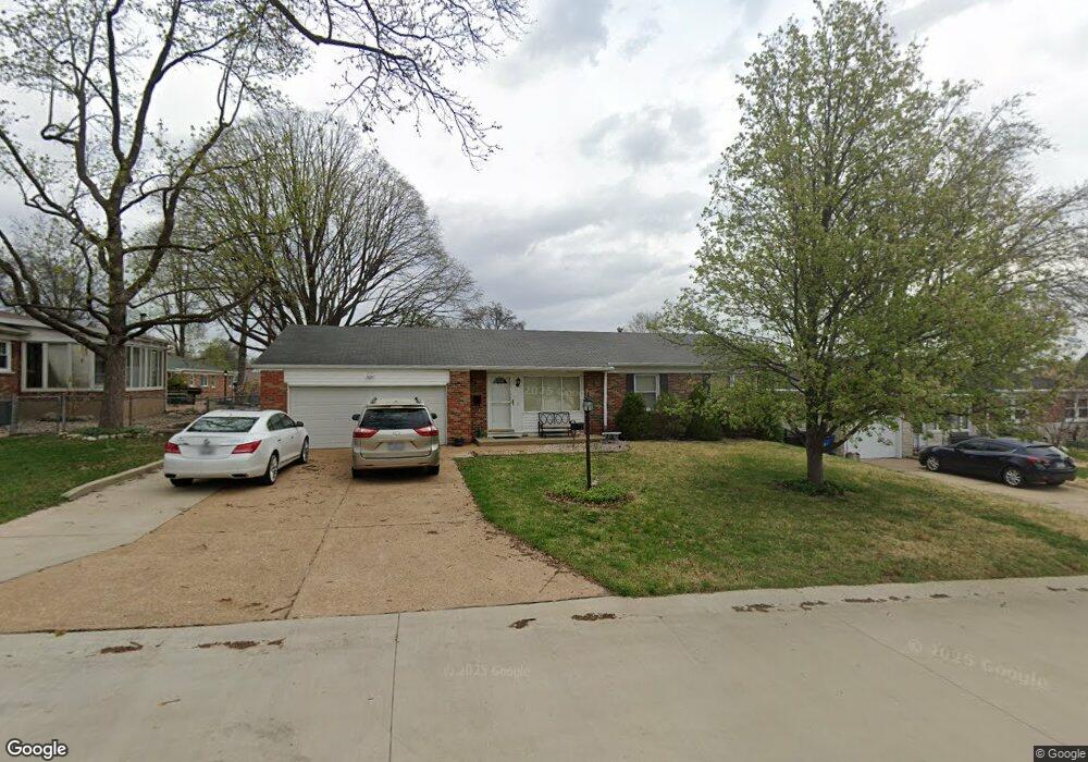
4515 Tomahawk Dr Saint Louis, MO 63123
Lemay NeighborhoodEstimated Value: $256,705 - $286,000
3
Beds
3
Baths
1,270
Sq Ft
$210/Sq Ft
Est. Value
About This Home
This home is located at 4515 Tomahawk Dr, Saint Louis, MO 63123 and is currently estimated at $266,426, approximately $209 per square foot. 4515 Tomahawk Dr is a home located in St. Louis County with nearby schools including Bayless Elementary School, Bayless Junior High School, and Bayless Senior High School.
Ownership History
Date
Name
Owned For
Owner Type
Purchase Details
Closed on
Feb 23, 2012
Sold by
Huelsing Dennis M and Huelsing Phyllis A
Bought by
The Dennis & Phyllis Huelsing Revocable
Current Estimated Value
Purchase Details
Closed on
Oct 19, 2011
Sold by
Buck Alice A
Bought by
Huelsing Dennis M and Huelsing Phyllis A
Purchase Details
Closed on
Oct 20, 1999
Sold by
Buck Alice A
Bought by
Alice A Buck Trust
Purchase Details
Closed on
May 12, 1999
Sold by
Perkins David T and Graham Perkins Carrie E
Bought by
Buck Alice A
Purchase Details
Closed on
Feb 18, 1998
Sold by
Heppe Irene M and Heppe Richard A
Bought by
Perkins David T and Graham Perkins Carrie E
Home Financials for this Owner
Home Financials are based on the most recent Mortgage that was taken out on this home.
Original Mortgage
$94,500
Interest Rate
6.92%
Create a Home Valuation Report for This Property
The Home Valuation Report is an in-depth analysis detailing your home's value as well as a comparison with similar homes in the area
Home Values in the Area
Average Home Value in this Area
Purchase History
| Date | Buyer | Sale Price | Title Company |
|---|---|---|---|
| The Dennis & Phyllis Huelsing Revocable | -- | None Available | |
| Huelsing Dennis M | -- | None Available | |
| Alice A Buck Trust | -- | -- | |
| Buck Alice A | -- | Land Title Company | |
| Buck Alice A | $120,000 | Land Title Company | |
| Perkins David T | -- | -- |
Source: Public Records
Mortgage History
| Date | Status | Borrower | Loan Amount |
|---|---|---|---|
| Previous Owner | Perkins David T | $94,500 |
Source: Public Records
Tax History Compared to Growth
Tax History
| Year | Tax Paid | Tax Assessment Tax Assessment Total Assessment is a certain percentage of the fair market value that is determined by local assessors to be the total taxable value of land and additions on the property. | Land | Improvement |
|---|---|---|---|---|
| 2025 | $2,913 | $48,540 | $12,860 | $35,680 |
| 2024 | $2,913 | $40,080 | $6,940 | $33,140 |
| 2023 | $2,867 | $40,080 | $6,940 | $33,140 |
| 2022 | $3,097 | $36,630 | $7,920 | $28,710 |
| 2021 | $2,802 | $36,630 | $7,920 | $28,710 |
| 2020 | $2,710 | $32,810 | $8,700 | $24,110 |
| 2019 | $2,703 | $32,810 | $8,700 | $24,110 |
| 2018 | $2,589 | $27,850 | $6,760 | $21,090 |
| 2017 | $2,431 | $27,850 | $6,760 | $21,090 |
| 2016 | $2,307 | $25,990 | $4,480 | $21,510 |
| 2015 | $2,318 | $25,990 | $4,480 | $21,510 |
| 2014 | $2,272 | $25,390 | $4,390 | $21,000 |
Source: Public Records
Map
Nearby Homes
- 816 Forman Rd
- 9038 Kickapoo Dr
- 4415 Cayuga Dr
- 8911 Kammerer Ave
- 4409 Fatima Dr
- 8706 Fatima Dr
- 9430 Dana Ave
- 4500 Spring Dr
- 9544 Dana Ave
- 4248 Kay Ln Unit 9
- 4606 Heege Rd
- 4739 Heege Rd
- 8709 Holbrook Dr
- 4700 Stone Ave
- 4704 Stone Ave
- 4760 Stone Ave
- 8628 Hillery Dr
- 9121 Niger Dr
- 9606 Dana Ave
- 9108 Tiber Ct
- 4511 Tomahawk Dr
- 9208 Wampum Dr
- 4522 Canoe Dr
- 4518 Canoe Dr
- 9200 Wampum Dr
- 4507 Tomahawk Dr
- 4514 Tomahawk Dr
- 4518 Tomahawk Dr
- 4510 Tomahawk Dr
- 4514 Canoe Dr
- 4524 Tomahawk Dr
- 4500 Tomahawk Dr
- 4529 Tomahawk Dr
- 9207 Wampum Dr
- 4510 Canoe Dr
- 4501 Tomahawk Dr
- 9203 Wampum Dr
- 4528 Tomahawk Dr
- 4523 Canoe Dr
- 4527 Canoe Dr