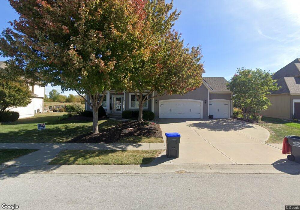
4517 N 141st St Basehor, KS 66007
Estimated Value: $583,000 - $633,000
4
Beds
4
Baths
2,733
Sq Ft
$221/Sq Ft
Est. Value
About This Home
This home is located at 4517 N 141st St, Basehor, KS 66007 and is currently estimated at $603,727, approximately $220 per square foot. 4517 N 141st St is a home located in Leavenworth County with nearby schools including Basehor Elementary School, Basehor-Linwood Middle School, and Basehor-Linwood High School.
Ownership History
Date
Name
Owned For
Owner Type
Purchase Details
Closed on
Jun 1, 2004
Bought by
Holthus Mitchell G and Holthus Tamara R
Current Estimated Value
Home Financials for this Owner
Home Financials are based on the most recent Mortgage that was taken out on this home.
Original Mortgage
$155,000
Outstanding Balance
$26,526
Interest Rate
6.32%
Mortgage Type
New Conventional
Estimated Equity
$577,201
Create a Home Valuation Report for This Property
The Home Valuation Report is an in-depth analysis detailing your home's value as well as a comparison with similar homes in the area
Home Values in the Area
Average Home Value in this Area
Purchase History
| Date | Buyer | Sale Price | Title Company |
|---|---|---|---|
| Holthus Mitchell G | $282,000 | -- |
Source: Public Records
Mortgage History
| Date | Status | Borrower | Loan Amount |
|---|---|---|---|
| Open | Holthus Mitchell G | $155,000 | |
| Closed | Holthus Mitchell G | $161,800 |
Source: Public Records
Tax History Compared to Growth
Tax History
| Year | Tax Paid | Tax Assessment Tax Assessment Total Assessment is a certain percentage of the fair market value that is determined by local assessors to be the total taxable value of land and additions on the property. | Land | Improvement |
|---|---|---|---|---|
| 2025 | $8,486 | $61,152 | $14,216 | $46,936 |
| 2024 | $7,988 | $59,371 | $14,216 | $45,155 |
| 2023 | $7,988 | $58,208 | $10,585 | $47,623 |
| 2022 | $7,436 | $51,744 | $9,879 | $41,865 |
| 2021 | $6,595 | $46,000 | $8,233 | $37,767 |
| 2020 | $6,368 | $43,666 | $8,233 | $35,433 |
| 2019 | $6,297 | $43,665 | $5,507 | $38,158 |
| 2018 | $6,214 | $40,354 | $5,507 | $34,847 |
| 2017 | $6,059 | $39,080 | $5,507 | $33,573 |
| 2016 | $5,513 | $35,529 | $5,507 | $30,022 |
| 2015 | $5,237 | $34,764 | $5,507 | $29,257 |
| 2014 | $5,021 | $33,564 | $4,699 | $28,865 |
Source: Public Records
Map
Nearby Homes
- 4417 N 141st St
- 4343-4501 N 139th St
- 4310 N 141st Place
- 4722 Clubhouse Dr
- 4270 Lake Shore Dr
- 14463 Aurora Ln
- 4271 Aspen Dr
- 4250 Aspen Dr
- 4615 N 144th Terrace
- 4248 Lake Shore Dr
- 4418 Tee Box Dr
- 4151 Lake Shore Dr
- The Azalea I Plan at The Communities of Falcon Lakes - Falcon Lakes
- 14574 Aurora Ln
- 4145 Lake Shore Dr
- 4282 Lake Shore Dr
- Yorkshire V Plan at The Communities of Falcon Lakes - The Communities at Falcon Lakes
- Ashwood Plan at The Communities of Falcon Lakes - The Communities at Falcon Lakes
- Cypress II Plan at The Communities of Falcon Lakes - The Communities at Falcon Lakes
- The York Plan at The Communities of Falcon Lakes - The Communties of Falcon Lakes
- 4513 N 141st St
- 4519 N 141st St
- 4509 N 141st St
- 4601 N 141st St
- 14101 Pine Valley Ct
- 14100 Pine Valley Ct
- 4505 N 141st St
- 14100 Nelson Ct
- 14105 Pine Valley Ct
- 14104 Pine Valley Ct
- 14104 Nelson Ct
- 4501 N 141st St
- 14109 Pine Valley Ct
- 4421 N 141st St
- 14101 Nelson Ct
- 14110 Nelson Ct
- 14112 Pine Valley Ct
- 14113 Pine Valley Ct
- 14105 Nelson Ct
- 14114 Nelson Ct