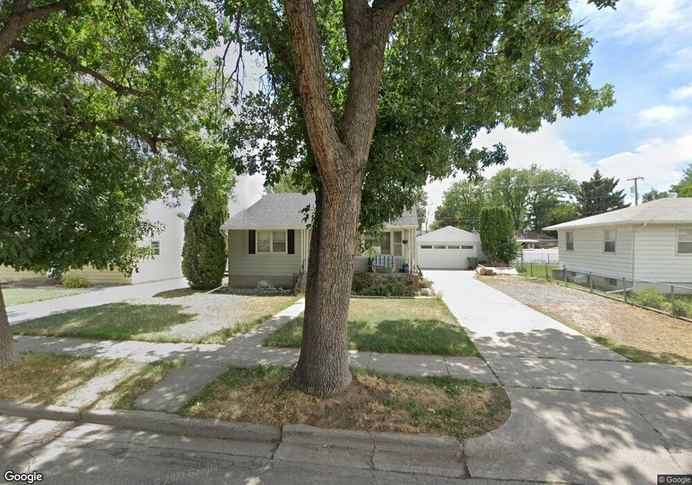
4518 Phillip St Billings, MT 59101
South Central Billings NeighborhoodEstimated Value: $297,000 - $324,723
About This Home
This home is located at 4518 Phillip St, Billings, MT 59101 and is currently estimated at $310,431, approximately $147 per square foot. 4518 Phillip St is a home located in Yellowstone County with nearby schools including Newman School, Riverside Junior High School, and Billings West High School.
Ownership History
We collect this data history from publicly available records. To have your information removed, we recommend requesting removal directly through your county’s website.
Purchase Details
Home Financials for this Owner
Home Financials are based on the most recent Mortgage that was taken out on this home.Purchase Details
Home Financials for this Owner
Home Financials are based on the most recent Mortgage that was taken out on this home.Purchase Details
Home Financials for this Owner
Home Financials are based on the most recent Mortgage that was taken out on this home.Purchase Details
Purchase Details
Purchase Details
Purchase Details
Purchase Details
Purchase Details
Home Values in the Area
Average Home Value in this Area
Purchase History
We collect this data history from publicly available records. To have your information removed, we recommend requesting removal directly through your county’s website.
| Date | Buyer | Sale Price | Title Company |
|---|---|---|---|
| -- | First Montana Title Company | ||
| -- | First Montana Title Co | ||
| -- | -- | ||
| -- | -- | ||
| -- | None Available | ||
| -- | None Available | ||
| -- | None Available | ||
| -- | None Available | ||
| -- | None Available |
Mortgage History
We collect this data history from publicly available records. To have your information removed, we recommend requesting removal directly through your county’s website.
| Date | Status | Borrower | Loan Amount |
|---|---|---|---|
| Open | $9,343 | ||
| Open | $289,478 | ||
| Previous Owner | $12,501 | ||
| Previous Owner | $196,321 |
Tax History
We collect this data history from publicly available records. To have your information removed, we recommend requesting removal directly through your county’s website.
| Year | Tax Paid | Tax Assessment Tax Assessment Total Assessment is a certain percentage of the fair market value that is determined by local assessors to be the total taxable value of land and additions on the property. | Land | Improvement |
|---|---|---|---|---|
| 2025 | $2,504 | $306,100 | $38,675 | $267,425 |
| 2024 | $2,504 | $248,600 | $37,879 | $210,721 |
| 2023 | $2,498 | $248,600 | $37,879 | $210,721 |
| 2022 | $1,861 | $197,100 | $0 | $0 |
| 2021 | $2,154 | $197,100 | $0 | $0 |
| 2020 | $2,142 | $185,400 | $0 | $0 |
| 2019 | $2,049 | $185,400 | $0 | $0 |
| 2018 | $1,779 | $154,800 | $0 | $0 |
| 2017 | $1,732 | $154,800 | $0 | $0 |
| 2016 | $1,644 | $148,100 | $0 | $0 |
| 2015 | $1,609 | $148,100 | $0 | $0 |
| 2014 | $1,520 | $74,200 | $0 | $0 |
Map
- 4401 Murphy Ave
- 4635 Simpson St
- 4640 Ruth Ave
- 731 Orchard Ln
- 4648 Mitchell Ave
- 4308 Brockton Ave SW
- 307 S Billings Blvd Unit 24
- 307 S Billings Blvd Unit 36
- 4142 Morgan Ave
- 4113 Stone St
- 122 Orchard Ln
- 4124 Vaughn Ln
- 313 Viceroy St
- 210 Monarch St
- 223 Monarch St
- 4071 Morgan Ave
- 4039 Cambridge Dr
- 1119 Rays Ln
- 3902 Chamberlain Dr
- 632 Saint Johns Ave Unit 8
- 4518 Philip
- 4522 Phillip St
- 4512 Phillip St
- 4517 Stone St
- 4508 Phillip St
- 4521 Stone St
- 4513 Stone St
- 4517 Phillip St
- 4527 Stone St
- 4507 Stone St
- 4528 Phillip St
- 4521 Phillip St
- 4511 Phillip St
- 4504 Phillip St
- 4525 Phillip St
- 4505 Phillip St
- 4533 Stone St
- 4501 Stone St
- 4538 Phillip St
- 4446 Phillip St
Ask me questions while you tour the home.