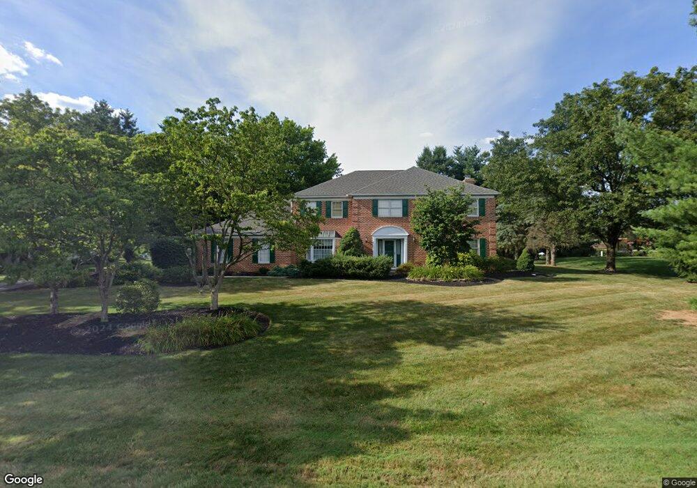
4519 Commonwealth Dr Emmaus, PA 18049
Lower Macungie Township East NeighborhoodEstimated Value: $658,000 - $742,000
4
Beds
3
Baths
3,022
Sq Ft
$230/Sq Ft
Est. Value
About This Home
This home is located at 4519 Commonwealth Dr, Emmaus, PA 18049 and is currently estimated at $695,500, approximately $230 per square foot. 4519 Commonwealth Dr is a home located in Lehigh County with nearby schools including Macungie Elementary School, Eyer Middle School, and Emmaus High School.
Ownership History
Date
Name
Owned For
Owner Type
Purchase Details
Closed on
Aug 25, 1992
Sold by
Dalmas Dino P
Bought by
Bohner William L and Bohner Kathleen S
Current Estimated Value
Purchase Details
Closed on
Mar 18, 1992
Sold by
Brookhaven Development Corp
Bought by
Dalmas Dino P
Purchase Details
Closed on
Dec 31, 1985
Bought by
Brookhaven Development Corp
Create a Home Valuation Report for This Property
The Home Valuation Report is an in-depth analysis detailing your home's value as well as a comparison with similar homes in the area
Home Values in the Area
Average Home Value in this Area
Purchase History
| Date | Buyer | Sale Price | Title Company |
|---|---|---|---|
| Bohner William L | $275,000 | -- | |
| Dalmas Dino P | $72,900 | -- | |
| Brookhaven Development Corp | $354,900 | -- |
Source: Public Records
Tax History Compared to Growth
Tax History
| Year | Tax Paid | Tax Assessment Tax Assessment Total Assessment is a certain percentage of the fair market value that is determined by local assessors to be the total taxable value of land and additions on the property. | Land | Improvement |
|---|---|---|---|---|
| 2025 | $9,936 | $389,200 | $57,100 | $332,100 |
| 2024 | $9,613 | $389,200 | $57,100 | $332,100 |
| 2023 | $9,421 | $389,200 | $57,100 | $332,100 |
| 2022 | $9,198 | $389,200 | $332,100 | $57,100 |
| 2021 | $9,003 | $389,200 | $57,100 | $332,100 |
| 2020 | $8,917 | $389,200 | $57,100 | $332,100 |
| 2019 | $8,765 | $389,200 | $57,100 | $332,100 |
| 2018 | $8,650 | $389,200 | $57,100 | $332,100 |
| 2017 | $8,499 | $389,200 | $57,100 | $332,100 |
| 2016 | -- | $389,200 | $57,100 | $332,100 |
| 2015 | -- | $389,200 | $57,100 | $332,100 |
| 2014 | -- | $389,200 | $57,100 | $332,100 |
Source: Public Records
Map
Nearby Homes
- 4490 Canterbury Dr
- 3149 Sheffield Dr
- 3045 Sheffield Dr
- 4476 Stonebridge Dr
- 4804 Parkview Dr S
- 2834 Sheffield Dr
- 3721 Samantha Ln
- 3721 Samantha Ln Unit 76
- 3703 Samantha Ln Unit Lot 70
- 3736 Samantha Ln Unit Lot 7
- 3748 Samantha Ln
- 3748 Samantha Ln Unit Lot 3
- 3734 Samantha Ln Unit Lot 8
- 3746 Samantha Ln Unit Lot 4
- 3713 Samantha Ln Unit Lot 73
- 3707 Samantha Ln Unit Lot 71
- Foxgrove I - TR Plan at The Fields at Twin Run
- Folcroft -TR Plan at The Fields at Twin Run
- Sierra - TR Plan at The Fields at Twin Run
- Cheswick - TR Plan at The Fields at Twin Run
- 4497 Lexington Cir
- 4541 Woodlawn Dr
- 4524 Woodlawn Dr
- 4332 Commonwealth Dr
- 4415 Lexington Cir
- 4312 Commonwealth Dr
- 4502 Woodlawn Dr
- 4350 Commonwealth Dr
- 4296 Commonwealth Dr
- 4487 Lexington Cir
- 4569 Woodlawn Dr
- 4368 Commonwealth Dr
- 4399 Lexington Cir
- 3116 Bradford Cir
- 4545 Woodlawn Dr
- 4549 Canterbury Dr
- 4567 Canterbury Dr
- 4396 Lexington Cir
- 4280 Commonwealth Dr
- 3113 Bradford Cir