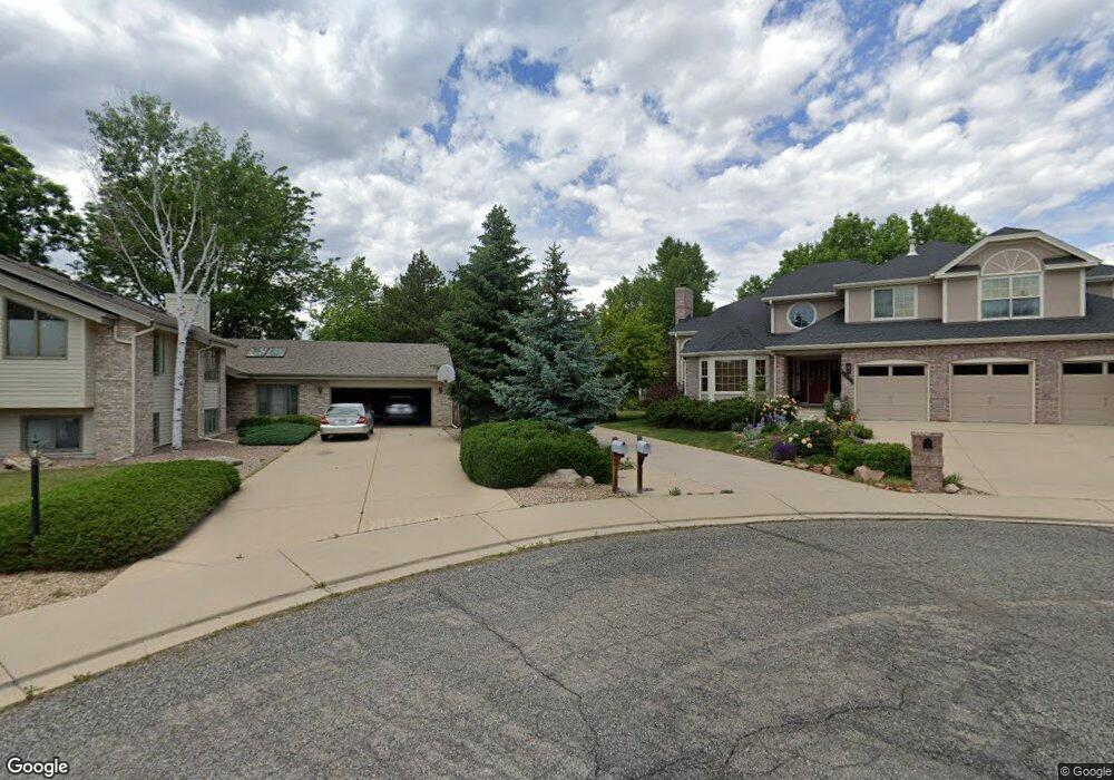
4519 Northfield Ct Boulder, CO 80301
Gunbarrel NeighborhoodEstimated Value: $1,209,520 - $1,348,000
4
Beds
3
Baths
3,252
Sq Ft
$394/Sq Ft
Est. Value
About This Home
This home is located at 4519 Northfield Ct, Boulder, CO 80301 and is currently estimated at $1,280,130, approximately $393 per square foot. 4519 Northfield Ct is a home located in Boulder County with nearby schools including Heatherwood Elementary School, Nevin Platt Middle School, and Boulder High School.
Ownership History
Date
Name
Owned For
Owner Type
Purchase Details
Closed on
Sep 3, 1993
Sold by
Korori Sousan A
Bought by
Korori Sousan A
Current Estimated Value
Purchase Details
Closed on
Sep 6, 1991
Bought by
Korori Urroz Hector A and Korori Sousan Urroz
Purchase Details
Closed on
Dec 2, 1988
Bought by
Korori Urroz Hector A and Korori Sousan Urroz
Purchase Details
Closed on
Aug 23, 1988
Bought by
Korori Urroz Hector A and Korori Sousan Urroz
Create a Home Valuation Report for This Property
The Home Valuation Report is an in-depth analysis detailing your home's value as well as a comparison with similar homes in the area
Home Values in the Area
Average Home Value in this Area
Purchase History
| Date | Buyer | Sale Price | Title Company |
|---|---|---|---|
| Korori Sousan A | -- | -- | |
| Korori Urroz Hector A | $256,000 | -- | |
| Korori Urroz Hector A | $262,700 | -- | |
| Korori Urroz Hector A | $68,500 | -- |
Source: Public Records
Tax History Compared to Growth
Tax History
| Year | Tax Paid | Tax Assessment Tax Assessment Total Assessment is a certain percentage of the fair market value that is determined by local assessors to be the total taxable value of land and additions on the property. | Land | Improvement |
|---|---|---|---|---|
| 2025 | $7,030 | $81,850 | $39,469 | $42,381 |
| 2024 | $7,030 | $81,850 | $39,469 | $42,381 |
| 2023 | $6,914 | $82,772 | $42,759 | $43,697 |
| 2022 | $5,620 | $64,566 | $31,838 | $32,728 |
| 2021 | $5,358 | $66,423 | $32,754 | $33,669 |
| 2020 | $4,776 | $59,381 | $28,672 | $30,709 |
| 2019 | $4,704 | $59,381 | $28,672 | $30,709 |
| 2018 | $4,472 | $56,297 | $23,904 | $32,393 |
| 2017 | $4,338 | $62,239 | $26,427 | $35,812 |
| 2016 | $4,572 | $50,275 | $22,049 | $28,226 |
| 2015 | $4,341 | $47,680 | $19,900 | $27,780 |
| 2014 | $4,369 | $47,680 | $19,900 | $27,780 |
Source: Public Records
Map
Nearby Homes
- 7401 Park Cir
- 4697 Tanglewood Trail
- 7302 Island Cir
- 4667 Ashfield Dr
- 4803 Briar Ridge Ct
- 7028 Indian Peaks Trail
- 4716 Berkshire Ct
- 4953 Clubhouse Ct
- 4936 Clubhouse Cir
- 7711 Devonshire Ct
- 4993 Clubhouse Ct
- 4862 Silver Sage Ct
- 7430 Clubhouse Rd
- 7264 Siena Way Unit C
- 4872 Country Club Way
- 7126 Cedarwood Cir
- 7134 Cedarwood Cir
- 5128 Buckingham Rd
- 5174 Buckingham Rd Unit L1
- 7329 Windsor Dr
- 4538 S Meadow Dr
- 4515 Northfield Ct
- 4524 S Meadow Dr
- 4550 S Meadow Dr
- 4512 S Meadow Dr
- 7388 Old Mill Trail
- 7366 Old Mill Trail
- 4524 Northfield Ct
- 4501 Northfield Ct
- 7420 Old Mill Trail
- 4500 S Meadow Dr
- 7322 Yucca Ct
- 4535 S Meadow Dr
- 4547 S Meadow Dr
- 4504 Northfield Ct
- 7344 Yucca Ct
- 4563 S Meadow Dr
- 7432 Old Mill Trail
- 4515 S Meadow Dr
- 4509 S Meadow Dr