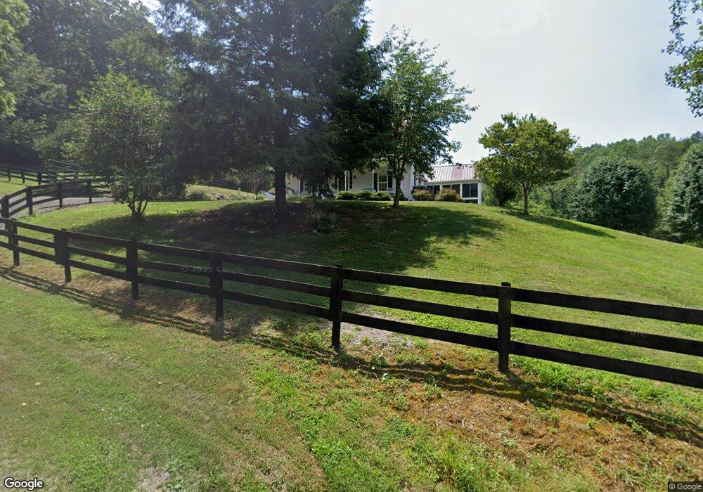
452 Loy Rd Speedwell, TN 37870
Estimated Value: $224,000 - $403,974
--
Bed
2
Baths
1,712
Sq Ft
$188/Sq Ft
Est. Value
About This Home
This home is located at 452 Loy Rd, Speedwell, TN 37870 and is currently estimated at $322,658, approximately $188 per square foot. 452 Loy Rd is a home located in Claiborne County.
Ownership History
Date
Name
Owned For
Owner Type
Purchase Details
Closed on
Mar 27, 2006
Sold by
Welch Steve
Bought by
Steed Robert W
Current Estimated Value
Purchase Details
Closed on
Mar 21, 2006
Sold by
Welch Steve and Welch Yvonne
Bought by
Steed Robert W
Purchase Details
Closed on
Aug 10, 2005
Sold by
Welch Henry and Welch Naomi R
Bought by
Steed Robert W
Purchase Details
Closed on
Apr 30, 2004
Sold by
Sumpter Tony
Bought by
Steed Robert
Purchase Details
Closed on
Jun 16, 1993
Bought by
Welch Stanley H
Purchase Details
Closed on
Nov 12, 1992
Purchase Details
Closed on
Jul 1, 1992
Purchase Details
Closed on
Apr 29, 1991
Create a Home Valuation Report for This Property
The Home Valuation Report is an in-depth analysis detailing your home's value as well as a comparison with similar homes in the area
Home Values in the Area
Average Home Value in this Area
Purchase History
| Date | Buyer | Sale Price | Title Company |
|---|---|---|---|
| Steed Robert W | $1,000 | -- | |
| Steed Robert W | $1,000 | -- | |
| Steed Robert W | $5,000 | -- | |
| Steed Robert | $36,006 | -- | |
| Sumpter Tony | $36,006 | -- | |
| Welch Stanley H | $500 | -- | |
| -- | -- | -- | |
| -- | -- | -- | |
| -- | -- | -- |
Source: Public Records
Tax History Compared to Growth
Tax History
| Year | Tax Paid | Tax Assessment Tax Assessment Total Assessment is a certain percentage of the fair market value that is determined by local assessors to be the total taxable value of land and additions on the property. | Land | Improvement |
|---|---|---|---|---|
| 2024 | $2,242 | $95,825 | $6,325 | $89,500 |
| 2023 | $2,242 | $95,825 | $6,325 | $89,500 |
| 2022 | $1,917 | $95,825 | $6,325 | $89,500 |
| 2021 | $1,813 | $70,325 | $5,625 | $64,700 |
| 2020 | $1,813 | $70,325 | $5,625 | $64,700 |
| 2019 | $1,813 | $70,325 | $5,625 | $64,700 |
| 2018 | $1,813 | $70,325 | $5,625 | $64,700 |
| 2017 | $1,813 | $70,325 | $5,625 | $64,700 |
| 2016 | $1,969 | $76,325 | $5,550 | $70,775 |
| 2015 | $1,893 | $76,325 | $5,550 | $70,775 |
| 2014 | $1,893 | $73,191 | $0 | $0 |
Source: Public Records
Map
Nearby Homes
- 673 Aaron Davis Rd
- 0 Powell Ridge Rd
- 303 Robertson Ln
- 138 Ashley Ct
- 164 Ashley Ct
- 0 Friendship Hollow Rd
- 586 Back Valley Rd
- 387 Price Dr
- 0 Watson Ln Unit 1309370
- 112 Auggie Belle Ln
- 148 Auggie Belle Ln
- 132 Auggie Belle Ln
- 138 Lilac Ln
- 125 Lilac Ln
- 0 Old Highway 63 Unit 1273834
- 210 Brumitt Ln
- 317 Singleton Hollow Rd
- 317 Singleton Hollow Rd Unit lot 3
- 317 Singleton Hollow Rd Unit lot 1
- 201 Flatwoods Rd