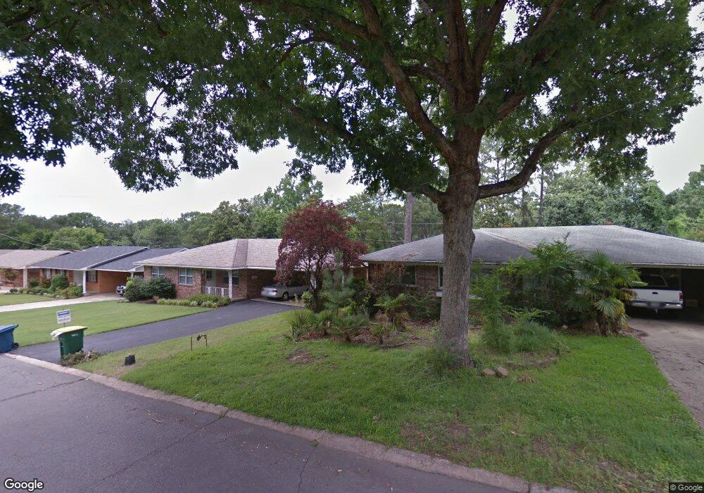
4524 Kenyon Dr Little Rock, AR 72205
Hillcrest NeighborhoodEstimated Value: $357,000 - $600,000
--
Bed
4
Baths
3,346
Sq Ft
$152/Sq Ft
Est. Value
About This Home
This home is located at 4524 Kenyon Dr, Little Rock, AR 72205 and is currently estimated at $507,202, approximately $151 per square foot. 4524 Kenyon Dr is a home located in Pulaski County with nearby schools including Pulaski Heights Elementary School, Pulaski Heights Middle School, and Central High School.
Ownership History
Date
Name
Owned For
Owner Type
Purchase Details
Closed on
Jul 22, 2025
Sold by
Quo Geoffrey Q and Quo Maury
Bought by
Geoffrey And Maury Quo Revocable Trust
Current Estimated Value
Purchase Details
Closed on
May 4, 2005
Sold by
Smith Stephen J and Smith Jocelyn E
Bought by
Quo Geoffrey Q and Quo Maury
Home Financials for this Owner
Home Financials are based on the most recent Mortgage that was taken out on this home.
Original Mortgage
$168,000
Interest Rate
6.06%
Mortgage Type
Fannie Mae Freddie Mac
Purchase Details
Closed on
Mar 30, 2005
Sold by
Elliott Robert E and Worsham Kimberly R
Bought by
Smith Stephen J and Smith Jocelyn E
Home Financials for this Owner
Home Financials are based on the most recent Mortgage that was taken out on this home.
Original Mortgage
$168,000
Interest Rate
6.06%
Mortgage Type
Fannie Mae Freddie Mac
Create a Home Valuation Report for This Property
The Home Valuation Report is an in-depth analysis detailing your home's value as well as a comparison with similar homes in the area
Home Values in the Area
Average Home Value in this Area
Purchase History
| Date | Buyer | Sale Price | Title Company |
|---|---|---|---|
| Geoffrey And Maury Quo Revocable Trust | -- | None Listed On Document | |
| Quo Geoffrey Q | $210,000 | First National Title Company | |
| Smith Stephen J | $192,000 | First Property Title Llc |
Source: Public Records
Mortgage History
| Date | Status | Borrower | Loan Amount |
|---|---|---|---|
| Previous Owner | Quo Geoffrey Q | $168,000 | |
| Previous Owner | Smith Stephen J | $315,000 |
Source: Public Records
Tax History Compared to Growth
Tax History
| Year | Tax Paid | Tax Assessment Tax Assessment Total Assessment is a certain percentage of the fair market value that is determined by local assessors to be the total taxable value of land and additions on the property. | Land | Improvement |
|---|---|---|---|---|
| 2025 | $4,942 | $79,701 | $30,000 | $49,701 |
| 2024 | $4,530 | $79,701 | $30,000 | $49,701 |
| 2023 | $4,530 | $79,701 | $30,000 | $49,701 |
| 2022 | $4,325 | $79,701 | $30,000 | $49,701 |
| 2021 | $4,148 | $68,780 | $24,500 | $44,280 |
| 2020 | $3,954 | $68,780 | $24,500 | $44,280 |
| 2019 | $3,415 | $68,780 | $24,500 | $44,280 |
| 2018 | $3,275 | $68,780 | $24,500 | $44,280 |
| 2017 | $3,111 | $68,780 | $24,500 | $44,280 |
| 2016 | $2,946 | $65,640 | $15,000 | $50,640 |
| 2015 | $2,906 | $45,210 | $15,000 | $30,210 |
| 2014 | $2,906 | $41,450 | $15,000 | $26,450 |
Source: Public Records
Map
Nearby Homes
- 1100 N Palm St
- 1109 N Spruce St
- 416 N Spruce St
- 314 N Walnut St
- 4907 N Lookout St
- 5015 E Crestwood Dr
- 4009 Kenyon Dr
- 5009 N Lookout Dr
- 4523 Woodlawn Dr
- 5024 Crestwood Dr
- 5116 Edgewood Rd
- 501 N Palm St
- 5120 F St
- 1109 N Tyler St
- 3901 Cedar Hill #23 Rd
- 4001 Cedar Hill Rd
- 5223 G St
- 4817 Kavanaugh Blvd
- 3901 Cedar Hill Rd
- 1816 N Jackson St
- 4520 Kenyon Dr
- 4516 Kenyon Dr
- 1021 Beechwood St
- 1112 Beechwood St
- 1106 Beechwood St
- 4600 Kenyon Dr
- 1019 Beechwood St
- 4525 N Lookout St
- 4525 N Lookout St
- 4609 N Lookout St
- 4611 N Lookout St
- 1020 Beechwood St
- 4513 Kenyon Dr
- 4519 N Lookout Rd
- 1017 Beechwood St
- 4613 N Lookout St
- 1018 Beechwood St
- 1100 Ash St
- 4517 N Lookout St
- 4507 Kenyon Dr