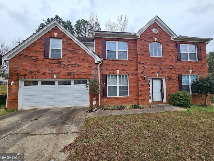
4527 Mill Station Trace Lithonia, GA 30038
Estimated payment $2,137/month
Highlights
- Fireplace in Primary Bedroom
- Wood Flooring
- High Ceiling
- Partially Wooded Lot
- Corner Lot
- No HOA
About This Home
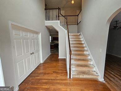
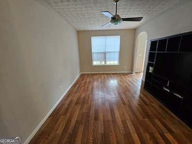
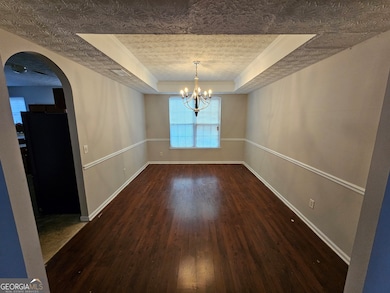
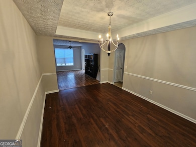
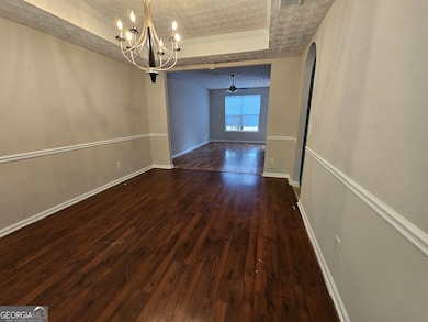
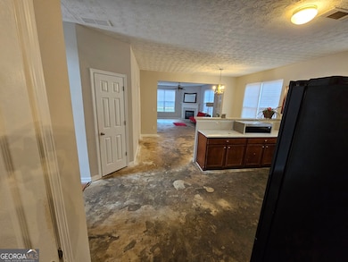
Awesome 2 story brick home in the Highly Rated Arabia Mountain school district, beauty has a freshly painted interior and is just under 3500 square feet, there is an open 2 story foyer, separate living room, dining room, office, open kitchen with breakfast area and a family room with a fireplace all on the main level, the owner's level features a master bedroom with a fireplace and a circular flow into the bathroom and the separate sitting area, the secondary bedrooms are spacious and have step in closets and trey ceilings. The driveway can comfortably park 6-8 cars. Walking distance to popular trails. ***1 Year Home Warranty provided at closing***. Must schedule through Showingtime. Owner says sell!
Listing Agent
Alpine Properties, LLC Brokerage Phone: 404-234-9700 License #166371 Listed on: 12/04/2025
Home Details
Home Type
- Single Family
Est. Annual Taxes
- $4,038
Year Built
- Built in 2005
Lot Details
- 0.28 Acre Lot
- Corner Lot
- Partially Wooded Lot
- Grass Covered Lot
Home Design
- Slab Foundation
- Composition Roof
- Stone Siding
- Three Sided Brick Exterior Elevation
- Stone
Interior Spaces
- 3,497 Sq Ft Home
- 2-Story Property
- Tray Ceiling
- High Ceiling
- Fireplace With Gas Starter
- Family Room with Fireplace
- 2 Fireplaces
- Formal Dining Room
- Home Office
- Pull Down Stairs to Attic
- Laundry in Mud Room
Kitchen
- Breakfast Area or Nook
- Breakfast Bar
- Convection Oven
- Microwave
- Dishwasher
- Disposal
Flooring
- Wood
- Laminate
Bedrooms and Bathrooms
- 4 Bedrooms
- Fireplace in Primary Bedroom
- Walk-In Closet
Parking
- 2 Car Garage
- Parking Accessed On Kitchen Level
- Garage Door Opener
Outdoor Features
- Patio
Schools
- Murphy Candler Elementary School
- Salem Middle School
- Martin Luther King Jr High School
Utilities
- Central Heating and Cooling System
- Heat Pump System
- 220 Volts
- High Speed Internet
Community Details
- No Home Owners Association
- Brown Mill Station Subdivision
Listing and Financial Details
- Legal Lot and Block 8 / B
Map
Home Values in the Area
Average Home Value in this Area
Tax History
| Year | Tax Paid | Tax Assessment Tax Assessment Total Assessment is a certain percentage of the fair market value that is determined by local assessors to be the total taxable value of land and additions on the property. | Land | Improvement |
|---|---|---|---|---|
| 2025 | $4,034 | $133,440 | $12,000 | $121,440 |
| 2024 | $4,378 | $143,320 | $12,000 | $131,320 |
| 2023 | $4,378 | $141,280 | $12,000 | $129,280 |
| 2022 | $4,079 | $134,440 | $12,000 | $122,440 |
| 2021 | $3,297 | $98,440 | $12,000 | $86,440 |
| 2020 | $2,910 | $86,840 | $12,000 | $74,840 |
| 2019 | $2,806 | $82,880 | $12,000 | $70,880 |
| 2018 | $1,802 | $57,000 | $7,980 | $49,020 |
| 2017 | $1,991 | $57,000 | $7,980 | $49,020 |
| 2016 | $1,637 | $57,000 | $7,840 | $49,160 |
| 2014 | $1,493 | $44,080 | $7,840 | $36,240 |
Property History
| Date | Event | Price | List to Sale | Price per Sq Ft |
|---|---|---|---|---|
| 12/04/2025 12/04/25 | For Sale | $349,900 | -- | $100 / Sq Ft |
Purchase History
| Date | Type | Sale Price | Title Company |
|---|---|---|---|
| Deed | $135,000 | -- | |
| Foreclosure Deed | $210,403 | -- |
Mortgage History
| Date | Status | Loan Amount | Loan Type |
|---|---|---|---|
| Open | $121,500 | New Conventional |
Source: Georgia MLS
MLS Number: 10653536
APN: 16-112-01-012
Disclaimer: Certain information contained herein is derived from information provided by parties other than Homes.com. All information provided is deemed reliable, but is not guaranteed to be accurate and should be independently verified.
![]() The data relating to real estate for sale on this web site comes in part from the Broker Reciprocity Program of Georgia MLS. Real estate listings held by brokerage firms other than Redfin are marked with the Broker Reciprocity logo and detailed information about them includes the name of the listing brokers. Information deemed reliable but not guaranteed. Copyright 2026 Georgia MLS. All rights reserved.
The data relating to real estate for sale on this web site comes in part from the Broker Reciprocity Program of Georgia MLS. Real estate listings held by brokerage firms other than Redfin are marked with the Broker Reciprocity logo and detailed information about them includes the name of the listing brokers. Information deemed reliable but not guaranteed. Copyright 2026 Georgia MLS. All rights reserved.
- 4561 Browns Mill Close
- 4584 Browns Mill Close
- 6305 Cathedral Ln
- 4701 Garden City Dr
- 4626 Garden City Dr
- 4480 English Loop
- 6114 Leverett Dr
- 4381 Klondike Rd
- 6420 Thurgood Cir
- 4520 Idlewood Park
- 4486 Housworth Dr
- 4496 Housworth Dr Unit 2
- 6378 Browns Mill Rd
- 4492 Idlewood Park
- 4716 Idlewood Gate
- 6303 Klondike River Rd
- 4345 Idlewood Park
- 4270 Klondike Rd
- 6177 Idlewood Cir
- 7043 S Goddard Rd
- 6328 Sunflower Place
- 4577 Garden City Dr
- 6269 Cathedral Ln
- 6238 Leverett Dr
- 6188 Leverett Dr
- 6950 Carleen Ct
- 4675 Forest Creek Ln
- 4609 Post Ridge Ln
- 6062 Idlewood Trace
- 6354 Klondike River Rd
- 4642 Latchwood Dr
- 6530 Lake Mill Ct
- 4712 Jackam Ridge Ct
- 6223 Klondike River Rd
- 4365 Idlewood Park
- 7043 S Goddard Rd
- 6800 Gina Agha Cir
- 6662 Browns Mill Ferry Dr
- 4935 River Overlook Way
- 6600 Browns Mill Ferry Dr

Ask me questions while you tour the home.