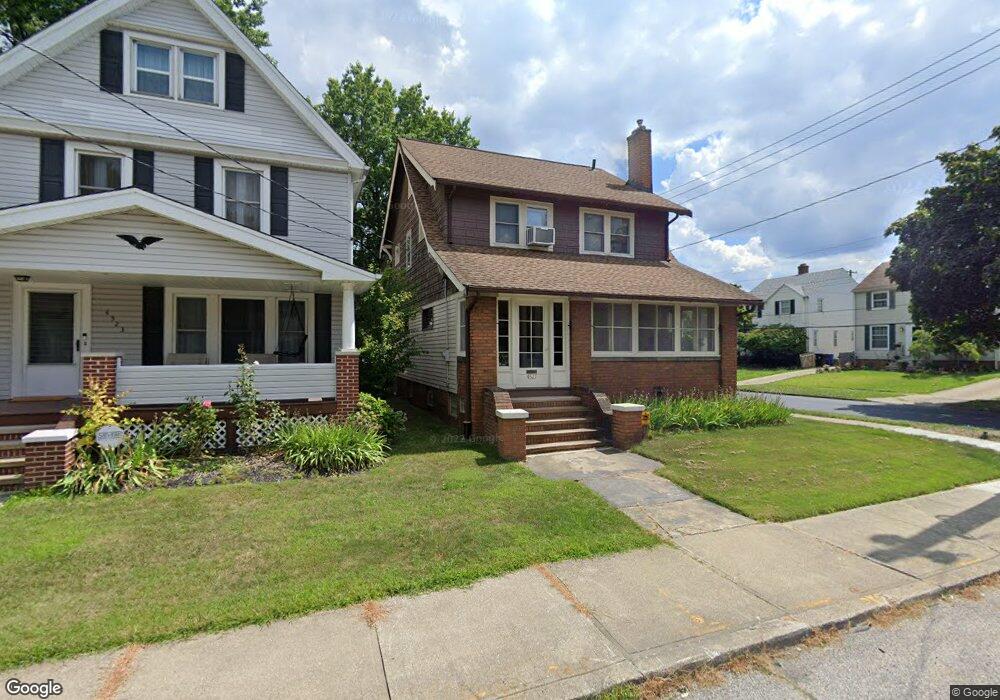
4527 W 20th St Cleveland, OH 44109
Old Brooklyn NeighborhoodEstimated Value: $148,000 - $203,000
3
Beds
1
Bath
1,811
Sq Ft
$94/Sq Ft
Est. Value
About This Home
This home is located at 4527 W 20th St, Cleveland, OH 44109 and is currently estimated at $171,090, approximately $94 per square foot. 4527 W 20th St is a home located in Cuyahoga County with nearby schools including Benjamin Franklin, Almira Academy, and Artemus Ward School.
Ownership History
Date
Name
Owned For
Owner Type
Purchase Details
Closed on
Jul 21, 1999
Sold by
Dziak Mary Louise
Bought by
Lim Scott Kirby and Rubin Carla M
Current Estimated Value
Home Financials for this Owner
Home Financials are based on the most recent Mortgage that was taken out on this home.
Original Mortgage
$86,247
Outstanding Balance
$24,120
Interest Rate
7.54%
Mortgage Type
FHA
Estimated Equity
$146,970
Purchase Details
Closed on
Apr 3, 1990
Sold by
Dziak John A
Bought by
Dziak Mary Louise
Purchase Details
Closed on
Jun 8, 1984
Sold by
Bradick Gerald S
Bought by
Dziak John A
Purchase Details
Closed on
Dec 5, 1977
Sold by
Roll Edward F and Roll Arlene
Bought by
Bradick Gerald S
Purchase Details
Closed on
Jan 1, 1975
Bought by
Roll Edward F and Roll Arlene
Create a Home Valuation Report for This Property
The Home Valuation Report is an in-depth analysis detailing your home's value as well as a comparison with similar homes in the area
Home Values in the Area
Average Home Value in this Area
Purchase History
| Date | Buyer | Sale Price | Title Company |
|---|---|---|---|
| Lim Scott Kirby | $87,000 | Real Estate Title | |
| Dziak Mary Louise | -- | -- | |
| Dziak John A | $43,400 | -- | |
| Bradick Gerald S | $38,500 | -- | |
| Roll Edward F | -- | -- |
Source: Public Records
Mortgage History
| Date | Status | Borrower | Loan Amount |
|---|---|---|---|
| Open | Lim Scott Kirby | $86,247 |
Source: Public Records
Tax History Compared to Growth
Tax History
| Year | Tax Paid | Tax Assessment Tax Assessment Total Assessment is a certain percentage of the fair market value that is determined by local assessors to be the total taxable value of land and additions on the property. | Land | Improvement |
|---|---|---|---|---|
| 2024 | $2,380 | $46,095 | $7,560 | $38,535 |
| 2023 | $2,196 | $38,120 | $8,120 | $30,000 |
| 2022 | $2,215 | $38,120 | $8,120 | $30,000 |
| 2021 | $2,193 | $38,120 | $8,120 | $30,000 |
| 2020 | $1,795 | $29,540 | $6,300 | $23,240 |
| 2019 | $1,660 | $84,400 | $18,000 | $66,400 |
| 2018 | $1,427 | $29,540 | $6,300 | $23,240 |
| 2017 | $1,452 | $26,360 | $5,390 | $20,970 |
| 2016 | $1,441 | $26,360 | $5,390 | $20,970 |
| 2015 | $1,446 | $26,360 | $5,390 | $20,970 |
| 2014 | $1,446 | $26,360 | $5,390 | $20,970 |
Source: Public Records
Map
Nearby Homes
- 2018 Tampa Ave
- 1917 Cypress Ave
- 2219 Hood Ave
- 1825 Treadway Ave
- 4463 S Hills Dr
- 2101 Broadview Rd
- 4475 W 12th St
- 2312 Roanoke Ave Unit 1-2
- 2815 Tampa Ave
- 4233 Valley Rd
- 2810 Natchez Ave
- 4491 W 30th St
- 4771 S Hills Dr
- 1917 Alvin Ave
- 4267 W 21st St
- 1025 Timothy Ln
- 2802 Colburn Ave
- 1516 Amberley Ave
- 902 Colonel Dr
- 4249 W 23rd St
- 4523 W 20th St
- 4519 W 20th St
- 4757 W 20th St
- 4515 W 20th St
- 2002 Tampa Ave
- 1917 Tampa Ave
- 1921 Tampa Ave
- 1913 Tampa Ave
- 2001 Tampa Ave Unit ID1061103P
- 1909 Tampa Ave
- 2006 Tampa Ave
- 4511 W 20th St
- 2003 Tampa Ave
- 1905 Tampa Ave
- 2001 Natchez Ave
- 2010 Tampa Ave
- 4507 W 20th St
- 2007 Tampa Ave
- 1901 Tampa Ave
- 2007 Natchez Ave