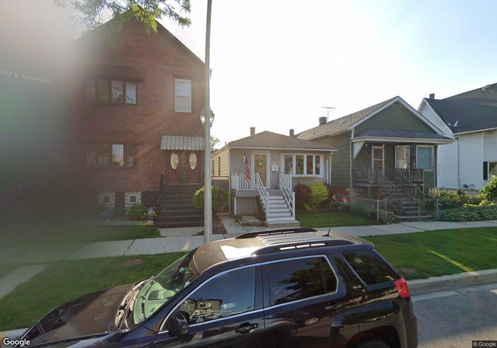
4528 S Lowe Ave Chicago, IL 60609
Bridgeport NeighborhoodEstimated Value: $219,000 - $319,000
3
Beds
1
Bath
1,170
Sq Ft
$234/Sq Ft
Est. Value
About This Home
This home is located at 4528 S Lowe Ave, Chicago, IL 60609 and is currently estimated at $273,477, approximately $233 per square foot. 4528 S Lowe Ave is a home located in Cook County with nearby schools including Graham A Elementary School, St Gabriel Elementary School, and Cambridge Classical Academy.
Ownership History
Date
Name
Owned For
Owner Type
Purchase Details
Closed on
Oct 1, 2001
Sold by
Mahon William M and Mahon Shawn M
Bought by
Mccarthy Margaret Mary and Mccarthy Edmond Charles
Current Estimated Value
Purchase Details
Closed on
Feb 18, 1998
Sold by
Mccarthy Edmund G and Mccarthy Margaret
Bought by
Mahon William M and Mahon Shawn M
Purchase Details
Closed on
Apr 1, 1994
Sold by
Cole Taylor Bank
Bought by
Mahon William M and Mahon Shawn M
Home Financials for this Owner
Home Financials are based on the most recent Mortgage that was taken out on this home.
Original Mortgage
$72,000
Interest Rate
7.51%
Create a Home Valuation Report for This Property
The Home Valuation Report is an in-depth analysis detailing your home's value as well as a comparison with similar homes in the area
Home Values in the Area
Average Home Value in this Area
Purchase History
| Date | Buyer | Sale Price | Title Company |
|---|---|---|---|
| Mccarthy Margaret Mary | $135,000 | Ticor Title Insurance | |
| Mahon William M | -- | Dukane Title | |
| Mahon William M | $53,333 | -- |
Source: Public Records
Mortgage History
| Date | Status | Borrower | Loan Amount |
|---|---|---|---|
| Previous Owner | Mahon William M | $72,000 |
Source: Public Records
Tax History Compared to Growth
Tax History
| Year | Tax Paid | Tax Assessment Tax Assessment Total Assessment is a certain percentage of the fair market value that is determined by local assessors to be the total taxable value of land and additions on the property. | Land | Improvement |
|---|---|---|---|---|
| 2024 | $1,579 | $19,000 | $1,890 | $17,110 |
| 2023 | $1,588 | $18,000 | $3,150 | $14,850 |
| 2022 | $1,588 | $18,000 | $3,150 | $14,850 |
| 2021 | $1,512 | $18,000 | $3,150 | $14,850 |
| 2020 | $888 | $17,136 | $3,150 | $13,986 |
| 2019 | $886 | $19,041 | $3,150 | $15,891 |
| 2018 | $872 | $19,041 | $3,150 | $15,891 |
| 2017 | $934 | $15,776 | $2,835 | $12,941 |
| 2016 | $1,347 | $15,776 | $2,835 | $12,941 |
| 2015 | $1,295 | $15,776 | $2,835 | $12,941 |
| 2014 | $1,284 | $15,242 | $2,677 | $12,565 |
| 2013 | $1,288 | $15,242 | $2,677 | $12,565 |
Source: Public Records
Map
Nearby Homes
- 4425 S Union Ave
- 613 W 46th Place
- 4555 S Halsted St
- 3606 S Halsted St
- 4419 S Wallace St
- 4361 S Halsted St
- 4411 S Wallace St
- 4407 S Wallace St
- 520 W 44th Place
- 606 W 47th Place
- 4353 S Halsted St
- 4801 S Union Ave
- 604 W 43rd St
- 4217 S Emerald Ave
- 4452 S Shields Ave
- 4842 S Wallace St
- 735 W 48th Place
- 4857 S Union Ave
- 4438 S Princeton Ave
- 4904 S Princeton Ave
- 4526 S Lowe Ave
- 4530 S Lowe Ave Unit 1
- 4530 S Lowe Ave
- 4532 S Lowe Ave Unit 2
- 4518 S Lowe Ave
- 4556 S Lowe Ave
- 4536 S Lowe Ave
- 4516 S Lowe Ave
- 4516 S Lowe Ave
- 4540 S Lowe Ave
- 4540 S Lowe Ave Unit 2F
- 4514 S Lowe Ave
- 4514 S Lowe Ave
- 4527 S Union Ave Unit 2
- 4531 S Union Ave
- 4542 S Lowe Ave
- 4542 S Lowe Ave
- 4523 S Union Ave
- 4512 S Lowe Ave
- 4512 S Lowe Ave