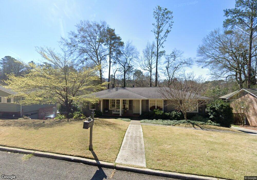
453 Crest Dr Birmingham, AL 35209
Estimated Value: $622,000 - $729,000
3
Beds
2
Baths
2,482
Sq Ft
$278/Sq Ft
Est. Value
About This Home
This home is located at 453 Crest Dr, Birmingham, AL 35209 and is currently estimated at $689,660, approximately $277 per square foot. 453 Crest Dr is a home located in Jefferson County with nearby schools including Edgewood Elementary School, Homewood Middle School, and Homewood High School.
Ownership History
Date
Name
Owned For
Owner Type
Purchase Details
Closed on
Mar 5, 2004
Sold by
Peters Matthew C and Peters Elizabeth G
Bought by
Thornton Taylor Bert P and Thornton Taylor Mary
Current Estimated Value
Home Financials for this Owner
Home Financials are based on the most recent Mortgage that was taken out on this home.
Original Mortgage
$227,905
Outstanding Balance
$44,034
Interest Rate
3.25%
Mortgage Type
Unknown
Estimated Equity
$645,626
Purchase Details
Closed on
Mar 24, 1999
Sold by
Cendant Mobility Services Corp
Bought by
Petters Matthew C and Gniadek Elizabeth J
Home Financials for this Owner
Home Financials are based on the most recent Mortgage that was taken out on this home.
Original Mortgage
$172,918
Interest Rate
6.37%
Create a Home Valuation Report for This Property
The Home Valuation Report is an in-depth analysis detailing your home's value as well as a comparison with similar homes in the area
Home Values in the Area
Average Home Value in this Area
Purchase History
| Date | Buyer | Sale Price | Title Company |
|---|---|---|---|
| Thornton Taylor Bert P | $239,900 | -- | |
| Petters Matthew C | -- | -- | |
| Cendant Mobility Services Corp | -- | -- |
Source: Public Records
Mortgage History
| Date | Status | Borrower | Loan Amount |
|---|---|---|---|
| Open | Thornton Taylor Bert P | $227,905 | |
| Closed | Cendant Mobility Services Corp | $172,918 |
Source: Public Records
Tax History Compared to Growth
Tax History
| Year | Tax Paid | Tax Assessment Tax Assessment Total Assessment is a certain percentage of the fair market value that is determined by local assessors to be the total taxable value of land and additions on the property. | Land | Improvement |
|---|---|---|---|---|
| 2024 | $3,886 | $57,260 | -- | -- |
| 2022 | $3,845 | $52,210 | $23,580 | $28,630 |
| 2021 | $3,305 | $45,010 | $23,580 | $21,430 |
| 2020 | $3,305 | $45,010 | $23,580 | $21,430 |
| 2019 | $3,049 | $41,600 | $0 | $0 |
| 2018 | $2,955 | $40,340 | $0 | $0 |
| 2017 | $2,955 | $40,340 | $0 | $0 |
| 2016 | $3,210 | $43,740 | $0 | $0 |
| 2015 | $2,707 | $37,040 | $0 | $0 |
| 2014 | $2,385 | $35,800 | $0 | $0 |
| 2013 | $2,385 | $35,800 | $0 | $0 |
Source: Public Records
Map
Nearby Homes
- 1505 Ridge Rd
- 511 Kenilworth Dr
- 1426 Overlook Rd
- 334 Kenilworth Dr
- 1640 Ridge Rd
- 1719 Windsor Blvd
- 74 Parkway Dr
- 825 Sylvia Dr
- 1725 Windsor Blvd
- 1733 Windsor Blvd
- 1124 S Shadesview Terrace
- 1614 Wellington Rd
- 1735 Saulter Rd
- 1618 Wellington Rd
- 590 Forrest Dr S
- 411 Edgeland Place
- 312 Westover Dr
- 807 Carr Ave
- 1451 Woodridge Cove
- 1500 Woodridge Place
- 449 Crest Dr
- 457 Crest Dr
- 501 Old Saulter Cir
- 500 Old Saulter Cir
- 445 Crest Dr
- 452 Crest Dr
- 712 Colony Cir
- 708 Colony Cir
- 456 Crest Dr
- 448 Crest Dr
- 504 Old Saulter Cir
- 716 Colony Cir
- 704 Colony Cir
- 444 Crest Dr
- 505 Old Saulter Cir
- 441 Crest Dr
- 440 Crest Dr
- 508 Old Saulter Cir
- 1400 Saulter Rd
- 700 Colony Cir