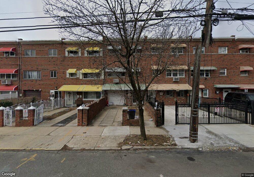
453 Olmstead Ave Bronx, NY 10473
Castle Hill NeighborhoodEstimated Value: $665,487 - $827,000
6
Beds
2
Baths
1,594
Sq Ft
$462/Sq Ft
Est. Value
About This Home
This home is located at 453 Olmstead Ave, Bronx, NY 10473 and is currently estimated at $737,122, approximately $462 per square foot. 453 Olmstead Ave is a home located in Bronx County with nearby schools including P.S. 182.
Ownership History
Date
Name
Owned For
Owner Type
Purchase Details
Closed on
Sep 26, 2016
Sold by
Carpignano Diane and Chavis Cleo
Bought by
Amartey Gladys and Oluwatukesi Olasoji
Current Estimated Value
Home Financials for this Owner
Home Financials are based on the most recent Mortgage that was taken out on this home.
Original Mortgage
$361,810
Outstanding Balance
$290,059
Interest Rate
3.46%
Mortgage Type
New Conventional
Estimated Equity
$447,063
Purchase Details
Closed on
Jul 12, 2004
Sold by
Chavis Cleo
Bought by
Carpignano Diane and Chavis Cleo
Create a Home Valuation Report for This Property
The Home Valuation Report is an in-depth analysis detailing your home's value as well as a comparison with similar homes in the area
Home Values in the Area
Average Home Value in this Area
Purchase History
| Date | Buyer | Sale Price | Title Company |
|---|---|---|---|
| Amartey Gladys | $373,000 | -- | |
| Amartey Gladys | $373,000 | -- | |
| Carpignano Diane | -- | -- | |
| Carpignano Diane | -- | -- |
Source: Public Records
Mortgage History
| Date | Status | Borrower | Loan Amount |
|---|---|---|---|
| Open | Amartey Gladys | $361,810 | |
| Closed | Amartey Gladys | $361,810 |
Source: Public Records
Tax History Compared to Growth
Tax History
| Year | Tax Paid | Tax Assessment Tax Assessment Total Assessment is a certain percentage of the fair market value that is determined by local assessors to be the total taxable value of land and additions on the property. | Land | Improvement |
|---|---|---|---|---|
| 2025 | $5,314 | $32,476 | $5,378 | $27,098 |
| 2024 | $5,314 | $26,459 | $5,003 | $21,456 |
| 2023 | $5,374 | $26,459 | $5,021 | $21,438 |
| 2022 | $4,416 | $28,500 | $6,240 | $22,260 |
| 2021 | $4,392 | $28,920 | $6,240 | $22,680 |
| 2020 | $4,168 | $27,240 | $6,240 | $21,000 |
| 2019 | $3,886 | $24,840 | $6,240 | $18,600 |
| 2018 | $3,787 | $18,576 | $4,916 | $13,660 |
| 2017 | $3,758 | $18,435 | $4,866 | $13,569 |
| 2016 | $2,742 | $17,392 | $5,138 | $12,254 |
| 2015 | $1,524 | $16,408 | $6,140 | $10,268 |
| 2014 | $1,524 | $15,480 | $6,960 | $8,520 |
Source: Public Records
Map
Nearby Homes
- 2114 Lacombe Ave
- 437 Torry Ave
- 423 Olmstead Ave
- 595 Olmstead Ave
- 433 Howe Ave Unit A
- 2037 Cicero Ave
- 2049 Caesar Place
- 317 Torry Ave
- 452 Howe Ave
- 422 Castle Hill Ave
- 303 Howe Ave
- 430 Turneur Ave
- 2067 Seward Ave
- 2109 Seward Ave
- 2286 Lacombe Ave
- 234 Betts Ave
- 1909 Lacombe Ave
- 1904 Lacombe Ave
- 1903 Lacombe Ave
- 508 Bolton Ave
- 453 Olmstead Ave Unit 1
- 455 Olmstead Ave
- 451 Olmstead Ave
- 457 Olmstead Ave
- 449 Olmstead Ave
- 459 Olmstead Ave
- 461 Olmstead Ave
- 445 Olmstead Ave
- 443 Olmstead Ave
- 446 Screvin Ave
- 444 Screvin Ave
- 448 Screvin Ave Unit 3 bedroom unit
- 448 Screvin Ave Unit 2 bedroom unit
- 442 Screvin Ave
- 441 Olmstead Ave
- 450 Screvin Ave
- 440 Screvin Ave
- 438 Screvin Ave
- 452 Screvin Ave