Estimated Value: $166,000 - $244,000
3
Beds
2
Baths
950
Sq Ft
$227/Sq Ft
Est. Value
About This Home
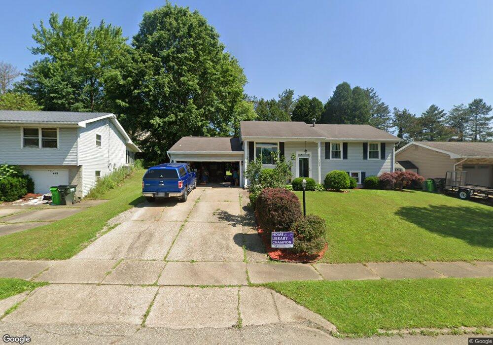
This home is located at 453 Shawnee Dr, Dover, OH 44622 and is currently estimated at $215,739, approximately $227 per square foot. 453 Shawnee Dr is a home located in Tuscarawas County with nearby schools including Dover High School and Tuscarawas Central Catholic Elementary School.
Ownership History
Date
Name
Owned For
Owner Type
Purchase Details
Closed on
Aug 16, 2019
Sold by
Big D Real Estate Llc
Bought by
Grunder Albert
Current Estimated Value
Home Financials for this Owner
Home Financials are based on the most recent Mortgage that was taken out on this home.
Original Mortgage
$109,900
Interest Rate
3.7%
Mortgage Type
New Conventional
Purchase Details
Closed on
Jul 26, 2019
Sold by
Miller Frank L and Miller Linda S
Bought by
Big D Real Estate Llc
Home Financials for this Owner
Home Financials are based on the most recent Mortgage that was taken out on this home.
Original Mortgage
$109,900
Interest Rate
3.7%
Mortgage Type
New Conventional
Purchase Details
Closed on
Jul 6, 2018
Sold by
Lawver Construction Ltd
Bought by
Miller Frank L and Miller Linda S
Home Financials for this Owner
Home Financials are based on the most recent Mortgage that was taken out on this home.
Original Mortgage
$47,000
Interest Rate
4.6%
Mortgage Type
Credit Line Revolving
Create a Home Valuation Report for This Property
The Home Valuation Report is an in-depth analysis detailing your home's value as well as a comparison with similar homes in the area
Home Values in the Area
Average Home Value in this Area
Purchase History
| Date | Buyer | Sale Price | Title Company |
|---|---|---|---|
| Grunder Albert | $109,900 | Connolly Hillyer & Welch Ttl | |
| Big D Real Estate Llc | $84,000 | Tusc Title | |
| Miller Frank L | $220,000 | Tusc Title |
Source: Public Records
Mortgage History
| Date | Status | Borrower | Loan Amount |
|---|---|---|---|
| Closed | Grunder Albert | $109,900 | |
| Previous Owner | Miller Frank L | $47,000 |
Source: Public Records
Tax History Compared to Growth
Tax History
| Year | Tax Paid | Tax Assessment Tax Assessment Total Assessment is a certain percentage of the fair market value that is determined by local assessors to be the total taxable value of land and additions on the property. | Land | Improvement |
|---|---|---|---|---|
| 2024 | $2,484 | $58,020 | $13,570 | $44,450 |
| 2023 | $2,484 | $165,750 | $38,760 | $126,990 |
| 2022 | $2,509 | $58,013 | $13,566 | $44,447 |
| 2021 | $2,174 | $47,188 | $10,672 | $36,516 |
| 2020 | $2,174 | $47,188 | $10,672 | $36,516 |
| 2019 | $2,190 | $47,188 | $10,672 | $36,516 |
| 2018 | $1,963 | $39,990 | $9,040 | $30,950 |
| 2017 | $1,963 | $39,990 | $9,040 | $30,950 |
| 2016 | $1,966 | $39,990 | $9,040 | $30,950 |
| 2014 | $1,799 | $39,810 | $9,040 | $30,770 |
| 2013 | $1,818 | $39,810 | $9,040 | $30,770 |
Source: Public Records
Map
Nearby Homes
- 2719 Wyandot Dr
- 502 Oakdale Dr
- 520 Oakdale Dr
- 1242 Schneiders Crossing Rd NW Unit C
- 3030 N Wooster Ave
- 306 E 15th St
- 971 Schneiders Crossing Rd NW
- 1411 Chestnut St
- 1319 N Walnut St
- 6238 Saint Peters Church Rd NW
- 119 Phoenix Dr
- 5747 Middle Run Rd NW
- 500 W 13th St
- 6113 Middle Run Rd
- 227 E Slingluff Ave
- 0 Bair Rd NW Unit 5124469
- 0 Bair Rd NW Unit 5124477
- 0 Bair Rd NW Unit 5124464
- 0 Bair Rd NW Unit 5124485
- 0 Bair Rd NW Unit 5124339
- 459 Shawnee Dr
- 449 Shawnee Dr
- 501 Shawnee Dr
- 445 Shawnee Dr
- 219 Aspen Dr
- 211 Aspen Dr Unit 209
- 209 Aspen Dr Unit 209
- 456 Shawnee Dr
- 217 Aspen Dr
- 446 Shawnee Dr
- 207 Aspen Dr Unit 205
- 505 Shawnee Dr
- 439 Shawnee Dr
- 205 Aspen Dr Unit 205
- 215 Aspen Dr
- 2740 Wyandot Dr
- 2733 Wyandot Dr
- 223 Aspen Dr
- 511 Shawnee Dr
- 203 Aspen Dr Unit 203