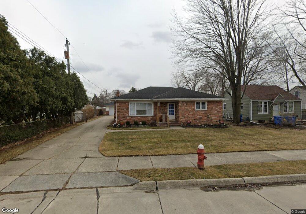
4530 Kiefer Ave Unit 7 Warren, MI 48091
Southwest Warren NeighborhoodEstimated Value: $247,000 - $259,000
3
Beds
2
Baths
1,540
Sq Ft
$165/Sq Ft
Est. Value
About This Home
This home is located at 4530 Kiefer Ave Unit 7, Warren, MI 48091 and is currently estimated at $254,746, approximately $165 per square foot. 4530 Kiefer Ave Unit 7 is a home located in Macomb County with nearby schools including Mark C. Roose Elementary School, Center Line High School, and Wolfe Middle School.
Ownership History
Date
Name
Owned For
Owner Type
Purchase Details
Closed on
Jul 6, 2017
Sold by
Allen Ronald M and Allen Beverly J
Bought by
Allen Ronald M and The Ronald M Allen Revocable Living Trus
Current Estimated Value
Purchase Details
Closed on
Feb 16, 2006
Sold by
Gallo Homes Inc
Bought by
Obedencio Rodesa G and Obedencio Rycar A
Home Financials for this Owner
Home Financials are based on the most recent Mortgage that was taken out on this home.
Original Mortgage
$222,500
Interest Rate
6.2%
Mortgage Type
Fannie Mae Freddie Mac
Create a Home Valuation Report for This Property
The Home Valuation Report is an in-depth analysis detailing your home's value as well as a comparison with similar homes in the area
Home Values in the Area
Average Home Value in this Area
Purchase History
| Date | Buyer | Sale Price | Title Company |
|---|---|---|---|
| Allen Ronald M | -- | None Available | |
| Obedencio Rodesa G | $70,000 | Lawyers Title Insurance Co |
Source: Public Records
Mortgage History
| Date | Status | Borrower | Loan Amount |
|---|---|---|---|
| Closed | Obedencio Rodesa G | $222,500 |
Source: Public Records
Tax History
| Year | Tax Paid | Tax Assessment Tax Assessment Total Assessment is a certain percentage of the fair market value that is determined by local assessors to be the total taxable value of land and additions on the property. | Land | Improvement |
|---|---|---|---|---|
| 2025 | $3,386 | $129,880 | $0 | $0 |
| 2024 | $33 | $117,560 | $0 | $0 |
| 2023 | $3,223 | $103,960 | $0 | $0 |
| 2022 | $3,115 | $94,690 | $0 | $0 |
| 2021 | $3,168 | $90,720 | $0 | $0 |
| 2020 | $3,089 | $87,130 | $0 | $0 |
| 2019 | $3,031 | $86,400 | $0 | $0 |
| 2018 | $3,038 | $66,340 | $0 | $0 |
| 2017 | $2,779 | $59,270 | $8,210 | $51,060 |
| 2016 | $2,757 | $59,270 | $0 | $0 |
| 2015 | -- | $46,960 | $0 | $0 |
| 2013 | $5,870 | $46,710 | $0 | $0 |
Source: Public Records
Map
Nearby Homes
- 4225 Kiefer Ave
- 4510 Marr Ave
- 4245 Kiefer Ave
- 4949 E 10 Mile Rd
- 4973 E 10 Mile Rd Unit 8
- 4925 E 10 Mile Rd Unit 1
- 24955 Beierman Ave
- 24609 Eureka Ave
- 24906 Patricia Ave
- 4320 Frazho Rd
- 25808 Ryan Rd
- 26112 Cunningham Dr
- 4715 Shell Ct
- 24756 Hill Ave
- 4251 Dolores Ave
- 3440 E 10 Mile Rd
- 26405 Eureka Dr
- 24134 Loretta Ave
- 24025 Cunningham Ave
- 3890 Shannon Dr Unit 7
- 4520 Kiefer Ave
- 25069 Cunningham Ave
- 25057 Cunningham Ave
- 25081 Cunningham Ave
- 25045 Cunningham Ave
- 25103 Cunningham Ave
- 25033 Cunningham Ave
- 4541 E 10 Mile Rd
- 4509 E 10 Mile Rd
- 25160 Eureka Dr
- 25170 Eureka Dr
- 25021 Cunningham Ave
- 25115 Cunningham Ave
- 25150 Eureka Dr
- 4493 E 10 Mile Rd
- 25180 Eureka Dr
- 25127 Cunningham Ave
- 4537 Kiefer Ave
- 4525 Kiefer Ave
- 4477 E 10 Mile Rd
Your Personal Tour Guide
Ask me questions while you tour the home.