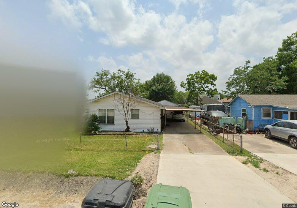
4530 White Rock St Houston, TX 77051
Sunnyside NeighborhoodEstimated Value: $171,000 - $194,000
3
Beds
1
Bath
1,240
Sq Ft
$149/Sq Ft
Est. Value
About This Home
This home is located at 4530 White Rock St, Houston, TX 77051 and is currently estimated at $184,794, approximately $149 per square foot. 4530 White Rock St is a home located in Harris County with nearby schools including Young Elementary School, Attucks Middle School, and Worthing High School.
Ownership History
Date
Name
Owned For
Owner Type
Purchase Details
Closed on
Jul 21, 2021
Sold by
Mcclain Dorothy Wright White
Bought by
Wright Beverly Ann
Current Estimated Value
Purchase Details
Closed on
Oct 8, 2020
Sold by
Wright Beverly Ann
Bought by
Wright Beverly Ann
Create a Home Valuation Report for This Property
The Home Valuation Report is an in-depth analysis detailing your home's value as well as a comparison with similar homes in the area
Home Values in the Area
Average Home Value in this Area
Purchase History
| Date | Buyer | Sale Price | Title Company |
|---|---|---|---|
| Wright Beverly Ann | -- | None Available | |
| Wright Beverly Ann | -- | None Available | |
| Wright Beverly Ann | -- | None Available | |
| Wright Beverly Ann | -- | None Available |
Source: Public Records
Tax History Compared to Growth
Tax History
| Year | Tax Paid | Tax Assessment Tax Assessment Total Assessment is a certain percentage of the fair market value that is determined by local assessors to be the total taxable value of land and additions on the property. | Land | Improvement |
|---|---|---|---|---|
| 2025 | $946 | $169,668 | $118,125 | $51,543 |
| 2024 | $946 | $165,829 | $110,250 | $55,579 |
| 2023 | $946 | $156,000 | $102,375 | $53,625 |
| 2022 | $2,058 | $147,275 | $78,750 | $68,525 |
| 2021 | $2,424 | $104,026 | $55,125 | $48,901 |
| 2020 | $1,871 | $77,248 | $45,282 | $31,966 |
| 2019 | $1,499 | $65,435 | $33,469 | $31,966 |
| 2018 | $0 | $53,851 | $23,625 | $30,226 |
| 2017 | $1,239 | $48,985 | $17,719 | $31,266 |
| 2016 | $1,239 | $48,985 | $17,719 | $31,266 |
| 2015 | -- | $47,736 | $17,719 | $30,017 |
| 2014 | -- | $40,528 | $17,719 | $22,809 |
Source: Public Records
Map
Nearby Homes
- 4548 Briscoe St
- 4523 Sunflower St
- 4608 White Rock St
- 4545 Bricker St
- 4638 Sunflower St Unit 9
- 4607 Bricker St
- 4524 Rosemont St Unit A/B
- 4614 Redbud St
- 8505 Rubin St
- 7905 Rock Rose St
- 8521 Dosia St
- 4429 Sterling St Unit A and B
- 8201 Calhoun Rd Unit A/B
- 4555 Newberry St
- 4314 Sunflower St
- 4741 Bricker St
- 8107 Calhoun Rd
- 4312 Sunflower St
- 4418 Rosemont St
- 1202 Vera Lou St
- 4528 White Rock St
- 4534 White Rock St
- 4541 Sunflower St
- 4536 White Rock St
- 4526 White Rock St
- 4553 Sunflower St
- 4539 Sunflower St
- 4531 White Rock St
- 4522 White Rock St
- 4542 Briscoe St
- 4525 White Rock St
- 4559 Sunflower St
- 4533 Sunflower St
- 4521 White Rock St
- 4542 White Rock St
- 4518 White Rock St
- 4519 White Rock St
- 4563 Sunflower St
- 4531 Sunflower St
- 4541 White Rock St