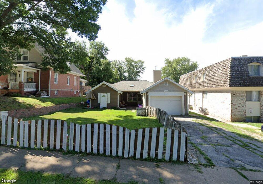
4531 Parker St Omaha, NE 68104
Military Avenue NeighborhoodEstimated Value: $219,000 - $290,000
3
Beds
2
Baths
1,691
Sq Ft
$145/Sq Ft
Est. Value
About This Home
This home is located at 4531 Parker St, Omaha, NE 68104 and is currently estimated at $244,560, approximately $144 per square foot. 4531 Parker St is a home located in Douglas County with nearby schools including Walnut Hill Elementary School, Lewis & Clark Middle School, and Benson Magnet High School.
Ownership History
Date
Name
Owned For
Owner Type
Purchase Details
Closed on
Aug 19, 2013
Sold by
Azimi Ghafar and Ashari Maria
Bought by
Padilla Adrian
Current Estimated Value
Purchase Details
Closed on
Dec 15, 2008
Sold by
Mccubbin Garry Tr
Bought by
Wells Fargo Bank
Purchase Details
Closed on
Feb 8, 2005
Sold by
Kirchmann Sandra M
Bought by
Craig Wells
Create a Home Valuation Report for This Property
The Home Valuation Report is an in-depth analysis detailing your home's value as well as a comparison with similar homes in the area
Home Values in the Area
Average Home Value in this Area
Purchase History
| Date | Buyer | Sale Price | Title Company |
|---|---|---|---|
| Padilla Adrian | $51,000 | None Available | |
| Wells Fargo Bank | $52,200 | -- | |
| Craig Wells | $73,000 | -- |
Source: Public Records
Tax History Compared to Growth
Tax History
| Year | Tax Paid | Tax Assessment Tax Assessment Total Assessment is a certain percentage of the fair market value that is determined by local assessors to be the total taxable value of land and additions on the property. | Land | Improvement |
|---|---|---|---|---|
| 2025 | $3,422 | $242,700 | $13,600 | $229,100 |
| 2024 | $4,464 | $211,600 | $13,600 | $198,000 |
| 2023 | $4,464 | $211,600 | $13,600 | $198,000 |
| 2022 | $3,874 | $181,500 | $13,600 | $167,900 |
| 2021 | $3,334 | $157,500 | $13,600 | $143,900 |
| 2020 | $1,342 | $62,700 | $6,800 | $55,900 |
| 2019 | $1,346 | $62,700 | $6,800 | $55,900 |
| 2018 | $1,914 | $89,000 | $6,800 | $82,200 |
| 2017 | $1,923 | $89,000 | $6,800 | $82,200 |
| 2016 | $1,910 | $89,000 | $6,800 | $82,200 |
| 2015 | $1,884 | $89,000 | $6,800 | $82,200 |
| 2014 | $1,884 | $89,000 | $6,800 | $82,200 |
Source: Public Records
Map
Nearby Homes
- 4523 Blondo St
- 2002 N 45th St
- 4537 Franklin St
- 4548 Seward St
- 2016 N 48th St
- 4719 Grant St
- 4323 Patrick Ave
- 2214 N 48th St
- 4819 Franklin St
- 4534 Charles St
- 1801 N 49th St
- 1721 N 49th St
- 2031 N 49th St
- 4245 Grant St
- 4236 Burdette St
- 4215 Patrick Ave
- 4855 NW Radial Hwy
- 2318 N 49th St
- 2476 N 47th Ave
- 2460 N 45th Ave
- 4525 Parker St
- 1825 NW Radial Hwy Unit 16
- 1825 NW Radial Hwy Unit 4
- 1825 NW Radial Hwy Unit 1
- 1825 NW Radial Hwy Unit 6
- 4523 Parker St
- 1809 N 46th Ave
- 4521 Parker St
- 1807 N 46th Ave
- 4534 Parker St
- 12623 N Park St
- 4524 Parker St
- 4519 Parker St
- 4526 Decatur St
- 1901 NW Radial Hwy
- 4522 Decatur St
- 1801 N 46th Ave
- 4520 Parker St
- 4522 Parker St
- 4518 Decatur St