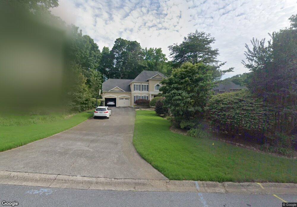
4532 Forest Peak Cir Unit 2 Marietta, GA 30066
Sandy Plains NeighborhoodEstimated Value: $744,000 - $874,000
5
Beds
5
Baths
3,603
Sq Ft
$222/Sq Ft
Est. Value
About This Home
This home is located at 4532 Forest Peak Cir Unit 2, Marietta, GA 30066 and is currently estimated at $800,016, approximately $222 per square foot. 4532 Forest Peak Cir Unit 2 is a home located in Cobb County with nearby schools including Davis Elementary School, Mabry Middle School, and Lassiter High School.
Ownership History
Date
Name
Owned For
Owner Type
Purchase Details
Closed on
May 24, 2024
Sold by
Obrien Michael and Obrien Amber
Bought by
Highland Pointe Recreation Association Inc
Current Estimated Value
Purchase Details
Closed on
Nov 4, 2022
Sold by
Cobb County
Bought by
Sparks Judith M and Sparks Randolph William
Purchase Details
Closed on
Mar 25, 2015
Sold by
Sparks Judith M
Bought by
Sparks Judith M and Sparks Randolph William
Home Financials for this Owner
Home Financials are based on the most recent Mortgage that was taken out on this home.
Original Mortgage
$324,000
Interest Rate
3.89%
Mortgage Type
New Conventional
Purchase Details
Closed on
Mar 24, 2015
Sold by
Sparks Randolph
Bought by
Sparks Judith M
Home Financials for this Owner
Home Financials are based on the most recent Mortgage that was taken out on this home.
Original Mortgage
$324,000
Interest Rate
3.89%
Mortgage Type
New Conventional
Purchase Details
Closed on
Jun 20, 2011
Sold by
Sparks Judith M
Bought by
Sparks Judith M and Sparks Randolph W
Home Financials for this Owner
Home Financials are based on the most recent Mortgage that was taken out on this home.
Original Mortgage
$341,127
Interest Rate
4.62%
Mortgage Type
FHA
Purchase Details
Closed on
Jun 17, 2011
Sold by
Harmon Robert T and Harmon Trinh T
Bought by
Sparks Judith M
Home Financials for this Owner
Home Financials are based on the most recent Mortgage that was taken out on this home.
Original Mortgage
$341,127
Interest Rate
4.62%
Mortgage Type
FHA
Purchase Details
Closed on
Apr 1, 1997
Sold by
Eudy Charles V and Wros Cheryl A
Bought by
Harmon Robert
Home Financials for this Owner
Home Financials are based on the most recent Mortgage that was taken out on this home.
Original Mortgage
$185,600
Interest Rate
7.12%
Mortgage Type
New Conventional
Purchase Details
Closed on
Jul 26, 1993
Sold by
Ridlehuber Ronald H
Bought by
Eudy Charles V Cheryl
Home Financials for this Owner
Home Financials are based on the most recent Mortgage that was taken out on this home.
Original Mortgage
$172,800
Interest Rate
7.39%
Create a Home Valuation Report for This Property
The Home Valuation Report is an in-depth analysis detailing your home's value as well as a comparison with similar homes in the area
Home Values in the Area
Average Home Value in this Area
Purchase History
| Date | Buyer | Sale Price | Title Company |
|---|---|---|---|
| Highland Pointe Recreation Association Inc | -- | None Listed On Document | |
| Sparks Judith M | -- | -- | |
| Sparks Judith M | -- | -- | |
| Sparks Judith M | -- | -- | |
| Sparks Judith M | -- | -- | |
| Sparks Judith M | $350,000 | -- | |
| Harmon Robert | $232,000 | -- | |
| Eudy Charles V Cheryl | $216,000 | -- |
Source: Public Records
Mortgage History
| Date | Status | Borrower | Loan Amount |
|---|---|---|---|
| Previous Owner | Sparks Judith M | $324,000 | |
| Previous Owner | Sparks Judith M | $341,127 | |
| Previous Owner | Harmon Robert | $185,600 | |
| Previous Owner | Eudy Charles V Cheryl | $172,800 |
Source: Public Records
Tax History Compared to Growth
Tax History
| Year | Tax Paid | Tax Assessment Tax Assessment Total Assessment is a certain percentage of the fair market value that is determined by local assessors to be the total taxable value of land and additions on the property. | Land | Improvement |
|---|---|---|---|---|
| 2025 | $7,292 | $242,004 | $60,000 | $182,004 |
| 2024 | $7,296 | $242,004 | $60,000 | $182,004 |
| 2023 | $7,296 | $242,004 | $60,000 | $182,004 |
| 2022 | $6,223 | $205,056 | $40,000 | $165,056 |
| 2021 | $5,414 | $178,392 | $40,000 | $138,392 |
| 2020 | $5,414 | $178,392 | $40,000 | $138,392 |
| 2019 | $5,414 | $178,392 | $40,000 | $138,392 |
| 2018 | $4,689 | $154,504 | $36,800 | $117,704 |
| 2017 | $4,442 | $154,504 | $36,800 | $117,704 |
| 2016 | $3,946 | $137,252 | $31,600 | $105,652 |
| 2015 | $4,043 | $137,252 | $31,600 | $105,652 |
| 2014 | -- | $137,252 | $0 | $0 |
Source: Public Records
Map
Nearby Homes
- 4243 N Mountain Rd NE
- 4734 Outlook Way NE
- 4302 Highborne Dr NE Unit 3
- 4380 Wood Creek Dr
- 3465 Township Ridge Point
- 4563 Ashmore Cir NE
- 4397 Windsor Oaks Cir
- 130 Cherecobb Dr
- 4589 Wigley Estates Rd
- 3043 Sawyer Trace NE
- 920 Lucky Ln
- 3350 Brookhill Cir
- 2855 Lamer Trace
- 422 Stovall Place
- 415 Bellehaven Ln
- 421 Stovall Place
- 146 Bellehaven Dr
- 2842 Forest Chase Dr NE
- 601 Cork St
- 4534 Forest Peak Cir
- 4530 Forest Peak Cir Unit 2
- 4536 Forest Peak Cir
- 3640 Lone Indian Ct
- 4700 W Forest Peak
- 3638 Lone Indian Ct Unit 2
- 4528 Forest Peak Cir
- 4531 Forest Peak Cir
- 4527 Forest Peak Cir
- 4525 Forest Peak Cir
- 4538 Forest Peak Cir
- 4710 W Forest Peak
- 4526 Forest Peak Cir
- 3642 Lone Indian Ct Unit 2
- 4533 Forest Peak Cir Unit 2
- 4523 Forest Peak Cir
- 3511 Forest Peak Ct
- 4661 E Forest Peak Unit 2
- 3636 Lone Indian Trail
- 4521 Forest Peak Cir