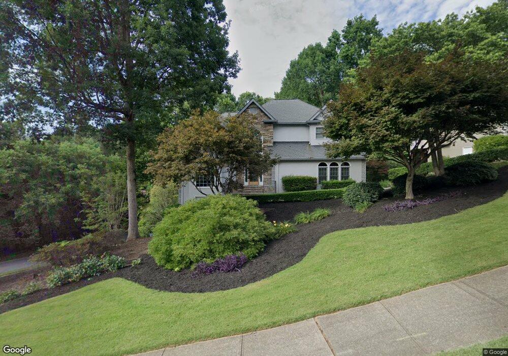
4533 Forest Peak Cir Unit 2 Marietta, GA 30066
Sandy Plains NeighborhoodEstimated Value: $620,000 - $786,000
4
Beds
4
Baths
2,674
Sq Ft
$269/Sq Ft
Est. Value
About This Home
This home is located at 4533 Forest Peak Cir Unit 2, Marietta, GA 30066 and is currently estimated at $718,842, approximately $268 per square foot. 4533 Forest Peak Cir Unit 2 is a home located in Cobb County with nearby schools including Davis Elementary School, Mabry Middle School, and Lassiter High School.
Ownership History
Date
Name
Owned For
Owner Type
Purchase Details
Closed on
May 30, 2001
Sold by
Trevino Arturo and Trevino Ann E
Bought by
Thornton Daniel L and Thornton Christine
Current Estimated Value
Home Financials for this Owner
Home Financials are based on the most recent Mortgage that was taken out on this home.
Original Mortgage
$188,000
Outstanding Balance
$71,238
Interest Rate
7.23%
Mortgage Type
New Conventional
Estimated Equity
$647,604
Purchase Details
Closed on
Jun 15, 1999
Sold by
Trevino Jr Arturo
Bought by
Trevino Arturo and Trevino Ann E
Purchase Details
Closed on
Sep 30, 1993
Sold by
Guy Patrick K Janice M
Bought by
Avera Roy C Denise M
Create a Home Valuation Report for This Property
The Home Valuation Report is an in-depth analysis detailing your home's value as well as a comparison with similar homes in the area
Home Values in the Area
Average Home Value in this Area
Purchase History
| Date | Buyer | Sale Price | Title Company |
|---|---|---|---|
| Thornton Daniel L | $298,000 | -- | |
| Trevino Arturo | -- | -- | |
| Avera Roy C Denise M | $240,000 | -- |
Source: Public Records
Mortgage History
| Date | Status | Borrower | Loan Amount |
|---|---|---|---|
| Open | Thornton Daniel L | $188,000 | |
| Closed | Avera Roy C Denise M | -- |
Source: Public Records
Tax History Compared to Growth
Tax History
| Year | Tax Paid | Tax Assessment Tax Assessment Total Assessment is a certain percentage of the fair market value that is determined by local assessors to be the total taxable value of land and additions on the property. | Land | Improvement |
|---|---|---|---|---|
| 2025 | $1,606 | $256,096 | $60,000 | $196,096 |
| 2024 | $1,611 | $256,096 | $60,000 | $196,096 |
| 2023 | $1,405 | $256,096 | $60,000 | $196,096 |
| 2022 | $1,492 | $216,140 | $40,000 | $176,140 |
| 2021 | $1,407 | $187,900 | $40,000 | $147,900 |
| 2020 | $1,407 | $187,900 | $40,000 | $147,900 |
| 2019 | $4,769 | $187,900 | $40,000 | $147,900 |
| 2018 | $3,896 | $148,012 | $36,800 | $111,212 |
| 2017 | $3,741 | $148,012 | $36,800 | $111,212 |
| 2016 | $3,529 | $138,168 | $31,600 | $106,568 |
| 2015 | $3,609 | $138,168 | $31,600 | $106,568 |
| 2014 | $3,636 | $138,168 | $0 | $0 |
Source: Public Records
Map
Nearby Homes
- 4243 N Mountain Rd NE
- 4734 Outlook Way NE
- 4380 Wood Creek Dr
- 4302 Highborne Dr NE Unit 3
- 3465 Township Ridge Point
- 4563 Ashmore Cir NE
- 130 Cherecobb Dr
- 4397 Windsor Oaks Cir
- 4589 Wigley Estates Rd
- 3350 Brookhill Cir
- 3043 Sawyer Trace NE
- 920 Lucky Ln
- 3870 Sweat Creek Run
- 415 Bellehaven Ln
- 146 Bellehaven Dr
- 422 Stovall Place
- 421 Stovall Place
- 2855 Lamer Trace
- 601 Cork St
- 4535 Forest Peak Cir
- 4538 Forest Peak Cir
- 4540 Forest Peak Cir
- 4536 Forest Peak Cir
- 4660 E Forest Peak
- 4537 Forest Peak Cir
- 4531 Forest Peak Cir
- 4661 E Forest Peak Unit 2
- 4534 Forest Peak Cir
- 4542 Forest Peak Cir Unit 2
- 3642 Lone Indian Ct Unit 2
- 3640 Lone Indian Ct
- 4666 E Forest Peak Unit 2
- 4532 Forest Peak Cir Unit 2
- 4539 Forest Peak Cir
- 4700 W Forest Peak
- 3646 Lone Indian Trail
- 4671 E Forest Peak Unit 2
- 3648 Lone Indian Trail
- 3650 Lone Indian Trail