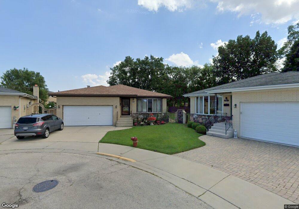
4533 N Anthon Ave Chicago, IL 60656
Schorsch Forest View NeighborhoodEstimated Value: $527,598 - $600,000
4
Beds
3
Baths
1,994
Sq Ft
$283/Sq Ft
Est. Value
About This Home
This home is located at 4533 N Anthon Ave, Chicago, IL 60656 and is currently estimated at $564,900, approximately $283 per square foot. 4533 N Anthon Ave is a home located in Cook County with nearby schools including Dirksen Elementary School, William Howard Taft High School, and St Eugene School.
Ownership History
Date
Name
Owned For
Owner Type
Purchase Details
Closed on
Jul 10, 2015
Sold by
First American Bank
Bought by
Dilollo Angelo Di
Current Estimated Value
Home Financials for this Owner
Home Financials are based on the most recent Mortgage that was taken out on this home.
Original Mortgage
$171,700
Interest Rate
3.75%
Mortgage Type
New Conventional
Purchase Details
Closed on
Feb 11, 1999
Sold by
Dilollo Angelo and Dilollo Antonetta
Bought by
Dilollo Angelo
Home Financials for this Owner
Home Financials are based on the most recent Mortgage that was taken out on this home.
Original Mortgage
$65,000
Interest Rate
6.83%
Create a Home Valuation Report for This Property
The Home Valuation Report is an in-depth analysis detailing your home's value as well as a comparison with similar homes in the area
Home Values in the Area
Average Home Value in this Area
Purchase History
| Date | Buyer | Sale Price | Title Company |
|---|---|---|---|
| Dilollo Angelo Di | -- | Surety Lender Services Llc | |
| Dilollo Angelo | -- | -- |
Source: Public Records
Mortgage History
| Date | Status | Borrower | Loan Amount |
|---|---|---|---|
| Previous Owner | Dilollo Angelo Di | $171,700 | |
| Previous Owner | Dilollo Angelo | $65,000 |
Source: Public Records
Tax History
| Year | Tax Paid | Tax Assessment Tax Assessment Total Assessment is a certain percentage of the fair market value that is determined by local assessors to be the total taxable value of land and additions on the property. | Land | Improvement |
|---|---|---|---|---|
| 2025 | $2,936 | $51,000 | $16,250 | $34,750 |
| 2024 | $2,936 | $51,000 | $16,250 | $34,750 |
| 2023 | $2,953 | $43,000 | $13,000 | $30,000 |
| 2022 | $2,953 | $43,000 | $13,000 | $30,000 |
| 2021 | $2,811 | $43,000 | $13,000 | $30,000 |
| 2020 | $2,900 | $41,192 | $8,125 | $33,067 |
| 2019 | $2,892 | $45,769 | $8,125 | $37,644 |
| 2018 | $2,848 | $45,769 | $8,125 | $37,644 |
| 2017 | $3,049 | $37,016 | $7,150 | $29,866 |
| 2016 | $3,427 | $37,016 | $7,150 | $29,866 |
| 2015 | $3,294 | $38,965 | $7,150 | $31,815 |
| 2014 | $3,266 | $37,685 | $6,500 | $31,185 |
| 2013 | $3,277 | $37,685 | $6,500 | $31,185 |
Source: Public Records
Map
Nearby Homes
- 8537 W Sunnyside Ave
- 8444 W Wilson Ave Unit 407S
- 4621 N Anthon Ave
- 4623 N Chester Ave Unit 311W
- 8455 W Leland Ave Unit 309N
- 4738 N Potawatomie Ave
- 5236 N Potawatomie St Unit 101
- 4525 N Plainfield Ave
- 8229 W Giddings St
- 8268 W Lawrence Ave
- 8124 W Courtland Ave
- 4955 N Delphia Ave
- 4930 N Clifton Ave
- 4939 N Cumberland Ave
- 4932 N Leonard Dr Unit 2A
- 8121 W Lawrence Ave
- 8517 W Carmen Ave
- 4917 N Prospect Ave
- 5037 N East River Rd Unit 1B
- 8547 W Saint Joseph Ave
- 4539 N Anthon Ave
- 4534 N Anthon Ave
- 4538 N Maria Ct
- 4543 N Anthon Ave
- 4548 N Maria Ct
- 4542 N Maria Ct Unit 1
- 4542 N Maria Ct Unit 2
- 4534 N Maria Ct
- 4538 N Anthon Ave
- 4552 N Maria Ct
- 4552 N Maria Ct Unit 1
- 4549 N Anthon Ave
- 4530 N Maria Ct
- 4544 N Anthon Ave
- 8520 W Castle Island Ave
- 4525B N Delphia Ave
- 4525 N Delphia Ave
- 4525 N Delphia Ave
- 8526 W Castle Island Ave
- 4558 N Maria Ct
Your Personal Tour Guide
Ask me questions while you tour the home.