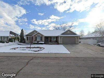
4535 Honeycut Cir Pleasant Grove, UT 84062
Estimated Value: $644,607 - $724,000
4
Beds
2
Baths
1,808
Sq Ft
$380/Sq Ft
Est. Value
About This Home
This home is located at 4535 Honeycut Cir, Pleasant Grove, UT 84062 and is currently estimated at $686,902, approximately $379 per square foot. 4535 Honeycut Cir is a home located in Utah County with nearby schools including Cedar Ridge Elementary School, Mountain Ridge Junior High School, and Lone Peak High School.
Ownership History
Date
Name
Owned For
Owner Type
Purchase Details
Closed on
Apr 29, 2013
Sold by
Wilson Ronald S and Wilson Andrea N
Bought by
Alger David C and Alger Christine L
Current Estimated Value
Home Financials for this Owner
Home Financials are based on the most recent Mortgage that was taken out on this home.
Original Mortgage
$308,750
Outstanding Balance
$226,553
Interest Rate
3.6%
Mortgage Type
New Conventional
Estimated Equity
$460,960
Purchase Details
Closed on
Mar 15, 2000
Sold by
Tbc Lc
Bought by
Wilson Ronald S and Wilson Andrea N
Purchase Details
Closed on
Feb 23, 2000
Sold by
Taylor Homes Associates Inc
Bought by
Wilson Ronald S and Wilson Andrea N
Create a Home Valuation Report for This Property
The Home Valuation Report is an in-depth analysis detailing your home's value as well as a comparison with similar homes in the area
Home Values in the Area
Average Home Value in this Area
Purchase History
| Date | Buyer | Sale Price | Title Company |
|---|---|---|---|
| Alger David C | -- | Title West | |
| Wilson Ronald S | -- | First American Title Co | |
| Wilson Ronald S | -- | First American Title Co | |
| Taylor Homes Associates Inc | -- | First American Title Co |
Source: Public Records
Mortgage History
| Date | Status | Borrower | Loan Amount |
|---|---|---|---|
| Open | Alger David C | $308,750 | |
| Previous Owner | Wilson Ronald S | $198,000 | |
| Previous Owner | Wilson Ronald S | $220,000 | |
| Previous Owner | Wilson Ronald S | $214,600 |
Source: Public Records
Tax History Compared to Growth
Tax History
| Year | Tax Paid | Tax Assessment Tax Assessment Total Assessment is a certain percentage of the fair market value that is determined by local assessors to be the total taxable value of land and additions on the property. | Land | Improvement |
|---|---|---|---|---|
| 2024 | $2,553 | $302,390 | $0 | $0 |
| 2023 | $2,405 | $306,075 | $0 | $0 |
| 2022 | $2,572 | $319,715 | $0 | $0 |
| 2021 | $2,368 | $438,400 | $143,600 | $294,800 |
| 2020 | $2,206 | $398,600 | $133,000 | $265,600 |
| 2019 | $1,987 | $372,700 | $125,800 | $246,900 |
| 2018 | $1,944 | $343,700 | $118,600 | $225,100 |
| 2017 | $1,887 | $178,310 | $0 | $0 |
| 2016 | $1,763 | $154,990 | $0 | $0 |
| 2015 | $1,824 | $151,800 | $0 | $0 |
| 2014 | $1,765 | $145,860 | $0 | $0 |
Source: Public Records
Map
Nearby Homes
- 4592 W Spruce Cir
- 10131 N Redwood Dr
- 4474 W Redwood Dr
- 10052 Marigold Ln
- 4275 W Sandalwood Dr
- 10111 N Cottonwood Dr
- 10063 N Poplar Ct
- 10079 Torreya Dr Unit 729
- 10067 N Torreya Dr Unit 730
- 10067 N Torreya Dr
- 10053 Torreya Dr Unit 733
- 10047 Torreya Dr Unit 734
- 10033 Torreya Dr Unit 737
- 10031 Torreya Dr Unit 738
- 4876 Coulter Ct Unit 701
- 4882 W Coulter Ct Unit 702
- 4202 W Cedar Hills Dr
- 4876 W Coulter Ct
- 4888 W Coulter Ct Unit 703
- 10053 N Torreya Dr
- 4535 Honeycut Cir
- 4549 Honeycut Cir
- 4523 Honeycut Cir
- 4534 Carriage Ln
- 4548 W Carriage Ln
- 4548 Carriage Ln
- 4522 W Carriage Ln
- 4522 Carriage Ln
- 10271 Honeycut Cir
- 10271 N Honeycut Cir
- 4648 W Honeycut Cir
- 4513 W Honeycut Cir
- 4513 W Honeycut Cir
- 10262 Honeycut Cir
- 4504 Carriage Ln
- 10245 Downing Dr
- 10281 Honeycut Cir
- 10259 Downing Dr
- 10259 N Downing Dr
- 10292 Downing Dr