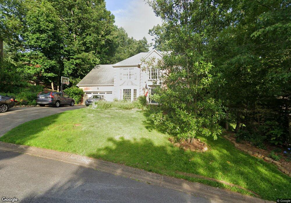
4539 Ashmore Cir NE Marietta, GA 30066
Sandy Plains NeighborhoodEstimated Value: $711,000 - $769,000
4
Beds
4
Baths
3,618
Sq Ft
$204/Sq Ft
Est. Value
About This Home
This home is located at 4539 Ashmore Cir NE, Marietta, GA 30066 and is currently estimated at $736,874, approximately $203 per square foot. 4539 Ashmore Cir NE is a home located in Cobb County with nearby schools including Davis Elementary School, Mabry Middle School, and Lassiter High School.
Ownership History
Date
Name
Owned For
Owner Type
Purchase Details
Closed on
Jan 21, 2011
Sold by
Coryell Randall M and Coryell Russell C
Bought by
Remaley Jason S and Remaley Stacy B
Current Estimated Value
Home Financials for this Owner
Home Financials are based on the most recent Mortgage that was taken out on this home.
Original Mortgage
$270,952
Outstanding Balance
$181,067
Interest Rate
4.37%
Mortgage Type
FHA
Estimated Equity
$555,807
Create a Home Valuation Report for This Property
The Home Valuation Report is an in-depth analysis detailing your home's value as well as a comparison with similar homes in the area
Home Values in the Area
Average Home Value in this Area
Purchase History
| Date | Buyer | Sale Price | Title Company |
|---|---|---|---|
| Remaley Jason S | $278,000 | -- |
Source: Public Records
Mortgage History
| Date | Status | Borrower | Loan Amount |
|---|---|---|---|
| Open | Remaley Jason S | $270,952 |
Source: Public Records
Tax History Compared to Growth
Tax History
| Year | Tax Paid | Tax Assessment Tax Assessment Total Assessment is a certain percentage of the fair market value that is determined by local assessors to be the total taxable value of land and additions on the property. | Land | Improvement |
|---|---|---|---|---|
| 2025 | $6,113 | $243,404 | $58,000 | $185,404 |
| 2024 | $5,931 | $234,776 | $58,000 | $176,776 |
| 2023 | $5,009 | $217,288 | $46,000 | $171,288 |
| 2022 | $4,561 | $170,132 | $42,000 | $128,132 |
| 2021 | $4,561 | $170,132 | $42,000 | $128,132 |
| 2020 | $4,239 | $155,420 | $44,000 | $111,420 |
| 2019 | $4,239 | $155,420 | $44,000 | $111,420 |
| 2018 | $4,239 | $155,420 | $44,000 | $111,420 |
| 2017 | $4,048 | $155,420 | $44,000 | $111,420 |
| 2016 | $4,052 | $155,420 | $44,000 | $111,420 |
| 2015 | $3,687 | $134,868 | $43,600 | $91,268 |
| 2014 | $3,718 | $134,868 | $0 | $0 |
Source: Public Records
Map
Nearby Homes
- 4563 Ashmore Cir NE
- 4589 Wigley Estates Rd
- 4397 Windsor Oaks Cir
- 3043 Sawyer Trace NE
- 2842 Forest Chase Dr NE
- 2855 Lamer Trace
- 4243 N Mountain Rd NE
- 3333 Devaughn Dr NE
- 4302 Highborne Dr NE Unit 3
- 4219 N Mountain Rd NE
- 2958 Forest Chase Terrace NE
- 4464 Windsor Oaks Dr
- 2768 Hawk Trace Ct NE
- 2713 Arbor Summit
- 4259 Arbor Club Dr
- 4887 Raven Way NE
- 3350 Brookhill Cir
- 4734 Outlook Way NE
- 3465 Township Ridge Point
- 2874 S Cherokee Ln
- 4541 Ashmore Cir NE
- 4402 Rosemary Ct NE Unit 1
- 4404 Rosemary Ct NE
- 0 Rosemary Ct NE Unit 7020600
- 0 Rosemary Ct NE
- 4543 Ashmore Cir NE
- 4540 Ashmore Cir NE
- 3293 Hampton Ridge Dr NE
- 4406 Rosemary Ct NE
- 4545 Ashmore Cir NE
- 4518 Ashmore Cir NE
- 4401 Rosemary Ct NE
- 4407 Rosemary Ct NE
- 4403 Rosemary Ct NE
- 4405 Rosemary Ct NE
- 3291 Hampton Ridge Dr NE
- 4408 Rosemary Ct NE
- 4535 Ashmore Cir NE
- 4544 Ashmore Cir NE
- 4547 Ashmore Cir NE