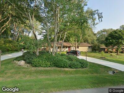
4539 Burnley Dr Bloomfield Hills, MI 48304
Estimated Value: $636,000 - $694,000
4
Beds
3
Baths
2,354
Sq Ft
$277/Sq Ft
Est. Value
About This Home
This home is located at 4539 Burnley Dr, Bloomfield Hills, MI 48304 and is currently estimated at $652,068, approximately $277 per square foot. 4539 Burnley Dr is a home located in Oakland County with nearby schools including Harlan Elementary School, Derby Middle School, and Ernest W. Seaholm High School.
Ownership History
Date
Name
Owned For
Owner Type
Purchase Details
Closed on
Dec 21, 2021
Sold by
James Beeman
Bought by
James Beeman Revocable Trust
Current Estimated Value
Purchase Details
Closed on
Aug 13, 2014
Sold by
Saunders Thomas P and Thomas P Saunders Agreement Of
Bought by
Saunders Thomas P and Beeman James
Purchase Details
Closed on
Nov 17, 2010
Sold by
Saunders Thomas P
Bought by
Saunders Thomas P and Thomas P Saunders Agreement Of Trust
Purchase Details
Closed on
Jun 12, 1997
Sold by
Francine Greenhalgh Tr
Bought by
Saunders Thomas P
Home Financials for this Owner
Home Financials are based on the most recent Mortgage that was taken out on this home.
Original Mortgage
$25,000
Interest Rate
8%
Create a Home Valuation Report for This Property
The Home Valuation Report is an in-depth analysis detailing your home's value as well as a comparison with similar homes in the area
Home Values in the Area
Average Home Value in this Area
Purchase History
| Date | Buyer | Sale Price | Title Company |
|---|---|---|---|
| James Beeman Revocable Trust | -- | None Listed On Document | |
| James Beeman Revocable Trust | -- | None Listed On Document | |
| Saunders Thomas P | -- | None Available | |
| Saunders Thomas P | -- | None Available | |
| Saunders Thomas P | $222,500 | -- |
Source: Public Records
Mortgage History
| Date | Status | Borrower | Loan Amount |
|---|---|---|---|
| Previous Owner | Saunders Thomas P | $200,000 | |
| Previous Owner | Saunders Thomas P | $25,000 |
Source: Public Records
Tax History Compared to Growth
Tax History
| Year | Tax Paid | Tax Assessment Tax Assessment Total Assessment is a certain percentage of the fair market value that is determined by local assessors to be the total taxable value of land and additions on the property. | Land | Improvement |
|---|---|---|---|---|
| 2024 | $3,297 | $254,780 | $0 | $0 |
| 2023 | $3,164 | $232,700 | $0 | $0 |
| 2022 | $5,356 | $224,710 | $0 | $0 |
| 2021 | $5,401 | $208,560 | $0 | $0 |
| 2020 | $3,040 | $194,100 | $0 | $0 |
| 2019 | $5,392 | $191,930 | $0 | $0 |
| 2018 | $5,352 | $191,210 | $0 | $0 |
| 2017 | $5,349 | $184,970 | $0 | $0 |
| 2016 | $5,378 | $175,350 | $0 | $0 |
| 2015 | -- | $165,480 | $0 | $0 |
| 2014 | -- | $146,630 | $0 | $0 |
| 2011 | -- | $117,370 | $0 | $0 |
Source: Public Records
Map
Nearby Homes
- 4540 Burnley Dr
- 4321 Meadowlane Ct
- 4535 Kirkcaldy Rd
- 4743 Burnley Dr
- 4755 Dover Rd
- 2755 Townhill
- 2653 W Wattles Rd
- 4144 Rouge Circle Dr
- 711 Hickory Heights Dr
- 458 Steeple Chase Ct
- 3406 Upton Dr
- 2570 Binbrooke Dr
- 4360 Squirrel Rd
- 4389 Charing Way
- 796 Rock Spring Rd
- 2960 Timberwyck Trail Dr
- 4675 Avondale Terrace
- 3125 N Adams Rd
- 4906 Charing Cross Rd
- 3183 Oakhill Dr
- 4539 Burnley Dr
- 4553 Burnley Dr
- 4535 Burnley Dr
- 740 Wattles Rd
- 4567 Burnley Dr
- 686 Wattles Rd
- 4515 Burnley Dr
- 4570 Burnley Dr
- 3841 N Adams Rd
- 674 Wattles Rd
- 730 Wattles Rd
- 777 Robinhood Cir
- 4581 Burnley Dr
- 3945 N Adams Rd
- 783 Robinhood Cir
- 3851 N Adams Rd
- 662 Wattles Rd
- 4584 Burnley Dr
- 4494 Burnley Dr
- 3821 N Adams Rd