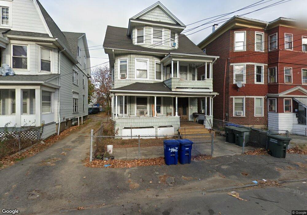
454 Poplar St Bridgeport, CT 06605
West End-West Side NeighborhoodEstimated Value: $348,000 - $517,000
6
Beds
2
Baths
3,391
Sq Ft
$127/Sq Ft
Est. Value
About This Home
This home is located at 454 Poplar St, Bridgeport, CT 06605 and is currently estimated at $430,994, approximately $127 per square foot. 454 Poplar St is a home located in Fairfield County with nearby schools including Bryant Elementary School, Bassick High School, and Park City Prep Charter School.
Ownership History
Date
Name
Owned For
Owner Type
Purchase Details
Closed on
Jan 12, 2006
Sold by
Lugo Luis
Bought by
Chen Xing
Current Estimated Value
Home Financials for this Owner
Home Financials are based on the most recent Mortgage that was taken out on this home.
Original Mortgage
$196,000
Interest Rate
8.99%
Purchase Details
Closed on
Oct 31, 1995
Sold by
Jackson Mark
Bought by
Lugo Luis F
Create a Home Valuation Report for This Property
The Home Valuation Report is an in-depth analysis detailing your home's value as well as a comparison with similar homes in the area
Home Values in the Area
Average Home Value in this Area
Purchase History
| Date | Buyer | Sale Price | Title Company |
|---|---|---|---|
| Chen Xing | $245,000 | -- | |
| Chen Xing | $245,000 | -- | |
| Lugo Luis F | $70,000 | -- | |
| Lugo Luis F | $70,000 | -- |
Source: Public Records
Mortgage History
| Date | Status | Borrower | Loan Amount |
|---|---|---|---|
| Closed | Lugo Luis F | $206,000 | |
| Closed | Lugo Luis F | $196,000 | |
| Previous Owner | Lugo Luis F | $15,000 |
Source: Public Records
Tax History Compared to Growth
Tax History
| Year | Tax Paid | Tax Assessment Tax Assessment Total Assessment is a certain percentage of the fair market value that is determined by local assessors to be the total taxable value of land and additions on the property. | Land | Improvement |
|---|---|---|---|---|
| 2025 | $7,258 | $167,050 | $50,820 | $116,230 |
| 2024 | $7,258 | $167,050 | $50,820 | $116,230 |
| 2023 | $7,258 | $167,050 | $50,820 | $116,230 |
| 2022 | $7,258 | $167,050 | $50,820 | $116,230 |
| 2021 | $7,258 | $167,050 | $50,820 | $116,230 |
| 2020 | $6,799 | $125,930 | $30,790 | $95,140 |
| 2019 | $6,799 | $125,930 | $30,790 | $95,140 |
| 2018 | $6,847 | $125,930 | $30,790 | $95,140 |
| 2017 | $6,847 | $125,930 | $30,790 | $95,140 |
| 2016 | $6,847 | $125,930 | $30,790 | $95,140 |
| 2015 | $7,488 | $177,450 | $46,580 | $130,870 |
| 2014 | $7,488 | $177,450 | $46,580 | $130,870 |
Source: Public Records
Map
Nearby Homes
- 2612 North Ave Unit E2
- 2612 North Ave Unit C1
- 725 Beechwood Ave Unit 727
- 74 Carleton Ave
- 25 Cartright St Unit 5D
- 80 Cartright St Unit 5D
- 80 Cartright St Unit 8J
- 80 Cartright St Unit 2F
- 80 Cartright St Unit GC
- 80 Cartright St Unit 8B
- 500 Dewey St
- 368 Lenox Ave
- 2370 North Ave Unit 4C
- 2370 North Ave Unit 12G
- 2370 North Ave Unit 3F
- 2660 North Ave Unit 217
- 255 Poplar St
- 860 Briarwood Ave
- 1059 Hancock Ave Unit 1061
- 1050 Hancock Ave Unit 1052
- 462 Poplar St
- 462 Poplar St Unit 1
- 448 Poplar St
- 448 Poplar St Unit 1
- 448 Poplar St Unit 2
- 444 Poplar St
- 442 Poplar St
- 459 Poplar St
- 451 Poplar St
- 440 Poplar St
- 650 Dewey St Unit 652
- 445 Poplar St
- 436 Poplar St
- 658 Dewey St Unit 660
- 439 Poplar St
- 439 Poplar St Unit 1
- 25 Dewey Ct
- 670 Dewey St Unit 672
- 19 Dewey Ct Unit 2
- 19 Dewey Ct