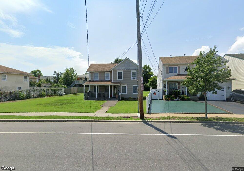
454 S Main St Freeport, NY 11520
Estimated Value: $611,801 - $621,000
--
Bed
2
Baths
1,452
Sq Ft
$425/Sq Ft
Est. Value
About This Home
This home is located at 454 S Main St, Freeport, NY 11520 and is currently estimated at $616,401, approximately $424 per square foot. 454 S Main St is a home located in Nassau County with nearby schools including Columbus Avenue School, Caroline G. Atkinson Intermediate School, and John W Dodd Middle School.
Ownership History
Date
Name
Owned For
Owner Type
Purchase Details
Closed on
Sep 14, 1999
Sold by
Grover Dante
Bought by
Rochester Mark
Current Estimated Value
Home Financials for this Owner
Home Financials are based on the most recent Mortgage that was taken out on this home.
Original Mortgage
$188,446
Interest Rate
7.85%
Mortgage Type
FHA
Purchase Details
Closed on
Jul 13, 1998
Create a Home Valuation Report for This Property
The Home Valuation Report is an in-depth analysis detailing your home's value as well as a comparison with similar homes in the area
Home Values in the Area
Average Home Value in this Area
Purchase History
| Date | Buyer | Sale Price | Title Company |
|---|---|---|---|
| Rochester Mark | $190,000 | First American Title Ins Co | |
| Rochester Mark | $190,000 | First American Title Ins Co | |
| Rochester Mark | $190,000 | First American Title Ins Co | |
| Rochester Mark | $190,000 | First American Title Ins Co | |
| -- | -- | -- | |
| -- | -- | -- |
Source: Public Records
Mortgage History
| Date | Status | Borrower | Loan Amount |
|---|---|---|---|
| Previous Owner | Rochester Mark | $188,446 |
Source: Public Records
Tax History Compared to Growth
Tax History
| Year | Tax Paid | Tax Assessment Tax Assessment Total Assessment is a certain percentage of the fair market value that is determined by local assessors to be the total taxable value of land and additions on the property. | Land | Improvement |
|---|---|---|---|---|
| 2025 | $7,103 | $371 | $219 | $152 |
| 2024 | $858 | $371 | $219 | $152 |
| 2023 | $7,393 | $371 | $219 | $152 |
| 2022 | $7,393 | $371 | $219 | $152 |
| 2021 | $11,673 | $356 | $210 | $146 |
| 2020 | $8,847 | $705 | $500 | $205 |
| 2019 | $9,037 | $705 | $500 | $205 |
| 2018 | $8,772 | $705 | $0 | $0 |
| 2017 | $7,084 | $705 | $500 | $205 |
| 2016 | $8,142 | $705 | $500 | $205 |
| 2015 | $1,018 | $705 | $500 | $205 |
| 2014 | $1,018 | $705 | $500 | $205 |
| 2013 | $962 | $705 | $500 | $205 |
Source: Public Records
Map
Nearby Homes
- 308 Bedell St
- 142 Gordon Place
- 30 E Bedell St
- 125 Garfield St
- 121 Garfield St
- 34 W 2nd St
- 51 Atlantic Ave
- 21 Stillwell Place
- 252 Arthur St
- 69 E 1st St
- 177 Sportsmans Ave
- 121a Garfield St
- 193 Sportsmans Ave
- 120 Sportsmans Ave
- 335 Arthur St
- 208 Sportsmans Ave
- 356 Arthur St
- 243 Sportsmans Ave
- 18 Ocean Watch Ct Unit 18
- 11 Ocean Watch Ct