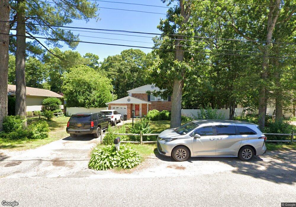
454 W End Ave Shirley, NY 11967
Estimated Value: $506,000 - $615,000
5
Beds
2
Baths
2,130
Sq Ft
$272/Sq Ft
Est. Value
About This Home
This home is located at 454 W End Ave, Shirley, NY 11967 and is currently estimated at $578,649, approximately $271 per square foot. 454 W End Ave is a home located in Suffolk County with nearby schools including Longwood Junior High School, Longwood Middle School, and Longwood Senior High School.
Ownership History
Date
Name
Owned For
Owner Type
Purchase Details
Closed on
Apr 22, 2022
Sold by
Waight Ellen M and Waight Wilhelm
Bought by
Waight Wilhelm and Rigg Christine D
Current Estimated Value
Home Financials for this Owner
Home Financials are based on the most recent Mortgage that was taken out on this home.
Original Mortgage
$184,000
Interest Rate
4.67%
Mortgage Type
Stand Alone Refi Refinance Of Original Loan
Purchase Details
Closed on
Apr 17, 2013
Sold by
Gatti Philip
Bought by
Waight Ellen M and Waight Wilhelm
Home Financials for this Owner
Home Financials are based on the most recent Mortgage that was taken out on this home.
Original Mortgage
$211,105
Interest Rate
3.5%
Mortgage Type
FHA
Purchase Details
Closed on
Jan 11, 2001
Sold by
Lamonaca Albert and Lamonaca Maddalena
Bought by
Gatti Philip
Create a Home Valuation Report for This Property
The Home Valuation Report is an in-depth analysis detailing your home's value as well as a comparison with similar homes in the area
Home Values in the Area
Average Home Value in this Area
Purchase History
| Date | Buyer | Sale Price | Title Company |
|---|---|---|---|
| Waight Wilhelm | -- | None Available | |
| Waight Wilhelm | -- | None Available | |
| Waight Ellen M | $215,000 | Skyline Trg Title | |
| Waight Ellen M | $215,000 | Skyline Trg Title | |
| Gatti Philip | $106,000 | -- | |
| Gatti Philip | $106,000 | -- |
Source: Public Records
Mortgage History
| Date | Status | Borrower | Loan Amount |
|---|---|---|---|
| Previous Owner | Waight Wilhelm | $184,000 | |
| Previous Owner | Waight Ellen M | $211,105 |
Source: Public Records
Tax History Compared to Growth
Tax History
| Year | Tax Paid | Tax Assessment Tax Assessment Total Assessment is a certain percentage of the fair market value that is determined by local assessors to be the total taxable value of land and additions on the property. | Land | Improvement |
|---|---|---|---|---|
| 2024 | $9,781 | $2,184 | $200 | $1,984 |
| 2023 | $9,781 | $2,184 | $200 | $1,984 |
| 2022 | $9,069 | $2,184 | $200 | $1,984 |
| 2021 | $9,069 | $2,184 | $200 | $1,984 |
| 2020 | $9,236 | $2,184 | $200 | $1,984 |
| 2019 | $9,236 | $0 | $0 | $0 |
| 2018 | $8,702 | $2,184 | $200 | $1,984 |
| 2017 | $8,702 | $2,184 | $200 | $1,984 |
| 2016 | $8,601 | $2,184 | $200 | $1,984 |
| 2015 | -- | $2,184 | $200 | $1,984 |
| 2014 | -- | $2,184 | $200 | $1,984 |
Source: Public Records
Map
Nearby Homes
- 65 Colin Dr
- 68 Crestwood Dr
- 411 Glen Dr
- 23 Monty Dr Unit 14
- VL Glen Dr
- 34 Belmont Dr
- 8 & 11 William Floyd Pkwy
- 283 W End Ave
- 1330 William Floyd Pkwy
- 334 Carnation Dr
- 380 Wellwood Dr
- 476 Carnation Dr
- 459 Wellwood Dr
- 336 Auborn Ave
- 461 Avondale Dr
- 101 Crestwood Dr
- 313 Decatur Ave
- 509 Lockwood Dr
- 8 Stratler Dr
- 425 Puritan Dr