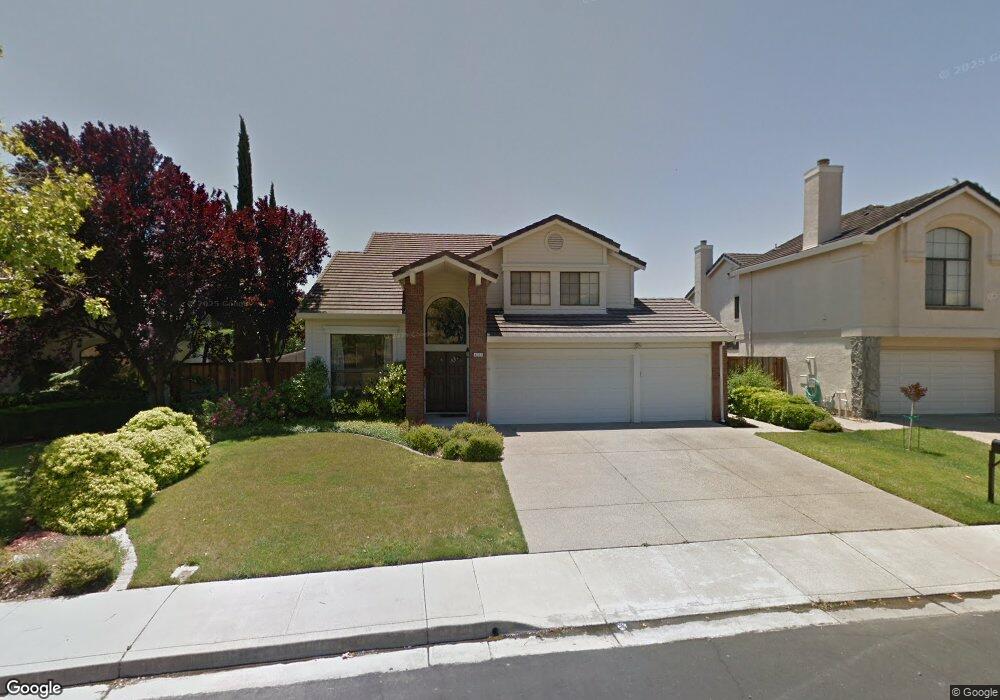
4542 Buckskin Dr Antioch, CA 94531
Deer Valley NeighborhoodEstimated Value: $688,000 - $855,000
5
Beds
3
Baths
2,435
Sq Ft
$306/Sq Ft
Est. Value
About This Home
This home is located at 4542 Buckskin Dr, Antioch, CA 94531 and is currently estimated at $744,470, approximately $305 per square foot. 4542 Buckskin Dr is a home located in Contra Costa County with nearby schools including Jack London Elementary School, Black Diamond Middle School, and Deer Valley High School.
Ownership History
Date
Name
Owned For
Owner Type
Purchase Details
Closed on
Feb 26, 2019
Sold by
Wilding Jeff R and Wilding Suzanne R
Bought by
Petty Jarvis Nykel and Petty Anastasia C
Current Estimated Value
Home Financials for this Owner
Home Financials are based on the most recent Mortgage that was taken out on this home.
Original Mortgage
$587,362
Outstanding Balance
$516,391
Interest Rate
4.4%
Mortgage Type
VA
Estimated Equity
$228,079
Purchase Details
Closed on
Oct 19, 1994
Sold by
Davis Richard W and Davis Pennie L
Bought by
Wilding Jeff R and Wilding Suzanne R
Home Financials for this Owner
Home Financials are based on the most recent Mortgage that was taken out on this home.
Original Mortgage
$156,000
Interest Rate
8.5%
Mortgage Type
Purchase Money Mortgage
Create a Home Valuation Report for This Property
The Home Valuation Report is an in-depth analysis detailing your home's value as well as a comparison with similar homes in the area
Home Values in the Area
Average Home Value in this Area
Purchase History
| Date | Buyer | Sale Price | Title Company |
|---|---|---|---|
| Petty Jarvis Nykel | $575,000 | Fidelity National Title Co | |
| Wilding Jeff R | $195,000 | Old Republic Title Company |
Source: Public Records
Mortgage History
| Date | Status | Borrower | Loan Amount |
|---|---|---|---|
| Open | Petty Jarvis Nykel | $587,362 | |
| Previous Owner | Wilding Jeff R | $156,000 |
Source: Public Records
Tax History
| Year | Tax Paid | Tax Assessment Tax Assessment Total Assessment is a certain percentage of the fair market value that is determined by local assessors to be the total taxable value of land and additions on the property. | Land | Improvement |
|---|---|---|---|---|
| 2025 | $7,392 | $641,419 | $156,171 | $485,248 |
| 2024 | $6,970 | $628,843 | $153,109 | $475,734 |
| 2023 | $6,970 | $616,513 | $150,107 | $466,406 |
| 2022 | $6,859 | $604,425 | $147,164 | $457,261 |
| 2021 | $6,656 | $592,575 | $144,279 | $448,296 |
| 2019 | $3,733 | $314,271 | $60,214 | $254,057 |
| 2018 | $3,591 | $308,110 | $59,034 | $249,076 |
| 2017 | $3,514 | $302,070 | $57,877 | $244,193 |
| 2016 | $3,424 | $296,148 | $56,743 | $239,405 |
| 2015 | $3,726 | $291,700 | $55,891 | $235,809 |
| 2014 | $4,816 | $285,987 | $54,797 | $231,190 |
Source: Public Records
Map
Nearby Homes
- 4437 Deerfield Dr
- 4601 Country Hills Dr
- 4442 Deerfield Dr
- 4520 Beaver Ct
- 4413 Montara Dr
- 4545 Elk Ct
- 4469 Pampas Cir
- 3237 Oso Grande Way
- 4672 Copper Hill Ct
- 4671 Copper Hill Ct
- 2725 Harvest Ln
- 2703 Ivy Ln
- 4807 Silver Hill Ct
- 2754 Winding Ln
- 2600 Covelite Way
- 4529 Pronghorn Way
- 4586 Donegal Way
- 5104 Carriage Way
- 5000 Morgan Way
- 4747 Dundee St
- 4546 Buckskin Dr
- 4536 Buckskin Dr
- 4552 Buckskin Dr
- 4532 Buckskin Dr
- 4529 Roebuck Way
- 4525 Roebuck Way
- 4413 Caribou Ct
- 4533 Roebuck Way
- 4521 Roebuck Way
- 4556 Buckskin Dr
- 4528 Buckskin Dr
- 4409 Caribou Ct
- 4517 Roebuck Way
- 4560 Buckskin Dr
- 4524 Buckskin Dr
- 4541 Roebuck Way
- 4416 Caribou Ct
- 4564 Buckskin Dr
- 4513 Roebuck Way
- 4545 Roebuck Way
Your Personal Tour Guide
Ask me questions while you tour the home.