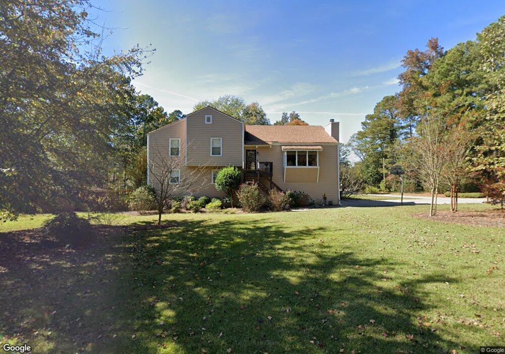
4543 Savage Dr NE Unit 2 Marietta, GA 30066
Sandy Plains NeighborhoodEstimated Value: $390,937 - $517,000
4
Beds
2
Baths
1,626
Sq Ft
$284/Sq Ft
Est. Value
About This Home
This home is located at 4543 Savage Dr NE Unit 2, Marietta, GA 30066 and is currently estimated at $462,484, approximately $284 per square foot. 4543 Savage Dr NE Unit 2 is a home located in Cobb County with nearby schools including Davis Elementary School, Mabry Middle School, and Lassiter High School.
Ownership History
Date
Name
Owned For
Owner Type
Purchase Details
Closed on
Nov 9, 2020
Sold by
Bohannan Scott E
Bought by
Bohannan Vanessa H
Current Estimated Value
Home Financials for this Owner
Home Financials are based on the most recent Mortgage that was taken out on this home.
Original Mortgage
$125,000
Outstanding Balance
$110,978
Interest Rate
2.8%
Mortgage Type
New Conventional
Estimated Equity
$351,506
Purchase Details
Closed on
May 26, 1995
Sold by
Boyett Theodore R Laurie
Bought by
Bohannan Scott E Vanessa H
Create a Home Valuation Report for This Property
The Home Valuation Report is an in-depth analysis detailing your home's value as well as a comparison with similar homes in the area
Home Values in the Area
Average Home Value in this Area
Purchase History
| Date | Buyer | Sale Price | Title Company |
|---|---|---|---|
| Bohannan Vanessa H | -- | None Available | |
| Bohannan Scott E Vanessa H | $102,000 | -- |
Source: Public Records
Mortgage History
| Date | Status | Borrower | Loan Amount |
|---|---|---|---|
| Open | Bohannan Vanessa H | $125,000 |
Source: Public Records
Tax History Compared to Growth
Tax History
| Year | Tax Paid | Tax Assessment Tax Assessment Total Assessment is a certain percentage of the fair market value that is determined by local assessors to be the total taxable value of land and additions on the property. | Land | Improvement |
|---|---|---|---|---|
| 2025 | $3,034 | $133,656 | $32,000 | $101,656 |
| 2024 | $3,037 | $133,656 | $32,000 | $101,656 |
| 2023 | $2,494 | $133,656 | $32,000 | $101,656 |
| 2022 | $2,740 | $118,940 | $24,000 | $94,940 |
| 2021 | $2,270 | $97,464 | $16,000 | $81,464 |
| 2020 | $2,270 | $97,464 | $16,000 | $81,464 |
| 2019 | $2,270 | $97,464 | $16,000 | $81,464 |
| 2018 | $2,065 | $88,120 | $16,000 | $72,120 |
| 2017 | $2,009 | $88,120 | $16,000 | $72,120 |
| 2016 | $1,359 | $58,492 | $8,800 | $49,692 |
| 2015 | $1,391 | $58,492 | $8,800 | $49,692 |
| 2014 | $1,001 | $42,512 | $0 | $0 |
Source: Public Records
Map
Nearby Homes
- 2958 Forest Chase Terrace NE
- 2842 Forest Chase Dr NE
- 4464 Windsor Oaks Dr
- 2603 Chadwick Rd
- 2610 Chadwick Rd
- 2855 Lamer Trace
- 4499 Browning Ct NE
- 4887 Raven Way NE
- 4709 Trickum Rd NE
- 4589 Wigley Estates Rd
- 2256 Turtle Club Dr NE Unit 1
- 2402 Woodbridge Dr
- 4899 Hawk Trail NE
- 3043 Sawyer Trace NE
- 2423 Turtle Crossing NE
- The Arlington Plan at Tanglewood
- The Alston A Plan at Tanglewood
- 2768 Hawk Trace Ct NE
- 4259 Arbor Club Dr
- 4563 Ashmore Cir NE
- 4557 Savage Dr NE
- 2563 Ruger Dr NE
- 4523 Savage Dr NE
- 4565 Savage Dr NE
- 4534 Savage Dr NE Unit 2
- 2570 Ruger Dr NE Unit 2
- 0 Savage Dr NE Unit 8500193
- 0 Savage Dr NE
- 4513 Savage Dr NE
- 4524 Savage Dr NE Unit 2
- 4554 Savage Dr NE
- 2560 Ruger Dr NE
- 4575 Savage Dr NE
- 4618 Mossburg Ct NE
- 4628 Mossburg Ct NE
- 4514 Savage Dr NE Unit 2
- 4598 Mossburg Ct NE
- 4564 Savage Dr NE
- 2550 Ruger Dr NE
- 4505 Savage Dr NE