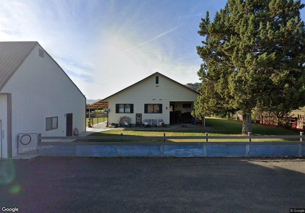
45466 Lone Fir Rd Halfway, OR 97834
Estimated Value: $266,000 - $468,000
2
Beds
2
Baths
2,790
Sq Ft
$133/Sq Ft
Est. Value
About This Home
This home is located at 45466 Lone Fir Rd, Halfway, OR 97834 and is currently estimated at $371,983, approximately $133 per square foot. 45466 Lone Fir Rd is a home located in Baker County with nearby schools including Pine Eagle Elementary School and Pine Eagle Charter School.
Ownership History
Date
Name
Owned For
Owner Type
Purchase Details
Closed on
Sep 6, 2018
Sold by
Huff Thomas F Living Trust
Bought by
Mitchell Weir H
Current Estimated Value
Home Financials for this Owner
Home Financials are based on the most recent Mortgage that was taken out on this home.
Original Mortgage
$45,000
Outstanding Balance
$39,081
Interest Rate
4.5%
Mortgage Type
New Conventional
Estimated Equity
$332,902
Create a Home Valuation Report for This Property
The Home Valuation Report is an in-depth analysis detailing your home's value as well as a comparison with similar homes in the area
Home Values in the Area
Average Home Value in this Area
Purchase History
| Date | Buyer | Sale Price | Title Company |
|---|---|---|---|
| Mitchell Weir H | $50,100 | Amerititle |
Source: Public Records
Mortgage History
| Date | Status | Borrower | Loan Amount |
|---|---|---|---|
| Open | Mitchell Weir H | $45,000 |
Source: Public Records
Tax History Compared to Growth
Tax History
| Year | Tax Paid | Tax Assessment Tax Assessment Total Assessment is a certain percentage of the fair market value that is determined by local assessors to be the total taxable value of land and additions on the property. | Land | Improvement |
|---|---|---|---|---|
| 2025 | $2,055 | $168,068 | $18,033 | $150,035 |
| 2024 | $1,997 | $163,291 | $17,625 | $145,666 |
| 2023 | $1,946 | $158,654 | $17,230 | $141,424 |
| 2022 | $1,893 | $154,151 | $16,846 | $137,305 |
| 2021 | $1,840 | $149,780 | $16,474 | $133,306 |
| 2020 | $2,554 | $207,093 | $82,982 | $124,111 |
| 2019 | $2,400 | $201,062 | $77,898 | $123,164 |
| 2018 | $2,284 | $195,206 | $73,374 | $121,832 |
| 2017 | $2,254 | $189,521 | $86,799 | $102,722 |
| 2016 | $2,271 | $184,001 | $87,667 | $96,334 |
| 2015 | $2,205 | $178,642 | $85,009 | $93,633 |
| 2014 | $2,141 | $173,439 | $75,520 | $97,919 |
| 2013 | -- | $168,388 | $76,485 | $91,903 |
Source: Public Records
Map
Nearby Homes
- 238 W Dawson St
- 220 Kellog St
- 226 Center St
- 217 N Main St
- 37867 Highway 414
- 46198 Slaughterhouse Rd
- 46682 Fish Lake Rd
- 0 Sawmill Cutoff Ln Unit 504566982
- 0 Sawmill Cutoff Ln Unit 101194861
- 47433 Slaughterhouse Rd
- 35912 Valley View Ln
- 48212 Clear Creek Rd
- 48144 E Pine Creek Rd
- 47664 Ryall Rd
- 48247 Hooker Flat Rd
- 43310 Eagle Creek Rd
- 43186 New Bridge Rd
- 42759 Moody Rd
- 43580 Old Foothill Rd
- 37102 Woods Ln
- 45442 Lone Fir Rd
- 45473 Lone Fir Rd
- 45491 Lone Fir Rd
- 45411 Lone Fir Rd
- 305 E Record St
- 145 Summit St
- 135 Summit St
- 155 Summit St
- 0 0 Lone Fir Unit 19409627
- 0 Summit St
- 140 Summit St
- 130 Summit St
- 105 Granite St
- 125 Granite St
- 45586 Lone Fir Rd
- 263 W Record St
- 0 Fir Unit 603 22372346
- 0 Fir Unit 611 22026212
- 0 Fir Unit 609 22246439
- 0 Fir Unit 608 22520077