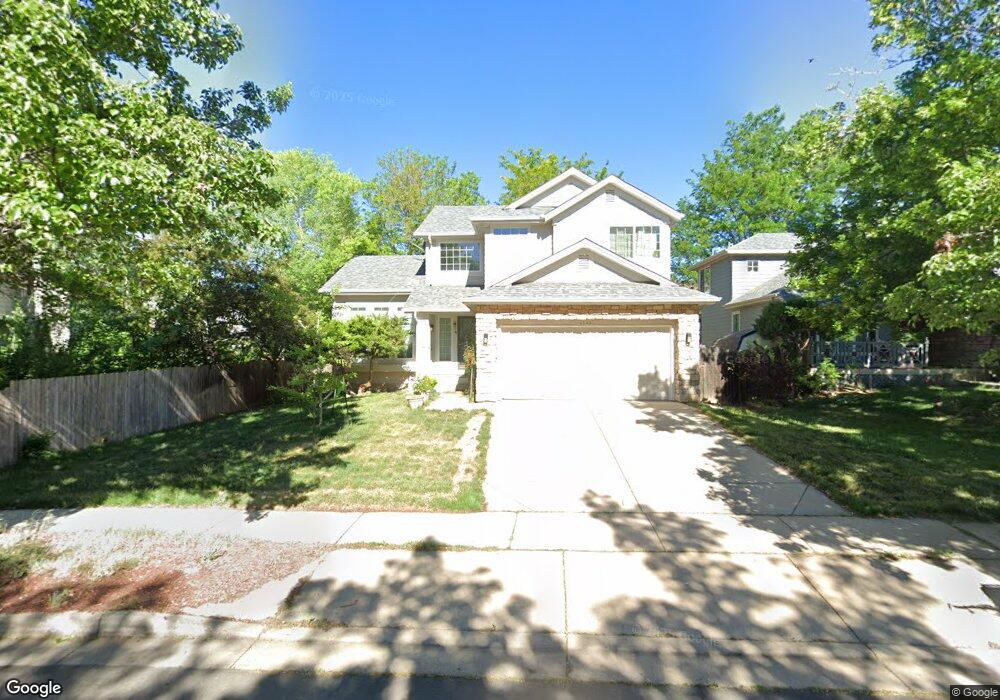
4549 Maple Ct Boulder, CO 80301
Gunbarrel NeighborhoodEstimated Value: $922,199 - $1,017,000
5
Beds
4
Baths
1,934
Sq Ft
$504/Sq Ft
Est. Value
About This Home
This home is located at 4549 Maple Ct, Boulder, CO 80301 and is currently estimated at $975,050, approximately $504 per square foot. 4549 Maple Ct is a home located in Boulder County with nearby schools including Crest View Elementary School, Centennial Middle School, and Boulder High School.
Ownership History
Date
Name
Owned For
Owner Type
Purchase Details
Closed on
Aug 11, 1995
Sold by
Lane Michael M
Bought by
Hong Bei
Current Estimated Value
Home Financials for this Owner
Home Financials are based on the most recent Mortgage that was taken out on this home.
Original Mortgage
$100,000
Interest Rate
7.59%
Purchase Details
Closed on
Jun 16, 1993
Bought by
Bei Hong and Hsu Shyh Shyan
Purchase Details
Closed on
Feb 12, 1993
Bought by
Bei Hong and Hsu Shyh Shyan
Purchase Details
Closed on
Jan 16, 1992
Bought by
Bei Hong and Hsu Shyh Shyan
Create a Home Valuation Report for This Property
The Home Valuation Report is an in-depth analysis detailing your home's value as well as a comparison with similar homes in the area
Home Values in the Area
Average Home Value in this Area
Purchase History
| Date | Buyer | Sale Price | Title Company |
|---|---|---|---|
| Hong Bei | $233,500 | Land Title | |
| Bei Hong | $189,900 | -- | |
| Bei Hong | $292,000 | -- | |
| Bei Hong | -- | -- |
Source: Public Records
Mortgage History
| Date | Status | Borrower | Loan Amount |
|---|---|---|---|
| Closed | Hong Bei | $100,000 |
Source: Public Records
Tax History
| Year | Tax Paid | Tax Assessment Tax Assessment Total Assessment is a certain percentage of the fair market value that is determined by local assessors to be the total taxable value of land and additions on the property. | Land | Improvement |
|---|---|---|---|---|
| 2025 | $5,694 | $64,013 | $17,069 | $46,944 |
| 2024 | $5,694 | $64,013 | $17,069 | $46,944 |
| 2023 | $5,595 | $64,789 | $18,727 | $49,748 |
| 2022 | $4,742 | $51,061 | $12,739 | $38,322 |
| 2021 | $4,522 | $52,531 | $13,106 | $39,425 |
| 2020 | $4,091 | $46,997 | $9,581 | $37,416 |
| 2019 | $4,028 | $46,997 | $9,581 | $37,416 |
| 2018 | $3,929 | $45,317 | $17,136 | $28,181 |
| 2017 | $3,806 | $50,100 | $18,945 | $31,155 |
| 2016 | $3,392 | $39,187 | $17,353 | $21,834 |
| 2015 | $3,212 | $35,231 | $15,602 | $19,629 |
| 2014 | $2,962 | $35,231 | $15,602 | $19,629 |
Source: Public Records
Map
Nearby Homes
- 5865 N Orchard Creek Cir
- 5900 Brandywine Ct
- 4650 White Rock Cir Unit 12
- 4660 White Rock Cir Unit 5
- 4656 White Rock Cir Unit 7
- 4658 White Rock Cir Unit 5
- 4658 White Rock Cir Unit 7
- 4490 Clay St
- 4725 Spine Rd Unit F
- 4741 White Rock Cir Unit C
- 4767 White Rock Cir Unit D
- 4705 Spine Rd Unit C
- 4789 White Rock Cir Unit D
- 4682 White Rock Cir Unit 10
- 4682 White Rock Cir Unit 5
- 5920 Gunbarrel Ave Unit D
- 4799 White Rock Cir Unit 4799-D
- 5922 Gunbarrel Ave Unit F
- 4791 White Rock Cir Unit A
- 4819 White Rock Cir Unit C
- 4563 Maple Ct
- 5831 Orchard Creek Ln
- 5823 Orchard Creek Ln
- 4554 Pussy Willow Ct
- 4566 Pussy Willow Ct
- 4548 Pussy Willow Ct
- 5843 Orchard Creek Ln
- 5815 Orchard Creek Ln
- 4550 Maple Ct
- 4581 Maple Ct
- 4570 Pussy Willow Ct
- 5803 Orchard Creek Ln
- 4556 Maple Ct
- 5857 Orchard Creek Ln
- 4593 Maple Ct
- 5836 Orchard Creek Ln
- 4578 Maple Ct
- 4584 Maple Ct
- 5844 Orchard Creek Ln
- 5830 Orchard Creek Ln
Your Personal Tour Guide
Ask me questions while you tour the home.