Estimated Value: $448,592
Studio
--
Bath
1,564
Sq Ft
$287/Sq Ft
Est. Value
About This Home
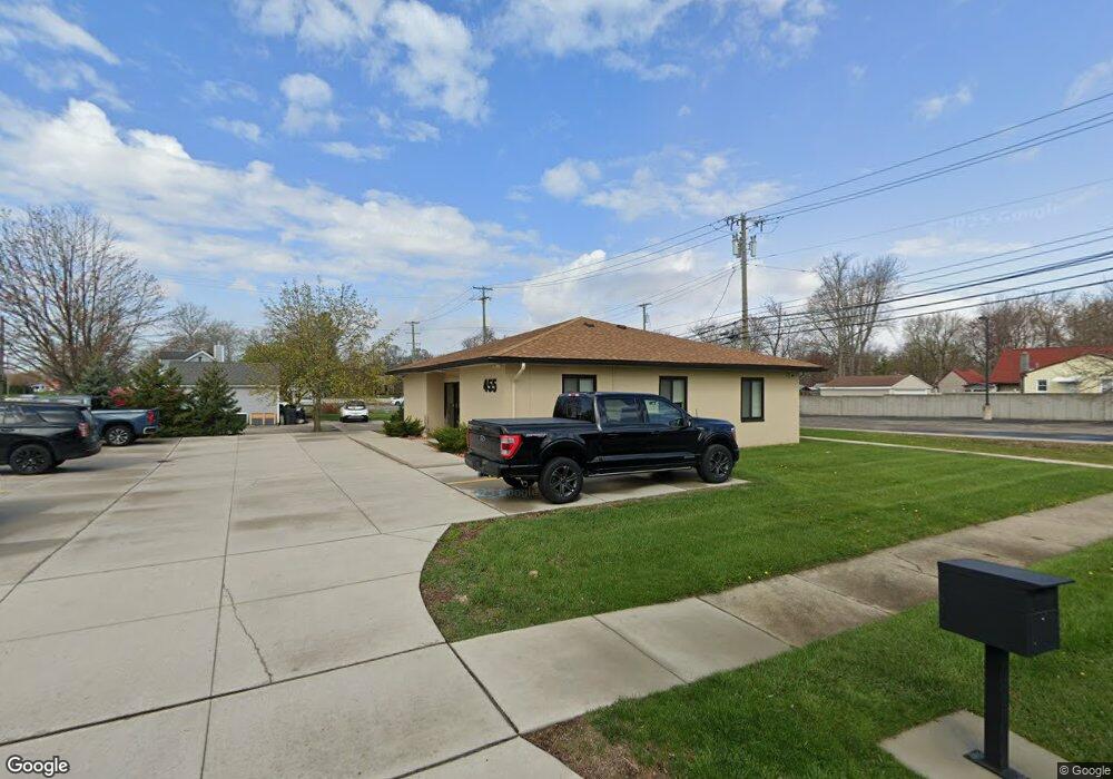
This home is located at 455 E Maple Rd, Troy, MI 48083 and is currently estimated at $448,592, approximately $286 per square foot. 455 E Maple Rd is a home located in Oakland County with nearby schools including Morse Elementary School, Baker Middle School, and Troy High School.
Ownership History
Date
Name
Owned For
Owner Type
Purchase Details
Closed on
Oct 11, 2023
Sold by
Younis Wesam and Younis Lourd
Bought by
Younis Real Estate Management Llc
Current Estimated Value
Purchase Details
Closed on
Oct 20, 2020
Sold by
Ses Property Management Llc
Bought by
Younis Wesam and Younis Lourd
Purchase Details
Closed on
Mar 22, 2016
Sold by
Ses Property Management Llc
Bought by
Land Holding Llc
Purchase Details
Closed on
Jun 28, 2005
Sold by
Eley Mary C and Eley Dan R
Bought by
Ses Property Management Llc
Home Financials for this Owner
Home Financials are based on the most recent Mortgage that was taken out on this home.
Original Mortgage
$233,750
Interest Rate
5.68%
Mortgage Type
Commercial
Create a Home Valuation Report for This Property
The Home Valuation Report is an in-depth analysis detailing your home's value as well as a comparison with similar homes in the area
Home Values in the Area
Average Home Value in this Area
Purchase History
| Date | Buyer | Sale Price | Title Company |
|---|---|---|---|
| Younis Real Estate Management Llc | -- | None Listed On Document | |
| Younis Real Estate Management Llc | -- | None Listed On Document | |
| Younis Wesam | $319,000 | First American Title Ins Co | |
| Land Holding Llc | $154,100 | None Available | |
| Ses Property Management Llc | $275,000 | Metropolitan Title Company |
Source: Public Records
Mortgage History
| Date | Status | Borrower | Loan Amount |
|---|---|---|---|
| Previous Owner | Ses Property Management Llc | $233,750 |
Source: Public Records
Tax History
| Year | Tax Paid | Tax Assessment Tax Assessment Total Assessment is a certain percentage of the fair market value that is determined by local assessors to be the total taxable value of land and additions on the property. | Land | Improvement |
|---|---|---|---|---|
| 2022 | $4,595 | $123,560 | $0 | $0 |
| 2015 | $5,124 | $70,520 | $0 | $0 |
| 2014 | -- | $66,160 | $0 | $0 |
| 2011 | -- | $84,790 | $0 | $0 |
Source: Public Records
Map
Nearby Homes
- 0000 Westwood Dr
- 1907 Kirkton Dr
- 138 Chopin St
- 1033 Chopin St
- 735 Robinwood Dr
- 1043 Arthur Dr
- 65 Algansee Dr
- 124 Leroy Ave
- 31 Starr Dr
- 35 Starr Dr
- 57 W Elmwood Ave
- 550 Roth Blvd
- 1563 N Bywood Ave Unit 6
- 917 Kenwood St
- 911 Kenwood St
- 909 Kenwood St
- 918 Kenwood St
- 659 W Maple Rd
- 2099 Mary Ann Dr
- 3076 Kilmer Dr
- 1661 Eastport Dr
- 505 E Maple Rd
- 1675 Eastport Dr
- 1660 Eastport Dr
- 405 E Maple Rd
- 1664 Kirkton Dr
- 1676 Eastport Dr Unit Bldg-Unit
- 1676 Eastport Dr
- 1685 Eastport Dr
- 430 E Maple Rd
- 1688 Eastport Dr
- 395 E Maple Rd
- 1691 Eastport Dr
- 1686 Kirkton Dr
- 551 E Maple Rd
- 1696 Eastport Dr
- 369 E Maple Rd
- 1703 Eastport Dr
- 1692 Kirkton Dr
- 1521 Combermere Dr
Your Personal Tour Guide
Ask me questions while you tour the home.