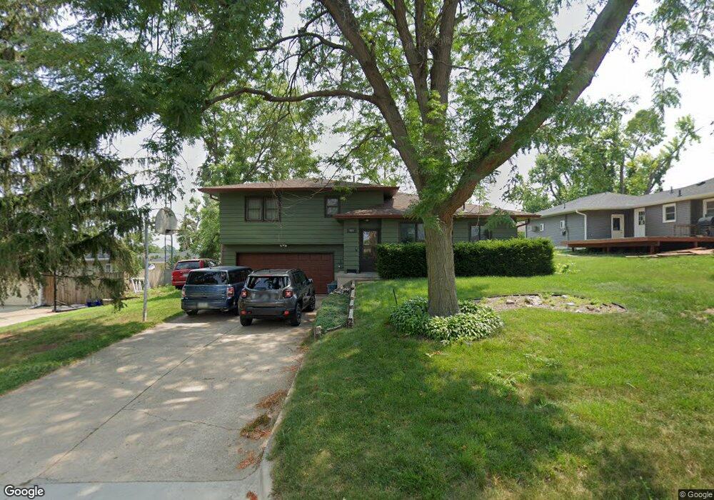
455 Ridge Dr Marion, IA 52302
Estimated Value: $199,145 - $218,000
3
Beds
2
Baths
1,420
Sq Ft
$148/Sq Ft
Est. Value
About This Home
This home is located at 455 Ridge Dr, Marion, IA 52302 and is currently estimated at $210,286, approximately $148 per square foot. 455 Ridge Dr is a home located in Linn County with nearby schools including Novak Elementary School, Oak Ridge School, and Linn-Mar High School.
Ownership History
Date
Name
Owned For
Owner Type
Purchase Details
Closed on
Jun 18, 2003
Sold by
Graves Bruce F and Graves Darla J
Bought by
Livin Andrew Dean and Livin Barbara Ann
Current Estimated Value
Home Financials for this Owner
Home Financials are based on the most recent Mortgage that was taken out on this home.
Original Mortgage
$122,000
Outstanding Balance
$47,952
Interest Rate
4.37%
Mortgage Type
Purchase Money Mortgage
Estimated Equity
$162,334
Create a Home Valuation Report for This Property
The Home Valuation Report is an in-depth analysis detailing your home's value as well as a comparison with similar homes in the area
Home Values in the Area
Average Home Value in this Area
Purchase History
| Date | Buyer | Sale Price | Title Company |
|---|---|---|---|
| Livin Andrew Dean | $121,500 | -- |
Source: Public Records
Mortgage History
| Date | Status | Borrower | Loan Amount |
|---|---|---|---|
| Open | Livin Andrew Dean | $122,000 |
Source: Public Records
Tax History
| Year | Tax Paid | Tax Assessment Tax Assessment Total Assessment is a certain percentage of the fair market value that is determined by local assessors to be the total taxable value of land and additions on the property. | Land | Improvement |
|---|---|---|---|---|
| 2025 | $2,898 | $208,800 | $21,200 | $187,600 |
| 2024 | $2,970 | $164,600 | $21,200 | $143,400 |
| 2023 | $2,970 | $164,600 | $21,200 | $143,400 |
| 2022 | $2,828 | $142,700 | $21,200 | $121,500 |
| 2021 | $2,964 | $142,700 | $21,200 | $121,500 |
| 2020 | $2,964 | $140,100 | $21,200 | $118,900 |
| 2019 | $2,850 | $134,900 | $24,700 | $110,200 |
Source: Public Records
Map
Nearby Homes
- 1125 W 10th Ave
- 4551 Maureen Dr SE Unit 33
- 4571 Maureen Dr SE Unit 43
- 4561 Maureen Dr SE Unit 42
- 340 Cemar Ct
- 1320 W 14th Ave
- 1015 Woodland Heights Ct SE Unit 11
- 869 Kerry Ln SE Unit 46
- 849 Kerry Ln SE Unit 58
- 819 Kerry Ln SE Unit 69
- 840 Edward Ct SE Unit 119
- 1080 Everdeen Ct
- 4505 Armar Dr SE Unit 79
- 245 8th Ave
- 840 Longbow Ct
- 1089 Archer Dr
- 287 8th Ave
- 841 Longbow Ct
- 275 5th Ave
- 4300 Maureen Ct SE Unit 168
- 1180 Mitchell Dr
- 485 Ridge Dr
- 1255 Blairs Ferry Rd Unit 2
- 1255 Blairs Ferry Rd Unit 1
- 1255 Blairs Ferry Rd
- 1175 Blairs Ferry Rd
- 1170 Mitchell Dr
- 470 Ridge Dr
- 1165 Blairs Ferry Rd
- LOT 10 Blairs Ferry Rd
- 1200 Block Blairs Ferry Rd
- 440 Ridge Dr
- 1160 Mitchell Dr
- 490 Ridge Dr
- 410 Ridge Dr
- 1185 Mitchell Dr
- 1155 Blairs Ferry Rd
- 1220* Blairs Ferry Rd
- 1150 Mitchell Dr
- 390 Ridge Dr
Your Personal Tour Guide
Ask me questions while you tour the home.