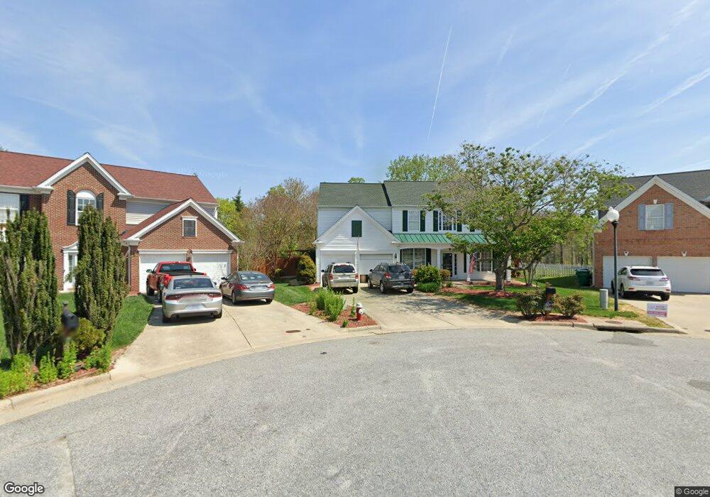
4552 Wayland Ct High Point, NC 27265
Squire Davis NeighborhoodEstimated Value: $359,000 - $401,000
4
Beds
3
Baths
2,354
Sq Ft
$159/Sq Ft
Est. Value
About This Home
This home is located at 4552 Wayland Ct, High Point, NC 27265 and is currently estimated at $374,895, approximately $159 per square foot. 4552 Wayland Ct is a home located in Guilford County with nearby schools including Shadybrook Elementary School, Ferndale Middle School, and High Point Central High School.
Ownership History
Date
Name
Owned For
Owner Type
Purchase Details
Closed on
Apr 7, 2011
Sold by
Finger Daniel N and Finger Lianne M
Bought by
Browning Jeffery A and Browning Allison K
Current Estimated Value
Home Financials for this Owner
Home Financials are based on the most recent Mortgage that was taken out on this home.
Original Mortgage
$187,750
Outstanding Balance
$130,255
Interest Rate
4.92%
Mortgage Type
VA
Estimated Equity
$244,640
Purchase Details
Closed on
Dec 14, 2001
Sold by
Pulte Home Corp
Bought by
Finger Daniel N and Finger Lianne M
Home Financials for this Owner
Home Financials are based on the most recent Mortgage that was taken out on this home.
Original Mortgage
$179,972
Interest Rate
6.5%
Create a Home Valuation Report for This Property
The Home Valuation Report is an in-depth analysis detailing your home's value as well as a comparison with similar homes in the area
Home Values in the Area
Average Home Value in this Area
Purchase History
| Date | Buyer | Sale Price | Title Company |
|---|---|---|---|
| Browning Jeffery A | $195,000 | None Available | |
| Finger Daniel N | $189,500 | -- |
Source: Public Records
Mortgage History
| Date | Status | Borrower | Loan Amount |
|---|---|---|---|
| Open | Browning Jeffery A | $187,750 | |
| Previous Owner | Finger Daniel N | $179,972 |
Source: Public Records
Tax History Compared to Growth
Tax History
| Year | Tax Paid | Tax Assessment Tax Assessment Total Assessment is a certain percentage of the fair market value that is determined by local assessors to be the total taxable value of land and additions on the property. | Land | Improvement |
|---|---|---|---|---|
| 2025 | $3,715 | $269,600 | $60,000 | $209,600 |
| 2024 | $3,715 | $269,600 | $60,000 | $209,600 |
| 2023 | $3,715 | $269,600 | $60,000 | $209,600 |
| 2022 | $3,634 | $269,600 | $60,000 | $209,600 |
| 2021 | $2,558 | $185,600 | $35,000 | $150,600 |
| 2020 | $2,558 | $185,600 | $35,000 | $150,600 |
| 2019 | $2,558 | $185,600 | $0 | $0 |
| 2018 | $2,545 | $185,600 | $0 | $0 |
| 2017 | $2,558 | $185,600 | $0 | $0 |
| 2016 | $2,537 | $180,900 | $0 | $0 |
| 2015 | $2,551 | $180,900 | $0 | $0 |
| 2014 | $2,594 | $180,900 | $0 | $0 |
Source: Public Records
Map
Nearby Homes
- 1349 Pondhaven Dr
- 4415 Johnson St
- 4505 Garden Club St
- 4485 Garden Club St
- 4802 Tradition Way
- 4612 Owls View Ct
- 2305 Faircloth Way
- 1018 Havenridge Dr
- 4244 Canter Creek Ln
- 4244 Canter Creek Ln Unit 96
- 4212 Canter Creek Ln Unit , Lot 88 ,
- 4212 Canter Creek Ln
- 4286 Lumsden Ln
- 2304 Rockland Cir
- 3819 Oak Forest Dr
- 2350 Birch View Dr
- 3025 Sycamore Point Trail
- 4000 Kim Dr
- 3522 Hunting Ridge Dr
- 2166 Glen Cove Way
- 4548 Wayland Ct
- 4551 Wayland Ct
- 4544 Wayland Ct
- 4547 Wayland Ct
- 4540 Wayland Ct
- 4543 Wayland Ct
- 4536 Wayland Ct
- 4539 Wayland Ct
- 1477 Cantwell Ct
- 4535 Wayland Ct
- 1481 Cantwell Ct
- 4532 Wayland Ct
- 1480 Cantwell Ct
- 1473 Cantwell Ct
- 4528 Wayland Ct
- 4531 Wayland Ct
- 1469 Cantwell Ct
- 4524 Wayland Ct
- 4527 Wayland Ct
- 1476 Cantwell Ct