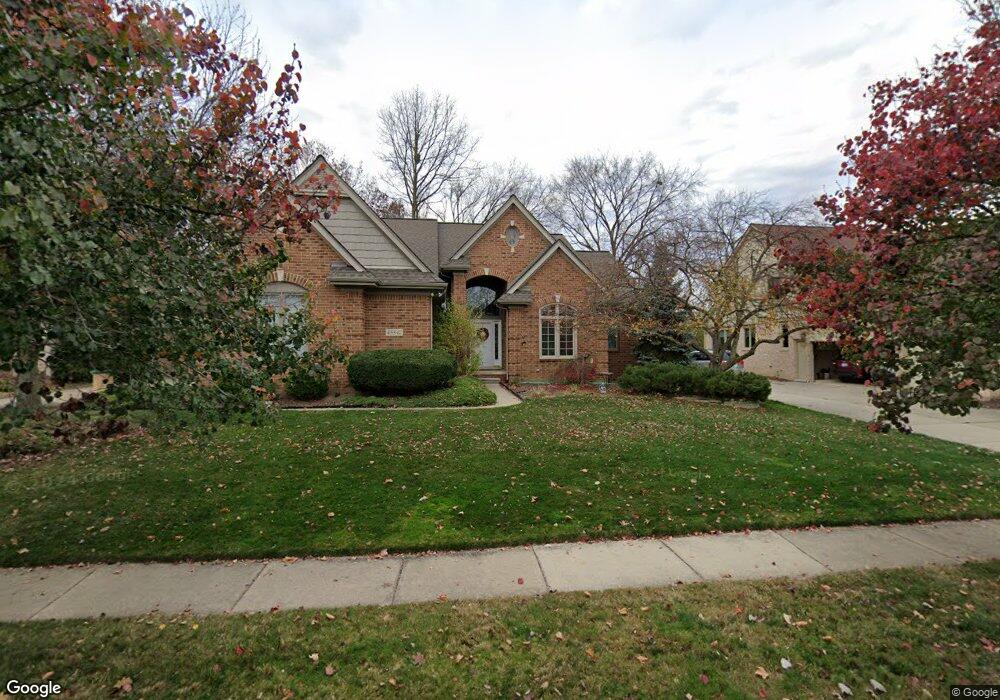
45542 Glengarry Blvd Canton, MI 48188
Estimated Value: $533,474 - $627,000
--
Bed
3
Baths
2,665
Sq Ft
$224/Sq Ft
Est. Value
About This Home
This home is located at 45542 Glengarry Blvd, Canton, MI 48188 and is currently estimated at $597,119, approximately $224 per square foot. 45542 Glengarry Blvd is a home located in Wayne County with nearby schools including Canton High School, Plymouth High School, and Salem High School.
Ownership History
Date
Name
Owned For
Owner Type
Purchase Details
Closed on
Mar 3, 2006
Sold by
Mcsurely Hugh B and Mcsurely Kathleen Margaret Brow
Bought by
Mcsurely Hugh B and Hugh B Mcsurely Revocable Trust Agreemtn
Current Estimated Value
Purchase Details
Closed on
Aug 12, 1994
Sold by
Bonadeo Fairway Corp
Bought by
Mcsurely Hugh B and Mcsurely Rosalie
Home Financials for this Owner
Home Financials are based on the most recent Mortgage that was taken out on this home.
Original Mortgage
$190,000
Interest Rate
8.73%
Mortgage Type
New Conventional
Create a Home Valuation Report for This Property
The Home Valuation Report is an in-depth analysis detailing your home's value as well as a comparison with similar homes in the area
Home Values in the Area
Average Home Value in this Area
Purchase History
| Date | Buyer | Sale Price | Title Company |
|---|---|---|---|
| Mcsurely Hugh B | -- | None Available | |
| Mcsurely Hugh B | -- | -- |
Source: Public Records
Mortgage History
| Date | Status | Borrower | Loan Amount |
|---|---|---|---|
| Closed | Mcsurely Hugh B | $190,000 |
Source: Public Records
Tax History Compared to Growth
Tax History
| Year | Tax Paid | Tax Assessment Tax Assessment Total Assessment is a certain percentage of the fair market value that is determined by local assessors to be the total taxable value of land and additions on the property. | Land | Improvement |
|---|---|---|---|---|
| 2025 | $3,249 | $245,000 | $0 | $0 |
| 2024 | $3,249 | $231,700 | $0 | $0 |
| 2023 | $3,097 | $201,500 | $0 | $0 |
| 2022 | $6,707 | $196,600 | $0 | $0 |
| 2021 | $6,506 | $193,700 | $0 | $0 |
| 2020 | $6,426 | $190,900 | $0 | $0 |
| 2019 | $6,307 | $177,520 | $0 | $0 |
| 2018 | $2,632 | $167,990 | $0 | $0 |
| 2017 | $6,361 | $167,400 | $0 | $0 |
| 2016 | $5,730 | $168,400 | $0 | $0 |
| 2015 | $14,464 | $157,050 | $0 | $0 |
| 2013 | $14,012 | $153,720 | $0 | $0 |
| 2010 | -- | $136,000 | $70,055 | $65,945 |
Source: Public Records
Map
Nearby Homes
- 241 Country Club Ln
- 316 Queen Anne Dr
- 47078 Bing Dr
- 45400 William Ct
- 51026 Meadowlands
- 45801 Henley Dr
- 500 Belvedere Ct N
- 288 Edington Cir Unit 61
- 45242 Thornhill Rd
- 1564 Crowndale Ln
- 685 N Beck Rd
- 227 Edington Cir
- 45030 Glengarry Rd
- 45814 Aragon Ln
- 1861 Stonebridge Way
- 1273 Kennebec
- 45678 Aragon Ln
- 1244 W Crystal Cir
- 1752 Thistle Dr
- 1709 Thistle Dr Unit 51
- 45536 Glengarry Blvd
- 45548 Glengarry Blvd
- 46400 Glengarry Blvd
- 45543 Glengarry Blvd
- 45530 Muirfield Dr
- 45547 Glengarry Blvd
- 400 Country Club Ct
- 46446 Glengarry Blvd
- 382 Country Club Ct
- 45555 Glengarry Blvd
- 45528 Muirfield Dr
- 45540 Muirfield Ct
- 45546 Muirfield Ct
- 387 Country Club Ct Unit Bldg-Unit
- 387 Country Club Ct
- 46403 Inverness Rd
- 46488 Glengarry Blvd
- 364 Country Club Ct
- 500 Merion Dr
- 45554 Muirfield Ct