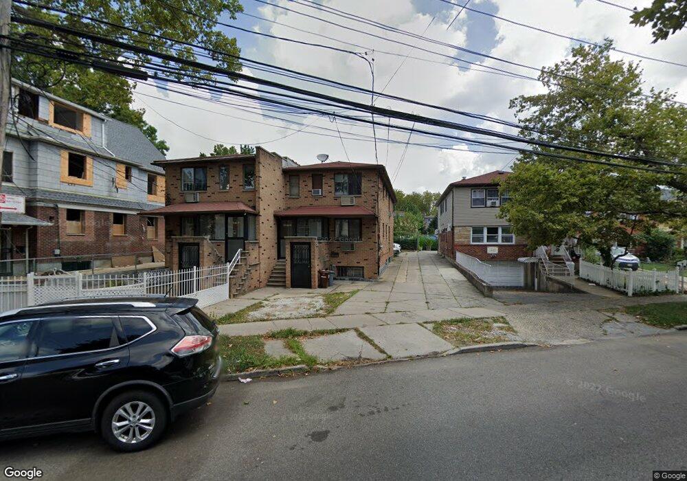
4555 Parsons Blvd Flushing, NY 11355
Flushing NeighborhoodEstimated Value: $1,275,000 - $1,557,000
--
Bed
--
Bath
1,780
Sq Ft
$810/Sq Ft
Est. Value
About This Home
This home is located at 4555 Parsons Blvd, Flushing, NY 11355 and is currently estimated at $1,441,333, approximately $809 per square foot. 4555 Parsons Blvd is a home located in Queens County with nearby schools including P.S. 22 - Thomas Jefferson, J.H.S. 189Q Daniel Carter Beard, and Francis Lewis High School.
Ownership History
Date
Name
Owned For
Owner Type
Purchase Details
Closed on
Aug 27, 2013
Sold by
Lan Chang Jie and Liu Wai Fong
Bought by
Liu Wai Fong
Current Estimated Value
Purchase Details
Closed on
Feb 26, 1998
Sold by
Shin Un Sun
Bought by
Lan Chang Jie and Liu Wai Fong
Home Financials for this Owner
Home Financials are based on the most recent Mortgage that was taken out on this home.
Original Mortgage
$230,000
Interest Rate
6.92%
Create a Home Valuation Report for This Property
The Home Valuation Report is an in-depth analysis detailing your home's value as well as a comparison with similar homes in the area
Home Values in the Area
Average Home Value in this Area
Purchase History
| Date | Buyer | Sale Price | Title Company |
|---|---|---|---|
| Liu Wai Fong | -- | -- | |
| Lan Chang Jie | $312,000 | -- |
Source: Public Records
Mortgage History
| Date | Status | Borrower | Loan Amount |
|---|---|---|---|
| Previous Owner | Lan Chang Jie | $230,000 |
Source: Public Records
Tax History Compared to Growth
Tax History
| Year | Tax Paid | Tax Assessment Tax Assessment Total Assessment is a certain percentage of the fair market value that is determined by local assessors to be the total taxable value of land and additions on the property. | Land | Improvement |
|---|---|---|---|---|
| 2025 | $13,545 | $71,460 | $23,949 | $47,511 |
| 2024 | $13,545 | $67,440 | $23,955 | $43,485 |
| 2023 | $12,794 | $63,700 | $19,081 | $44,619 |
| 2022 | $12,716 | $67,620 | $23,940 | $43,680 |
| 2021 | $13,297 | $68,700 | $23,940 | $44,760 |
| 2020 | $12,617 | $75,480 | $23,940 | $51,540 |
| 2019 | $11,764 | $66,540 | $23,940 | $42,600 |
| 2018 | $10,821 | $53,083 | $19,648 | $33,435 |
| 2017 | $10,821 | $53,083 | $21,590 | $31,493 |
| 2016 | $10,526 | $53,083 | $21,590 | $31,493 |
| 2015 | $6,040 | $49,673 | $24,921 | $24,752 |
| 2014 | $6,040 | $46,862 | $21,119 | $25,743 |
Source: Public Records
Map
Nearby Homes
- 45-53 Parsons Blvd
- 45-65 Parsons Blvd
- 45-73 Parsons Blvd
- 146-15 Holly Ave
- 43-45 Burling St
- 148-11 Kalmia Ave
- 148-10 Kalmia Ave
- 45-24 Burling St
- 149-31 45th Ave
- 148-24 Kalmia Ave
- 14824 Kalmia Ave
- 143-16 Holly Ave
- 4530 Smart St
- 148-29 Laburnum Ave
- 14716 Cherry Ave
- 4307 149th St
- 4341 Burling St
- 46-06 Bowne St
- 149-18 Cherry Ave
- 45-57 157th St
- 4553 Parsons Blvd
- 4559 Parsons Blvd
- 14718 Hawthorne Ave
- 4547 Parsons Blvd
- 14722 Hawthorne Ave
- 4563 Parsons Blvd
- 147-18 Hawthorne Ave
- 45-63 Parsons Blvd Unit 1st Fl
- 45-47 Parsons Blvd Unit 2F
- 45-47 Parsons Blvd Unit 3F
- 45-47 Parsons Blvd
- 14726 Hawthorne Ave
- 14726 Hawthorne Ave
- 4565 Parsons Blvd
- 45-72 Parsons Blvd
- 4569 Parsons Blvd
- 4569 Parsons Blvd Unit 3154581
- 4569 Parsons Blvd
- 14730 Hawthorne Ave
- 4569 Parsons Blvd