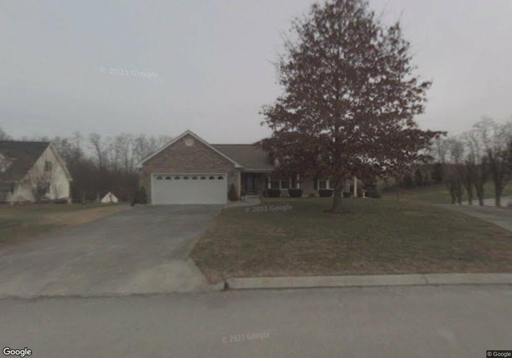
4556 Yorkshire Ln Morristown, TN 37813
Estimated Value: $363,000 - $528,000
2
Beds
3
Baths
1,878
Sq Ft
$234/Sq Ft
Est. Value
About This Home
This home is located at 4556 Yorkshire Ln, Morristown, TN 37813 and is currently estimated at $438,998, approximately $233 per square foot. 4556 Yorkshire Ln is a home located in Hamblen County with nearby schools including Russellville Elementary School, East Ridge Middle School, and Morristown East High School.
Ownership History
Date
Name
Owned For
Owner Type
Purchase Details
Closed on
Aug 2, 2017
Sold by
Epps Charles W and Epps Carl Phyllis
Bought by
Smith Herbert Ray and Smith Marie Y
Current Estimated Value
Purchase Details
Closed on
Jan 19, 2007
Bought by
Epps Barbara L and Epps E
Purchase Details
Closed on
Jan 14, 1994
Bought by
Epps Charles H and Epps Barbara J
Purchase Details
Closed on
Jul 28, 1992
Bought by
Whetsel Jimmy Dean
Purchase Details
Closed on
Jan 1, 1986
Bought by
Harrell Bruce F and Harrell Sue J
Purchase Details
Closed on
Aug 17, 1979
Bought by
Harrell Bruce F and Harrell Sue J
Create a Home Valuation Report for This Property
The Home Valuation Report is an in-depth analysis detailing your home's value as well as a comparison with similar homes in the area
Home Values in the Area
Average Home Value in this Area
Purchase History
| Date | Buyer | Sale Price | Title Company |
|---|---|---|---|
| Smith Herbert Ray | $210,000 | None Available | |
| Epps Barbara L | -- | -- | |
| Epps Charles H | $14,900 | -- | |
| Whetsel Jimmy Dean | $11,500 | -- | |
| Harrell Bruce F | -- | -- | |
| Harrell Bruce F | -- | -- |
Source: Public Records
Tax History Compared to Growth
Tax History
| Year | Tax Paid | Tax Assessment Tax Assessment Total Assessment is a certain percentage of the fair market value that is determined by local assessors to be the total taxable value of land and additions on the property. | Land | Improvement |
|---|---|---|---|---|
| 2024 | $1,062 | $53,925 | $8,225 | $45,700 |
| 2023 | $1,062 | $53,925 | $0 | $0 |
| 2022 | $1,062 | $53,925 | $8,225 | $45,700 |
| 2021 | $1,062 | $53,925 | $8,225 | $45,700 |
| 2020 | $1,062 | $53,925 | $8,225 | $45,700 |
| 2019 | $845 | $39,675 | $7,275 | $32,400 |
| 2018 | $845 | $39,675 | $7,275 | $32,400 |
| 2017 | $845 | $39,675 | $7,275 | $32,400 |
| 2016 | $790 | $39,675 | $7,275 | $32,400 |
| 2015 | $734 | $39,675 | $7,275 | $32,400 |
| 2014 | -- | $39,675 | $7,275 | $32,400 |
| 2013 | -- | $43,825 | $0 | $0 |
Source: Public Records
Map
Nearby Homes
- 4458 Brockland Dr
- 670 Jones Franklin Rd
- 4705 E Hampton Blvd
- 288 Fuller Estate Cir
- 358 Dover Rd
- 4581 Lockley Ct
- 4270 Brockland Dr
- 4907 Barton Springs Dr
- 4510 Westover Place
- 1148 George Byrd Rd
- 00 Shinbone E Sugar Hollow Rd
- 1342 Slop Creek Rd
- 3661 Halifax Cir
- 5085 Old Kentucky Rd
- 354 Volunteer Dr
- 4027 White Wood Cir
- 1134 Shannons Little Mountain Rd
- 4544 Yorkshire Ln
- 4566 Yorkshire Ln
- 4547 Yorkshire Ln
- 4532 Yorkshire Ln
- 4576 Yorkshire Ln
- 4575 Yorkshire Ln
- 4520 Yorkshire Ln
- 4515 Yorkshire Ln
- 586 Jones Franklin Rd
- 539 Ashland Oaks Dr
- 5020 Woodbine St
- 4526 Whitecliff St
- 4545 Whitecliff St
- 5014 Woodbine St
- 515 Ashland Oaks Dr
- 5008 Woodbine St Unit S/D Ashland Oaks
- 5008 Woodbine St
- 536 Ashland Oaks Dr
- 524 Ashland Oaks Dr
- 4516 Whitecliff St