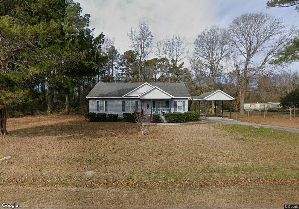
4558 Blue Banks Loop Rd NE Leland, NC 28451
Estimated Value: $299,000 - $324,000
3
Beds
2
Baths
1,500
Sq Ft
$206/Sq Ft
Est. Value
About This Home
This home is located at 4558 Blue Banks Loop Rd NE, Leland, NC 28451 and is currently estimated at $308,541, approximately $205 per square foot. 4558 Blue Banks Loop Rd NE is a home located in Brunswick County with nearby schools including Lincoln Elementary School, Leland Middle School, and North Brunswick High School.
Ownership History
Date
Name
Owned For
Owner Type
Purchase Details
Closed on
Mar 17, 2008
Sold by
Ballard Sylvester and Ballard Fossie Mae
Bought by
Dorsey Valerie B
Current Estimated Value
Home Financials for this Owner
Home Financials are based on the most recent Mortgage that was taken out on this home.
Original Mortgage
$105,000
Outstanding Balance
$67,674
Interest Rate
5.63%
Mortgage Type
Construction
Estimated Equity
$240,867
Create a Home Valuation Report for This Property
The Home Valuation Report is an in-depth analysis detailing your home's value as well as a comparison with similar homes in the area
Home Values in the Area
Average Home Value in this Area
Purchase History
| Date | Buyer | Sale Price | Title Company |
|---|---|---|---|
| Dorsey Valerie B | -- | None Available |
Source: Public Records
Mortgage History
| Date | Status | Borrower | Loan Amount |
|---|---|---|---|
| Open | Dorsey Valerie B | $105,000 |
Source: Public Records
Tax History Compared to Growth
Tax History
| Year | Tax Paid | Tax Assessment Tax Assessment Total Assessment is a certain percentage of the fair market value that is determined by local assessors to be the total taxable value of land and additions on the property. | Land | Improvement |
|---|---|---|---|---|
| 2025 | -- | $242,750 | $9,140 | $233,610 |
| 2024 | $1,671 | $242,750 | $9,140 | $233,610 |
| 2023 | $1,289 | $242,750 | $9,140 | $233,610 |
| 2022 | $0 | $147,570 | $6,840 | $140,730 |
| 2021 | $0 | $147,570 | $6,840 | $140,730 |
| 2020 | $1,245 | $147,570 | $6,840 | $140,730 |
| 2019 | $1,226 | $6,840 | $6,840 | $0 |
| 2018 | $1,145 | $136,440 | $6,080 | $130,360 |
| 2017 | $1,114 | $6,080 | $6,080 | $0 |
| 2016 | $1,089 | $6,080 | $6,080 | $0 |
| 2015 | $1,089 | $136,440 | $6,080 | $130,360 |
| 2014 | $993 | $134,860 | $7,640 | $127,220 |
Source: Public Records
Map
Nearby Homes
- 3479 Grist Creek Wynd
- 8891 Millers Path NE
- 8852 Millers Path NE
- 1722 Travor St Unit Lot 12
- 4834 Grinders Way NE
- 8780 N Fork Way NE
- 4887 Grinders Way NE
- 3177 Blue Banks Loop Rd NE
- 3538 Grist Creek Wynd
- 3575 Grist Creek
- 1 Saw Mill Rd NE
- 3529 Blue Banks Loop Rd NE
- 5488 Steamer Rd NE
- 3778 Northern Lights Dr
- 4056 Northwest Rd NE
- 4168 Pegasus Pkwy
- 3936 Virgo Ln
- 4023 Little Dipper Ct
- 539 Coronado Ave Unit 63
- 3975 Sourwood Ct NE
- 4551 Blue Banks Loop Rd NE
- 4573 Blue Banks Loop Rd NE
- 4583 Blue Banks Loop Rd NE
- 4591 Blue Banks Loop Rd NE
- 4515 Blue Banks Loop Rd NE
- 5040 Perkins Rd NE
- 4593 Blue Banks Loop Rd NE
- 5014 Perkins Rd NE
- 5100 Perkins Rd NE
- 4601 Blue Banks Loop Rd NE
- 5120 Perkins Rd NE
- 5057 Perkins Rd NE
- 5140 Perkins Rd NE
- 5160 Perkins Rd NE
- 4600 Ballard Cir NE
- 4480 Blue Banks Loop Rd NE
- 4480 Blue Banks Loop Rd NE
- 4843 Otis Dr NE
- 5167 Perkins Rd NE
- 4645 Blue Banks Loop Rd NE