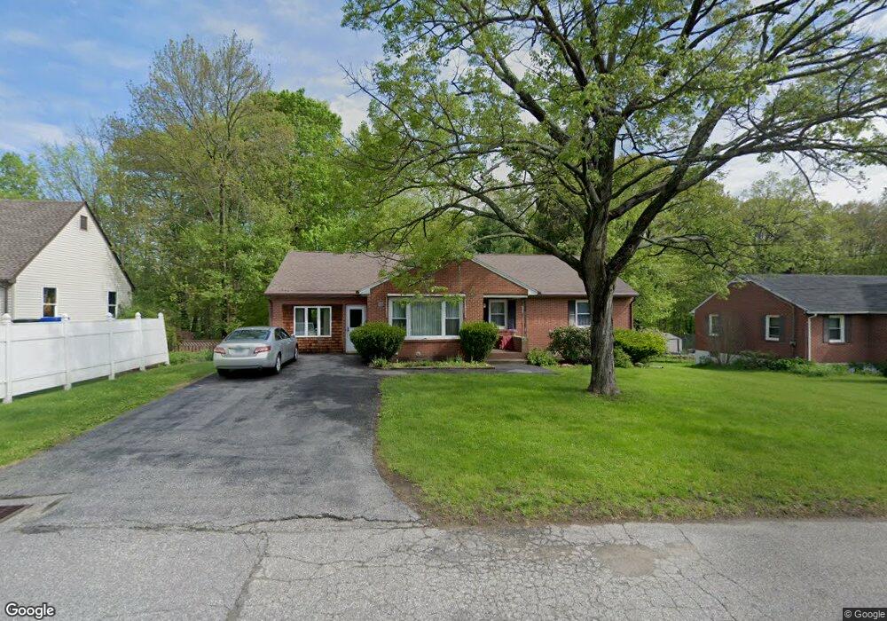
456 Funston Ave Torrington, CT 06790
Estimated Value: $340,000 - $388,000
3
Beds
2
Baths
1,677
Sq Ft
$215/Sq Ft
Est. Value
About This Home
This home is located at 456 Funston Ave, Torrington, CT 06790 and is currently estimated at $360,989, approximately $215 per square foot. 456 Funston Ave is a home located in Litchfield County with nearby schools including Torrington Middle School, Torrington High School, and Brooker Memorial CC & Learning Center.
Ownership History
Date
Name
Owned For
Owner Type
Purchase Details
Closed on
Nov 10, 2022
Sold by
Duksis Renate and Fnma
Bought by
Vetter Renate R
Current Estimated Value
Home Financials for this Owner
Home Financials are based on the most recent Mortgage that was taken out on this home.
Original Mortgage
$160,000
Outstanding Balance
$155,039
Interest Rate
6.95%
Mortgage Type
Stand Alone Refi Refinance Of Original Loan
Estimated Equity
$205,950
Purchase Details
Closed on
Nov 1, 1979
Bought by
Duksis Karlis L and Duksis Renate
Create a Home Valuation Report for This Property
The Home Valuation Report is an in-depth analysis detailing your home's value as well as a comparison with similar homes in the area
Home Values in the Area
Average Home Value in this Area
Purchase History
| Date | Buyer | Sale Price | Title Company |
|---|---|---|---|
| Vetter Renate R | -- | None Available | |
| Vetter Renate R | -- | None Available | |
| Duksis Karlis L | -- | -- |
Source: Public Records
Mortgage History
| Date | Status | Borrower | Loan Amount |
|---|---|---|---|
| Open | Vetter Renate R | $160,000 | |
| Closed | Vetter Renate R | $160,000 | |
| Previous Owner | Duksis Karlis L | $50,000 |
Source: Public Records
Tax History Compared to Growth
Tax History
| Year | Tax Paid | Tax Assessment Tax Assessment Total Assessment is a certain percentage of the fair market value that is determined by local assessors to be the total taxable value of land and additions on the property. | Land | Improvement |
|---|---|---|---|---|
| 2025 | $8,088 | $210,350 | $31,220 | $179,130 |
| 2024 | $5,296 | $110,400 | $31,180 | $79,220 |
| 2023 | $5,295 | $110,400 | $31,180 | $79,220 |
| 2022 | $5,204 | $110,400 | $31,180 | $79,220 |
| 2021 | $5,097 | $110,400 | $31,180 | $79,220 |
| 2020 | $5,097 | $110,400 | $31,180 | $79,220 |
| 2019 | $4,946 | $107,130 | $34,650 | $72,480 |
| 2018 | $4,946 | $107,130 | $34,650 | $72,480 |
| 2017 | $4,901 | $107,130 | $34,650 | $72,480 |
| 2016 | $4,901 | $107,130 | $34,650 | $72,480 |
| 2015 | $4,901 | $107,130 | $34,650 | $72,480 |
| 2014 | $4,978 | $137,070 | $47,780 | $89,290 |
Source: Public Records
Map
Nearby Homes
- 5 Zappulla Dr
- 130 Oakbrook Ln
- 271 Heights Dr
- 237 Wyoming Ave
- 244 Hawthorne Terrace
- 149 Heights Dr
- 361 Heights Dr
- 152 Funston Ave
- 231 Beechwood Ave
- 0 Highland Ave Unit 24088105
- 49 Chestnut Ave
- 69 Johnson St
- 21 Roosevelt Ave
- 75 Maple St
- 112 French St
- 116 Johnson St
- 168 Blake St
- 264 Allen Rd
- Lot 10 Westledge Dr
- 0 Peck Rd
- 448 Funston Ave
- 470 Funston Ave
- 438 Funston Ave
- 56 Oakbrook Ln
- 420 Funston Ave
- 33 Oakbrook Ln
- 455 Funston Ave
- 469 Funston Ave
- 49 Oakbrook Ln
- 429 Funston Ave
- 74 Oakbrook Ln
- 410 Funston Ave
- 61 Oakbrook Ln
- 417 Funston Ave
- 1 Oakbrook Ln
- 301 Aetna Ave
- 71 Oakbrook Ln
- 398 Funston Ave
- 327 Aetna Ave
- 100 Oakbrook Ln