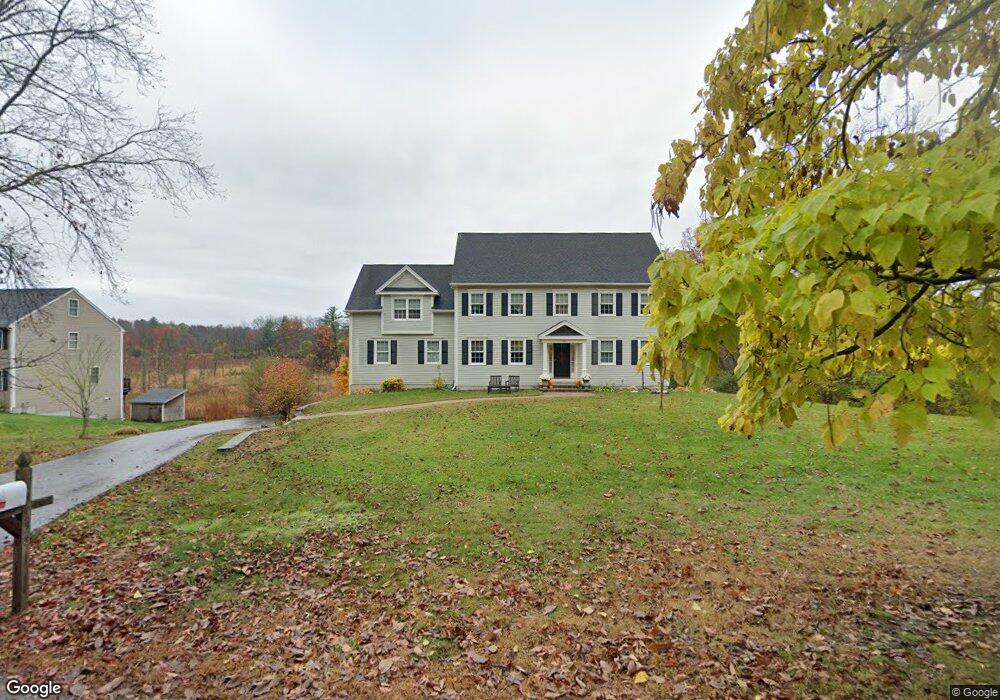
456 Wethersfield St Rowley, MA 01969
Estimated Value: $999,000 - $1,109,000
4
Beds
3
Baths
3,300
Sq Ft
$318/Sq Ft
Est. Value
About This Home
This home is located at 456 Wethersfield St, Rowley, MA 01969 and is currently estimated at $1,050,368, approximately $318 per square foot. 456 Wethersfield St is a home located in Essex County with nearby schools including Triton Regional High School, North Shore Montessori School, and Clark School.
Ownership History
Date
Name
Owned For
Owner Type
Purchase Details
Closed on
Jun 6, 2008
Sold by
Elkhorn Building Corp
Bought by
Garron Ronald A
Current Estimated Value
Purchase Details
Closed on
Jan 24, 2007
Sold by
Garron Ronald A and Johns Tammy M
Bought by
Garron Ronald
Create a Home Valuation Report for This Property
The Home Valuation Report is an in-depth analysis detailing your home's value as well as a comparison with similar homes in the area
Home Values in the Area
Average Home Value in this Area
Purchase History
| Date | Buyer | Sale Price | Title Company |
|---|---|---|---|
| Garron Ronald A | -- | -- | |
| Garron Ronald | -- | -- |
Source: Public Records
Mortgage History
| Date | Status | Borrower | Loan Amount |
|---|---|---|---|
| Open | Garron Ronald | $374,000 | |
| Closed | Garron Ronald | $405,694 | |
| Closed | Garron Ronald | $417,000 | |
| Closed | Garron Ronald | $50,000 |
Source: Public Records
Tax History
| Year | Tax Paid | Tax Assessment Tax Assessment Total Assessment is a certain percentage of the fair market value that is determined by local assessors to be the total taxable value of land and additions on the property. | Land | Improvement |
|---|---|---|---|---|
| 2025 | $10,715 | $910,400 | $305,700 | $604,700 |
| 2024 | $10,520 | $869,400 | $291,200 | $578,200 |
| 2023 | $10,343 | $794,400 | $252,700 | $541,700 |
| 2022 | $9,687 | $662,600 | $210,400 | $452,200 |
| 2021 | $9,490 | $609,100 | $183,400 | $425,700 |
| 2020 | $9,906 | $635,800 | $175,000 | $460,800 |
| 2019 | $8,629 | $587,800 | $175,000 | $412,800 |
| 2018 | $7,959 | $545,900 | $175,000 | $370,900 |
| 2017 | $7,719 | $545,900 | $175,000 | $370,900 |
| 2016 | $7,621 | $530,700 | $152,000 | $378,700 |
| 2015 | $7,513 | $527,600 | $152,000 | $375,600 |
Source: Public Records
Map
Nearby Homes
- 304-312 Wethersfield St
- 308 & 312 Wethersfield St
- 22 Taylor Ln
- 304 & 480 Wethersfield St & Nbpt Tnpk
- 460 - 472 Newburyport Turnpike
- 480 Newburyport Turnpike
- Lot 6 Osprey Ct
- 1 Osprey Ct
- 30 Christa Dr
- 12 Warren St
- 601 Newburyport Turnpike
- 12 Birch Ln
- 76-78 Daniels Rd
- 36 Caldwell Farm Rd
- 66 Parish Rd Unit 8
- 34 Central St Unit 2
- 34 Central St Unit 1
- 17 Ice Pond Dr
- 75 Country Club Way
- 34 Central St
- 448 Wethersfield St
- 470 Wethersfield St
- 467 Wethersfield St
- 476 Wethersfield St
- 438 Wethersfield St
- 445 Wethersfield St
- 441 Wethersfield St
- 11 Hillside St
- 5 Hillside St
- 488 Wethersfield St
- 12 Hillside St
- 38 Bob Merry Ln
- 35 Bob Merry Ln
- 435 Wethersfield St
- 36 Taylor Lane Lot 18
- 21 Hillside St
- 500 Wethersfield St
- 27 Hillside St
- 431 Wethersfield St
- 439 Wethersfield St
Your Personal Tour Guide
Ask me questions while you tour the home.