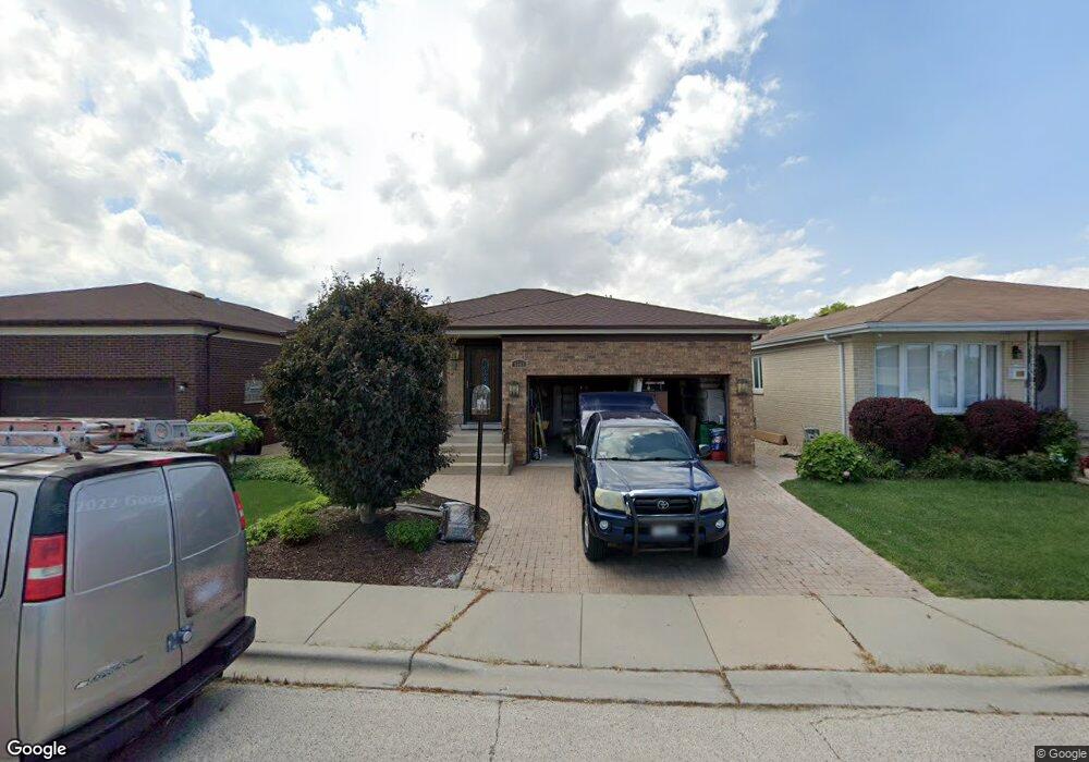
4564 N Anthon Ave Chicago, IL 60656
Schorsch Forest View NeighborhoodEstimated Value: $496,746 - $531,000
3
Beds
2
Baths
1,548
Sq Ft
$334/Sq Ft
Est. Value
About This Home
This home is located at 4564 N Anthon Ave, Chicago, IL 60656 and is currently estimated at $517,437, approximately $334 per square foot. 4564 N Anthon Ave is a home located in Cook County with nearby schools including Dirksen Elementary School, William Howard Taft High School, and St Eugene School.
Ownership History
Date
Name
Owned For
Owner Type
Purchase Details
Closed on
Dec 6, 2024
Sold by
Barileau Thomas J and Barileau Georgeanne
Bought by
Chicago Title Land Trust
Current Estimated Value
Purchase Details
Closed on
Jun 17, 2024
Sold by
Chicago Title Land Trust Company
Bought by
Barileau Thomas J and Barileau Georgeanne
Create a Home Valuation Report for This Property
The Home Valuation Report is an in-depth analysis detailing your home's value as well as a comparison with similar homes in the area
Home Values in the Area
Average Home Value in this Area
Purchase History
| Date | Buyer | Sale Price | Title Company |
|---|---|---|---|
| Chicago Title Land Trust | -- | None Listed On Document | |
| Chicago Title Land Trust | -- | None Listed On Document | |
| Barileau Thomas J | -- | Chicago Title | |
| Barileau Thomas J | -- | Chicago Title |
Source: Public Records
Tax History
| Year | Tax Paid | Tax Assessment Tax Assessment Total Assessment is a certain percentage of the fair market value that is determined by local assessors to be the total taxable value of land and additions on the property. | Land | Improvement |
|---|---|---|---|---|
| 2025 | $7,569 | $41,329 | $12,938 | $28,391 |
| 2024 | $7,569 | $41,329 | $12,938 | $28,391 |
| 2023 | $7,340 | $41,841 | $10,355 | $31,486 |
| 2022 | $7,340 | $41,841 | $10,355 | $31,486 |
| 2021 | $8,046 | $46,005 | $10,355 | $35,650 |
| 2020 | $5,841 | $31,804 | $6,468 | $25,336 |
| 2019 | $5,860 | $35,338 | $6,468 | $28,870 |
| 2018 | $5,759 | $35,338 | $6,468 | $28,870 |
| 2017 | $4,879 | $28,742 | $5,692 | $23,050 |
| 2016 | $6,102 | $30,465 | $5,692 | $24,773 |
| 2015 | $5,302 | $33,432 | $5,692 | $27,740 |
| 2014 | $4,647 | $29,448 | $5,175 | $24,273 |
| 2013 | $4,967 | $31,816 | $5,175 | $26,641 |
Source: Public Records
Map
Nearby Homes
- 4621 N Anthon Ave
- 8537 W Sunnyside Ave
- 8444 W Wilson Ave Unit 407S
- 4623 N Chester Ave Unit 311W
- 8455 W Leland Ave Unit 309N
- 4738 N Potawatomie Ave
- 5236 N Potawatomie St Unit 101
- 4525 N Plainfield Ave
- 8229 W Giddings St
- 4955 N Delphia Ave
- 8268 W Lawrence Ave
- 4932 N Leonard Dr Unit 2A
- 4930 N Clifton Ave
- 8124 W Courtland Ave
- 4939 N Cumberland Ave
- 8517 W Carmen Ave
- 8121 W Lawrence Ave
- 5037 N East River Rd Unit 1B
- 8547 W Saint Joseph Ave
- 4917 N Prospect Ave
- 4558 N Anthon Ave
- 4568 N Anthon Ave
- 4554 N Anthon Ave
- 4574 N Anthon Ave
- 4565 N Delphia Ave
- 4569 N Delphia Ave
- 4559 N Delphia Ave
- 4548 N Anthon Ave
- 4578 N Anthon Ave
- 4573 N Delphia Ave
- 4563 N Anthon Ave
- 4555 N Delphia Ave
- 4559 N Anthon Ave
- 4569 N Anthon Ave
- 8555 W Wilson Ave
- 4544 N Anthon Ave
- 4553 N Anthon Ave
- 4573 N Anthon Ave
- 4549 N Delphia Ave
- 4549 N Anthon Ave
Your Personal Tour Guide
Ask me questions while you tour the home.