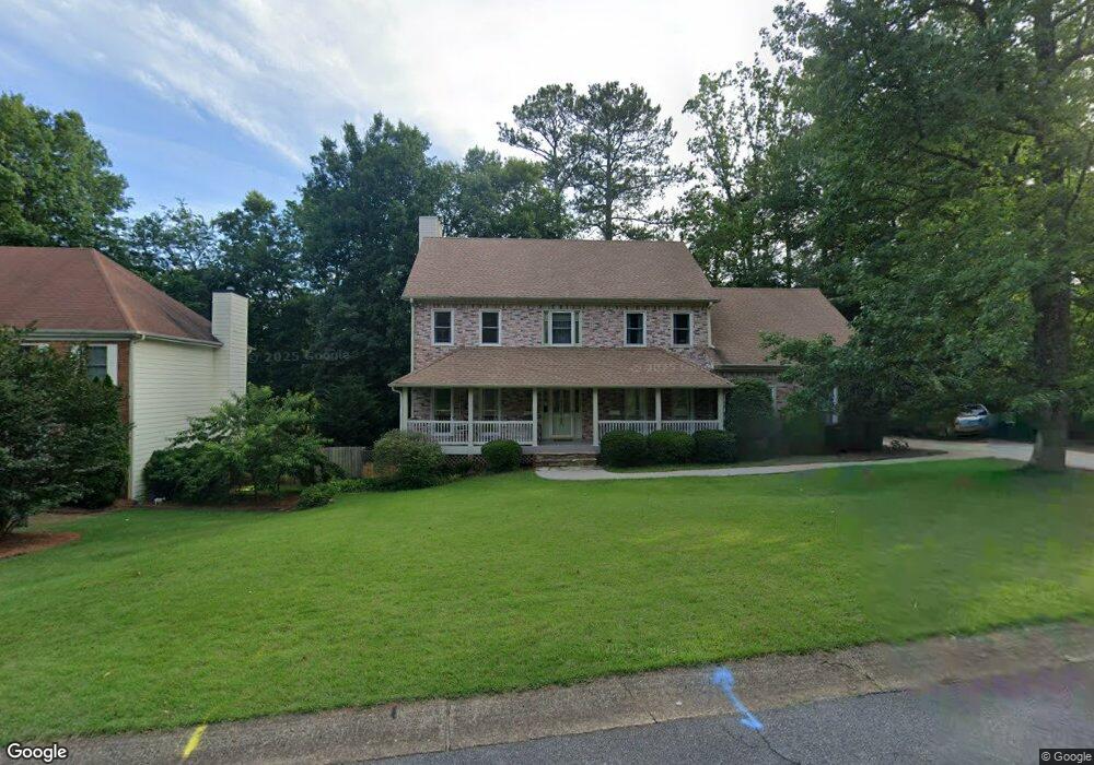
4569 Ashmore Cir NE Marietta, GA 30066
Sandy Plains NeighborhoodEstimated Value: $613,000 - $745,000
4
Beds
4
Baths
2,911
Sq Ft
$229/Sq Ft
Est. Value
About This Home
This home is located at 4569 Ashmore Cir NE, Marietta, GA 30066 and is currently estimated at $667,622, approximately $229 per square foot. 4569 Ashmore Cir NE is a home located in Cobb County with nearby schools including Davis Elementary School, Mabry Middle School, and Lassiter High School.
Ownership History
Date
Name
Owned For
Owner Type
Purchase Details
Closed on
Jun 5, 1998
Sold by
Elder Jack G and Elder Charlene
Bought by
Strom Candace J and Strom Jon C
Current Estimated Value
Home Financials for this Owner
Home Financials are based on the most recent Mortgage that was taken out on this home.
Original Mortgage
$100,000
Interest Rate
6.94%
Mortgage Type
New Conventional
Create a Home Valuation Report for This Property
The Home Valuation Report is an in-depth analysis detailing your home's value as well as a comparison with similar homes in the area
Home Values in the Area
Average Home Value in this Area
Purchase History
| Date | Buyer | Sale Price | Title Company |
|---|---|---|---|
| Strom Candace J | $175,000 | -- |
Source: Public Records
Mortgage History
| Date | Status | Borrower | Loan Amount |
|---|---|---|---|
| Previous Owner | Strom Candace J | $100,000 |
Source: Public Records
Tax History Compared to Growth
Tax History
| Year | Tax Paid | Tax Assessment Tax Assessment Total Assessment is a certain percentage of the fair market value that is determined by local assessors to be the total taxable value of land and additions on the property. | Land | Improvement |
|---|---|---|---|---|
| 2025 | $1,332 | $258,560 | $58,000 | $200,560 |
| 2024 | $1,261 | $233,100 | $58,000 | $175,100 |
| 2023 | $1,026 | $223,496 | $46,000 | $177,496 |
| 2022 | $1,097 | $178,352 | $42,000 | $136,352 |
| 2021 | $1,097 | $178,352 | $42,000 | $136,352 |
| 2020 | $1,050 | $162,544 | $44,000 | $118,544 |
| 2019 | $1,050 | $162,544 | $44,000 | $118,544 |
| 2018 | $1,050 | $162,544 | $44,000 | $118,544 |
| 2017 | $953 | $162,544 | $44,000 | $118,544 |
| 2016 | $3,846 | $162,544 | $44,000 | $118,544 |
| 2015 | $3,376 | $138,348 | $43,600 | $94,748 |
| 2014 | $3,396 | $138,348 | $0 | $0 |
Source: Public Records
Map
Nearby Homes
- 4563 Ashmore Cir NE
- 3043 Sawyer Trace NE
- 4397 Windsor Oaks Cir
- 4589 Wigley Estates Rd
- 2855 Lamer Trace
- 2842 Forest Chase Dr NE
- 3333 Devaughn Dr NE
- 4464 Windsor Oaks Dr
- 4302 Highborne Dr NE Unit 3
- 2958 Forest Chase Terrace NE
- 4243 N Mountain Rd NE
- 4219 N Mountain Rd NE
- 2713 Arbor Summit
- 4259 Arbor Club Dr
- 3350 Brookhill Cir
- 3130 Maley Ct
- 2696 S Arbor Dr
- 2768 Hawk Trace Ct NE
- 4887 Raven Way NE
- 2610 Chadwick Rd
- 4567 Ashmore Cir NE
- 4571 Ashmore Cir NE
- 4566 Ashmore Cir NE
- 4558 Ashmore Cir NE
- 4565 Ashmore Cir NE
- 4573 Ashmore Cir NE
- 4556 Ashmore Cir NE
- 3270 Hampton Ridge Dr NE
- 4500 Windsor Oaks Cir
- 4570 Ashmore Cir NE
- 4575 Ashmore Cir NE
- 3003 Oaktree Ct NE
- 3272 Hampton Ridge Dr NE
- 3296 Hutton Walk NE
- 0 Ashmore Cir Unit 7059159
- 0 Ashmore Cir Unit 7027766
- 0 Ashmore Cir Unit 8098130
- 0 Ashmore Cir Unit 8567142
- 0 Ashmore Cir Unit 8463534
- 0 Ashmore Cir Unit 7265008