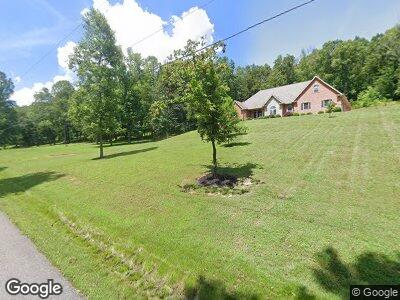
457 Brookefield Farm Rd Ashland, KY 41102
Estimated Value: $272,000 - $503,000
3
Beds
3
Baths
2,156
Sq Ft
$167/Sq Ft
Est. Value
About This Home
This home is located at 457 Brookefield Farm Rd, Ashland, KY 41102 and is currently estimated at $359,790, approximately $166 per square foot. 457 Brookefield Farm Rd is a home located in Greenup County with nearby schools including Greenup County High School.
Ownership History
Date
Name
Owned For
Owner Type
Purchase Details
Closed on
Jul 16, 2020
Sold by
Blevins Bonnie and Blevins Nathanial Ray
Bought by
Scaggs Larry J and Harris-Scaggs Christina
Current Estimated Value
Purchase Details
Closed on
Sep 21, 2007
Sold by
Jordan Charles E
Bought by
Scaggs Larry J and Harris-Scaggs Christina
Create a Home Valuation Report for This Property
The Home Valuation Report is an in-depth analysis detailing your home's value as well as a comparison with similar homes in the area
Home Values in the Area
Average Home Value in this Area
Purchase History
| Date | Buyer | Sale Price | Title Company |
|---|---|---|---|
| Scaggs Larry J | $65,000 | None Listed On Document | |
| Scaggs Larry J | $35,000 | -- |
Source: Public Records
Mortgage History
| Date | Status | Borrower | Loan Amount |
|---|---|---|---|
| Previous Owner | Scaggs Larry J | $94,297 | |
| Previous Owner | Scaggs Larry J | $100,150 | |
| Previous Owner | Scaggs Larry J | $95,000 |
Source: Public Records
Tax History Compared to Growth
Tax History
| Year | Tax Paid | Tax Assessment Tax Assessment Total Assessment is a certain percentage of the fair market value that is determined by local assessors to be the total taxable value of land and additions on the property. | Land | Improvement |
|---|---|---|---|---|
| 2024 | $3,283 | $193,000 | $35,000 | $158,000 |
| 2023 | $3,098 | $193,000 | $35,000 | $158,000 |
| 2022 | $3,003 | $193,000 | $35,000 | $158,000 |
| 2021 | $2,990 | $193,000 | $35,000 | $158,000 |
| 2020 | $2,942 | $193,000 | $35,000 | $158,000 |
| 2019 | $2,969 | $193,000 | $35,000 | $158,000 |
| 2018 | $3,041 | $193,000 | $35,000 | $158,000 |
| 2017 | $2,926 | $193,000 | $35,000 | $158,000 |
| 2016 | $2,926 | $193,000 | $35,000 | $158,000 |
| 2015 | $2,905 | $193,000 | $35,000 | $158,000 |
| 2014 | $2,879 | $193,000 | $35,000 | $158,000 |
| 2011 | -- | $209,680 | $35,000 | $174,680 |
Source: Public Records
Map
Nearby Homes
- 74 Muncy Ln
- 382 Brookefield Farm Rd
- 7110 State Route 5
- 12034 Meade Springer Rd
- 0 Salyers Ln
- 559 E Muddy Branch Rd
- 257 Mayor Ridge
- 8709 Grandview Lake Rd
- 0 Sinking Branch Unit 58216
- 0 Tunnel Branch Unit 57558
- 0 Argillite Unit 57744
- 619 W Greenhill Rd
- 6242 Emily St
- 8026 Hall Ridge
- 241 W Vanbibber Dr
- 0 Ivy Ln
- 6216 Gillum St
- 2207 Donta Rd
- 316 Manning Dr
- 2410 W Rosemont Dr
- 457 Brookefield Farm Rd
- 1000 Brookefield Farm Rd
- 1007 Brookefield Farm Rd
- 964 Brookefield Farm Rd
- 965 Brookefield Farm Rd
- 1033 Brookefield Farm Rd
- 935 Brookefield Farm Rd
- 145 Ashbrooke Hill
- 919 Brookefield Farm Rd
- 894 Brookefield Farm Rd
- 895 Brookefield Farm Rd
- 894 Brookfield Farm Rd
- 1112 Brookefield Farm Rd
- 845 Brookefield Farm Rd
- 8525 State Route 503
- 8505 State Route 503
- 8598 State Route 503
- 811 Brookefield Farm Rd
- 8528 State Route 503
- 8658 State Route 503