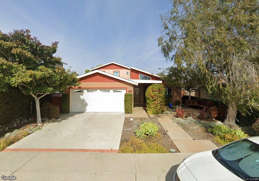
4572 Pauling Ave San Diego, CA 92122
University City NeighborhoodEstimated Value: $1,590,179 - $1,760,000
5
Beds
3
Baths
2,188
Sq Ft
$765/Sq Ft
Est. Value
About This Home
This home is located at 4572 Pauling Ave, San Diego, CA 92122 and is currently estimated at $1,673,045, approximately $764 per square foot. 4572 Pauling Ave is a home located in San Diego County with nearby schools including Marie Curie Elementary School, Standley Middle School, and University City High School.
Ownership History
Date
Name
Owned For
Owner Type
Purchase Details
Closed on
Jul 11, 2012
Sold by
Miner Jefrey N and Miner Angela Yee
Bought by
Miner Jeffrey N and Miner Angela Y
Current Estimated Value
Purchase Details
Closed on
Mar 3, 2003
Sold by
Miner Jeffrey N and Miner Angela Yee
Bought by
Miner Jeffrey N and Miner Angela Yee
Home Financials for this Owner
Home Financials are based on the most recent Mortgage that was taken out on this home.
Original Mortgage
$171,500
Outstanding Balance
$73,566
Interest Rate
5.85%
Estimated Equity
$1,599,479
Purchase Details
Closed on
May 25, 1994
Sold by
Johnson Alan E and Johnson Evelyn S
Bought by
Miner Jeffrey N and Yee Angela Grace
Home Financials for this Owner
Home Financials are based on the most recent Mortgage that was taken out on this home.
Original Mortgage
$202,700
Interest Rate
8.35%
Create a Home Valuation Report for This Property
The Home Valuation Report is an in-depth analysis detailing your home's value as well as a comparison with similar homes in the area
Home Values in the Area
Average Home Value in this Area
Purchase History
| Date | Buyer | Sale Price | Title Company |
|---|---|---|---|
| Miner Jeffrey N | -- | None Available | |
| Miner Jeffrey N | -- | Commonwealth Land Title Co | |
| Miner Jeffrey N | $225,500 | Chicago Title Company |
Source: Public Records
Mortgage History
| Date | Status | Borrower | Loan Amount |
|---|---|---|---|
| Open | Miner Jeffrey N | $171,500 | |
| Previous Owner | Miner Jeffrey N | $202,700 |
Source: Public Records
Tax History Compared to Growth
Tax History
| Year | Tax Paid | Tax Assessment Tax Assessment Total Assessment is a certain percentage of the fair market value that is determined by local assessors to be the total taxable value of land and additions on the property. | Land | Improvement |
|---|---|---|---|---|
| 2025 | $6,171 | $516,800 | $132,348 | $384,452 |
| 2024 | $6,171 | $506,667 | $129,753 | $376,914 |
| 2023 | $6,033 | $496,733 | $127,209 | $369,524 |
| 2022 | $5,871 | $486,994 | $124,715 | $362,279 |
| 2021 | $5,830 | $477,446 | $122,270 | $355,176 |
| 2020 | $5,758 | $472,552 | $121,017 | $351,535 |
| 2019 | $5,654 | $463,288 | $118,645 | $344,643 |
| 2018 | $5,285 | $454,205 | $116,319 | $337,886 |
| 2017 | $81 | $445,300 | $114,039 | $331,261 |
| 2016 | $5,074 | $436,569 | $111,803 | $324,766 |
| 2015 | $4,998 | $430,012 | $110,124 | $319,888 |
| 2014 | $4,918 | $421,589 | $107,967 | $313,622 |
Source: Public Records
Map
Nearby Homes
- 4635 Pauling Ave
- 4627 Huggins St
- 7056 Haworth St
- 4282 Robbins St
- 7212 Florey St
- 7190 Shoreline Dr Unit 6313
- 7160 Shoreline Dr Unit 4213
- 4612 Benhurst Ave
- 4224 Governor Dr
- 7224 Shoreline Dr Unit 172
- 6214 Agee St Unit 34
- 7182 Calabria Ct Unit A
- 7285 Calabria Ct Unit 18
- 6188 Agee St Unit 230
- 6180 Agee St Unit 159
- 6547 Radcliffe Dr
- 7132 Calabria Ct
- 6330 Genesee Ave Unit 319
- 6330 Genesee Ave Unit 220
- 6330 Genesee Ave Unit 119
- 4586 Pauling Ave
- 4558 Pauling Ave
- 4573 Cather Ave
- 4596 Pauling Ave
- 4581 Cather Ave
- 4565 Cather Ave
- 4544 Pauling Ave
- 4589 Cather Ave
- 4557 Cather Ave
- 7090 Weller St
- 4583 Pauling Ave
- 4530 Pauling Ave
- 4567 Pauling Ave
- 4549 Cather Ave
- 4535 Pauling Ave
- 4551 Pauling Ave
- 7080 Weller St
- 4606 Pauling Ave
- 4541 Cather Ave
- 7125 Lipmann St